Lábrea
Lábrea (Portuguese pronunciation: [ˈlabɾjɐ]) is the southernmost municipality in the Brazilian state of Amazonas.
Lábrea | |
|---|---|
Municipality | |
| Municipality of Lábrea | |
 Flag  Seal | |
 | |
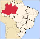
 Lábrea Location in Brazil | |
| Coordinates: 07°15′32″S 64°47′52″W | |
| Country | |
| Region | North |
| State | |
| Founded | March 7, 1881 |
| Government | |
| • Mayor | Gean Campos de Barros (PMDB) |
| Area | |
| • Total | 68,508.6 km2 (26,451.3 sq mi) |
| Highest elevation | 75 m (246 ft) |
| Lowest elevation | 61 m (200 ft) |
| Population (2008) | |
| • Total | 38,451 |
| • Density | 0.4/km2 (1/sq mi) |
| [1] | |
| Time zone | UTC-4 (AST) |
| HDI (2000) | 0.598 – medium[2] |
Economy
The population of the Lábrea municipality was 38,451 as of 2008. Its area is 68,508.6 square kilometres (26,451.3 sq mi).[3] This makes it the sixth largest municipality in Amazonas by area and the tenth largest in Brazil. The town is the seat of the Territorial Prelature of Lábrea. Lábrea Airport is served by scheduled regular air connections.
Conservation
The municipality contains the Iquiri National Forest, a 1,472,599 hectares (3,638,870 acres) sustainable use conservation unit created in 2008.[4] The municipality also contains part of the Mapinguari National Park, a 1,776,914 hectares (4,390,850 acres) conservation unit created in 2008.[5] It contains the 776,940 hectares (1,919,900 acres) Ituxi Extractive Reserve, created in 2008.[6] It contains 91% of the 604,209 hectares (1,493,030 acres) Médio Purus Extractive Reserve, created in 2008.[7]
Climate
| Climate data for Lábrea (1981–2010, extremes 1973–present) | |||||||||||||
|---|---|---|---|---|---|---|---|---|---|---|---|---|---|
| Month | Jan | Feb | Mar | Apr | May | Jun | Jul | Aug | Sep | Oct | Nov | Dec | Year |
| Record high °C (°F) | 36.6 (97.9) |
39.2 (102.6) |
39.4 (102.9) |
38.4 (101.1) |
36.6 (97.9) |
38.5 (101.3) |
38.2 (100.8) |
39.2 (102.6) |
40.0 (104.0) |
39.8 (103.6) |
38.4 (101.1) |
39.4 (102.9) |
40.0 (104.0) |
| Average high °C (°F) | 31.5 (88.7) |
31.4 (88.5) |
31.6 (88.9) |
31.8 (89.2) |
31.5 (88.7) |
31.5 (88.7) |
32.7 (90.9) |
33.6 (92.5) |
33.6 (92.5) |
33.1 (91.6) |
32.2 (90.0) |
31.6 (88.9) |
32.2 (90.0) |
| Daily mean °C (°F) | 26.1 (79.0) |
26.1 (79.0) |
26.0 (78.8) |
26.2 (79.2) |
25.8 (78.4) |
25.4 (77.7) |
25.4 (77.7) |
26.1 (79.0) |
26.6 (79.9) |
26.6 (79.9) |
26.2 (79.2) |
26.0 (78.8) |
26.0 (78.8) |
| Average low °C (°F) | 21.9 (71.4) |
21.8 (71.2) |
22.0 (71.6) |
21.8 (71.2) |
21.6 (70.9) |
20.3 (68.5) |
19.2 (66.6) |
20.1 (68.2) |
21.0 (69.8) |
21.4 (70.5) |
21.3 (70.3) |
21.5 (70.7) |
21.2 (70.2) |
| Record low °C (°F) | 16.2 (61.2) |
16.2 (61.2) |
15.6 (60.1) |
17.0 (62.6) |
10.8 (51.4) |
10.2 (50.4) |
7.8 (46.0) |
11.0 (51.8) |
12.0 (53.6) |
12.2 (54.0) |
12.8 (55.0) |
15.8 (60.4) |
12.2 (54.0) |
| Average precipitation mm (inches) | 314.1 (12.37) |
315.2 (12.41) |
357.7 (14.08) |
273.7 (10.78) |
147.8 (5.82) |
46.1 (1.81) |
32.4 (1.28) |
72.7 (2.86) |
112.5 (4.43) |
198.8 (7.83) |
243.2 (9.57) |
291.2 (11.46) |
2,405.4 (94.70) |
| Average precipitation days (≥ 1.0 mm) | 19 | 18 | 19 | 17 | 13 | 6 | 5 | 6 | 8 | 11 | 15 | 18 | 155 |
| Average relative humidity (%) | 87.6 | 87.6 | 87.9 | 87.9 | 87.7 | 85.6 | 82.1 | 80.3 | 81.1 | 83.1 | 85.7 | 87.3 | 85.3 |
| Mean monthly sunshine hours | 93.0 | 84.6 | 93.8 | 102.1 | 131.0 | 179.7 | 209.4 | 177.1 | 145.5 | 134.1 | 113.2 | 94.1 | 1,557.6 |
| Source 1: Instituto Nacional de Meteorologia[8] | |||||||||||||
| Source 2: Meteo Climat (record highs and lows)[9] | |||||||||||||
References
- IBGE 2008 statistics
- Archived 2009-10-03 at the Wayback Machine UNDP
- IBGE - "Archived copy". Archived from the original on 2007-01-09. Retrieved 2007-01-09.CS1 maint: archived copy as title (link)
- Unidade de Conservação: Floresta Nacional do Iquiri (in Portuguese), MMA: Ministério do Meio Ambiente, retrieved 2016-06-02
- PARNA Mapinguari (in Portuguese), ISA: Instituto Socioambiental, retrieved 2016-06-02
- RESEX Ituxi (in Portuguese), ISA: Instituto Socioambiental, retrieved 2016-08-30
- RESEX Médio Purus (in Portuguese), ISA: Instituto Socioambiental, retrieved 2016-09-03
- "Normais Climatológicas Do Brasil 1981–2010" (in Portuguese). Instituto Nacional de Meteorologia. Retrieved 26 October 2018.
- "Station Labrea" (in French). Meteo Climat. Retrieved 26 October 2018.
Capital: Manaus | ||||||||||||||
| Mesoregion Centro Amazonense |
|  | ||||||||||||
| Mesoregion Norte Amazonense |
| |||||||||||||
| Mesoregion Sudoeste Amazonense |
| |||||||||||||
| Mesoregion Sul Amazonense |
| |||||||||||||