Independence, Oregon
Independence is a city in Polk County, Oregon, United States, on the west bank of the Willamette River along Oregon Route 51, and east of nearby Monmouth. It is part of the Salem Metropolitan Statistical Area. Thirty square blocks of the oldest part of Independence form the National Register of Historic Places-listed Independence Historic District.
Independence, Oregon | |
|---|---|
_(polD0058).jpg) Independence National Bank | |
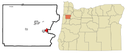 Location in Oregon | |
 Independence, Oregon Location in the United States | |
| Coordinates: 44°51′11″N 123°11′29″W | |
| Country | United States |
| State | Oregon |
| County | Polk |
| Incorporated | 1874 |
| Government | |
| • Mayor | John McArdle (D)[1] |
| Area | |
| • Total | 2.98 sq mi (7.71 km2) |
| • Land | 2.88 sq mi (7.45 km2) |
| • Water | 0.10 sq mi (0.26 km2) |
| Elevation | 168 ft (51.2 m) |
| Population | |
| • Total | 8,590 |
| • Estimate (2018)[4] | 10,154 |
| • Density | 3,530.60/sq mi (1,363.21/km2) |
| Time zone | UTC-8 (Pacific) |
| • Summer (DST) | UTC-7 (Pacific) |
| ZIP code | 97351 |
| Area code(s) | 503 and 971 |
| FIPS code | 41-36150[5] |
| GNIS feature ID | 1163064[6] |
| Website | www.ci.independence.or.us |
The population was 8,590 at the 2010 census.[7]
History
Independence was founded by pioneers who migrated from Independence, Missouri. Elvin A. Thorp arrived in the Independence area in 1845 and staked a claim north of Ash Creek in June of that year. He platted a small townsite that later became known as "Thorp's Town of Independence" or the "Original Town of Independence", now known as "Old Town". Thorp named the town for his hometown Independence, Missouri, and in honor of Andrew Jackson's characteristic of "Independence".[8]
In 1847, Henry Hill came across the plains looking for a level piece of ground on which to raise stock. On November 14, 1847, he found his location on the west bank of the Willamette River (south of Ash Street) and marked off his donation land claim, which was 1 mile (1.6 km) square. In 1867, after returning from the California gold mines, Hill platted 40 acres (160,000 m2) for a townsite, thereafter to be referred to as Henry Hill's Town of Independence. The city charter bill of February 26, 1885, incorporated E.A. Thorp's Independence and Henry Hill's Independence. Henry Hill Elementary School was named in honor of the latter.

Independence thrived as a shipping point, by both rail and boat, for agricultural products and lumber until the 1950s.[9] The city was known for its hops production from the 1890s through the 1940s, hosting a festival called the "Hops Fiesta" from the early 1930s to the mid-1950s.[10][11] When hop production began to decline in the early 1950s,[10] the city's fortunes also began to decline.[9][12][13]
Downtown Independence was bypassed by major freeways in the 1960s,[14] though the period saw an alternative form of transportation enabled by the construction of the Independence State Airport, which was dedicated on August 14, 1964.[15]
Geography
Independence is located at 44°51′11″N 123°11′29″W. [16] According to the United States Census Bureau, the city has a total area of 2.82 square miles (7.30 km2), of which 2.73 square miles (7.07 km2) is land and 0.09 square miles (0.23 km2) is water.[17] Ash Creek flows through Independence, where it meets the Willamette River.[18]
Demographics
| Historical population | |||
|---|---|---|---|
| Census | Pop. | %± | |
| 1860 | 425 | — | |
| 1880 | 691 | — | |
| 1900 | 909 | — | |
| 1910 | 1,160 | 27.6% | |
| 1920 | 1,148 | −1.0% | |
| 1930 | 1,248 | 8.7% | |
| 1940 | 1,372 | 9.9% | |
| 1950 | 1,987 | 44.8% | |
| 1960 | 1,930 | −2.9% | |
| 1970 | 2,594 | 34.4% | |
| 1980 | 4,024 | 55.1% | |
| 1990 | 4,425 | 10.0% | |
| 2000 | 6,035 | 36.4% | |
| 2010 | 8,590 | 42.3% | |
| Est. 2018 | 10,154 | [4] | 18.2% |
| U.S. Decennial Census[19] | |||
2010 census
As of the census[3] of 2010, there were 8,590 people, 2,857 households, and 2,021 families residing in the city. The population density was 3,146.5 inhabitants per square mile (1,214.9/km2). There were 3,168 housing units at an average density of 1,160.4 per square mile (448.0/km2). The racial makeup of the city was 73.3% White, 0.4% African American, 1.8% Native American, 1.2% Asian, 0.2% Pacific Islander, 19.1% from other races, and 4.1% from two or more races. Hispanic or Latino of any race were 35.3% of the population.
There were 2,857 households of which 42.0% had children under the age of 18 living with them, 51.6% were married couples living together, 12.7% had a female householder with no husband present, 6.5% had a male householder with no wife present, and 29.3% were non-families. 18.6% of all households were made up of individuals and 5.9% had someone living alone who was 65 years of age or older. The average household size was 2.99 and the average family size was 3.45.
The median age in the city was 28.3 years. 30.5% of residents were under the age of 18; 13.9% were between the ages of 18 and 24; 27.3% were from 25 to 44; 19.5% were from 45 to 64; and 8.7% were 65 years of age or older. The gender makeup of the city was 50.4% male and 49.6% female.
2000 census
As of the census[5] of 2000, there were 6,035 people, 1,994 households, and 1,425 families residing in the city. The population density was 2,585.8 people per square mile (1,000.1/km²). There were 2,131 housing units at an average density of 913.1 per square mile (353.1/km²). The racial makeup of the city was 73.69% White, 1.49% Native American, 0.58% Asian, 0.41% African American, 0.36% Pacific Islander, 19.64% from other races, and 3.83% from two or more races. Hispanic or Latino of any race were 30.12% of the population.
There were 1,994 households out of which 38.1% had children under the age of 18 living with them, 53.0% were married couples living together, 14.0% had a female householder with no husband present, and 28.5% were non-families. 18.4% of all households were made up of individuals and 6.8% had someone living alone who was 65 years of age or older. The average household size was 2.98 and the average family size was 3.41.
In the city, the population was spread out with 30.5% under the age of 18, 14.1% from 18 to 24, 26.4% from 25 to 44, 20.1% from 45 to 64, and 9.0% who were 65 years of age or older. The median age was 29 years. For every 100 females, there were 96.7 males. For every 100 females age 18 and over, there were 93.5 males.
The median income for a household in the city was $36,790, and the median income for a family was $40,466. Males had a median income of $30,253 versus $22,527 for females. The per capita income for the city was $13,933. About 14.6% of families and 16.9% of the population were below the poverty line, including 22.5% of those under age 18 and 7.4% of those age 65 or over.
Education
Independence shares a school district (Central School District) with Monmouth.[20] Two elementary schools (Henry Hill and Independence), a middle school (Talmadge), and a high school (Central) are shared between the two cities.
References
- "John McArdle". Democratic Party of Oregon. Retrieved 2 October 2015.
- "2018 U.S. Gazetteer Files". United States Census Bureau. Retrieved Feb 12, 2020.
- "U.S. Census website". United States Census Bureau. Retrieved 2012-12-21.
- "Population and Housing Unit Estimates". Retrieved June 4, 2019.
- "U.S. Census website". United States Census Bureau. Retrieved 2008-01-31.
- "US Board on Geographic Names". United States Geological Survey. 2007-10-25. Retrieved 2008-01-31.
- http://factfinder.census.gov/servlet/SAFFPopulation?_event=Search&geo_id=01000US&_geoContext=01000US&_street=&_county=independence&_cityTown=independence&_state=04000US41&_zip=&_lang=en&_sse=on&ActiveGeoDiv=geoSelect&_useEV=&pctxt=fph&pgsl=010&_submenuId=population_0&ds_name=null&_ci_nbr=null&qr_name=null®=null%3Anull&_keyword=&_industry=%5B%5D
- Newton, Sidney (1971). Early History of Independence, Oregon. p. 1.
- Independence History from the City of Independence
- "Independence Hop and Heritage Festival A Little Bit of History". Independence Hop & Heritage Festival. Archived from the original on 2014-07-25. Retrieved 2014-07-16.
The "original" Hop Festival, also known as the Hop Fiesta, began in early 1930s....The festival/fiesta in its original form continued until the mid-1950s, missing only years when the US was most deeply involved in World War II.
- "On main street of Williamette [sic] Valley town. Independence, Polk County, Oregon". Farm Security Administration - Office of War Information Photograph Collection. LC-USF34-020639-E: Library of Congress. August 1939. Retrieved 2011-03-31.CS1 maint: location (link)
- A Heady Success from Oregon State University
- Hops and Beer from Salem Online History
- Independence, Oregon: Historic Main Street from greatstreets.org
- "History of Independence State Airport (7S5)". Independence State Airport Support Group. April 8, 2005. Retrieved 2011-03-31.
The Independence Airport originally was developed from a request by the news media and eastern pilots to have a place to land aircraft and report on the arrival of the "On to Oregon Cavalcade" from Independence, Missouri to Independence, Oregon in 1959....Edwin Totten, a local farmer, allowed the aircraft to land on one of his grass seed fields which was later purchased by the City of Independence, with help from local donors and Polk County in early 1960s....The city decided developing, operating and managing the airport would be better served by donating the airport to the State of Oregon Aeronautics Division. After initial engineering and construction, the airport was dedicated as the Independence State Airport on August 14, 1964.
- "US Gazetteer files: 2010, 2000, and 1990". United States Census Bureau. 2011-02-12. Retrieved 2011-04-23.
- "US Gazetteer files 2010". United States Census Bureau. Archived from the original on January 12, 2012. Retrieved 2012-12-21.
- "United States Topographic Map". United States Geological Survey. Retrieved March 7, 2016 – via Acme Mapper..
- "Census of Population and Housing". Census.gov. Retrieved June 4, 2015.
- "Independence Schools | The City of Independence Oregon - Official Website". www.ci.independence.or.us. Retrieved 2020-04-26.
External links

- Entry for Independence in the Oregon Blue Book
- Photographs of Independence by Dorothy Lange from the Library of Congress
- Home page for Independence, Oregon at https://www.ci.independence.or.us/
Municipalities and communities of Polk County, Oregon, United States | ||
|---|---|---|
| Cities | 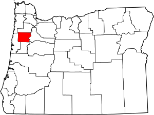 Polk County map | |
| CDPs | ||
| Unincorporated communities | ||
| Indian reservation | ||
| Ghost towns | ||
| Footnotes | ‡This populated place also has portions in an adjacent county or counties | |
| Authority control |
|
|---|