Huangling County
Huangling County (simplified Chinese: 黄陵县; traditional Chinese: 黃陵縣; pinyin: Huánglíng Xiàn) is a county in the north of Shaanxi province, China, bordering Gansu province to the west.[1] It is under the administration of the prefecture-level city of Yan'an.[1] The county spans an area of 2,286.7 square kilometers, and has a permanent population of 130,100 people as of 2012.[1]
Huangling 黄陵县 | |
|---|---|
County | |
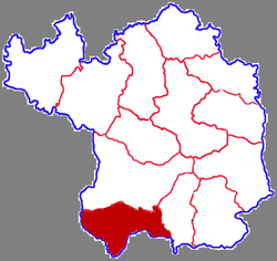 Huangling in Yan'an | |
.png) Yan'an in Shaanxi | |
| Country | People's Republic of China |
| Province | Shaanxi |
| Prefecture-level city | Yan'an |
| Area | |
| • Total | 2,286.7 km2 (882.9 sq mi) |
| Population (2017) | |
| • Total | 130,100 |
| • Density | 57/km2 (150/sq mi) |
| Time zone | UTC+8 (China standard time) |
| Postal code | 727300 |
| Licence plates | 陕J |
Administrative Divisions
Huangling County is divided into one subdistrict and five towns.[1] The county's sole subdistrict is Qiaoshan Subdistrict, and its five towns are Diantou, Longfang, Tianzhuang, Adang, and Shuanglong.[1] The county government is located in Qiaoshan Subdistrict.[1]
Geography
Huangling County is located in the Loess Plateau approximately 200 kilometers north of Xi'an's urban core, and 170 kilometers south of Yan'an's.[1] Over 70% of the county is forested.[2]
History
Archeoligcal evidence from the ancient Yangshao culture indicates that the area of present-day Huangling County has been inhabited since the Neolithic age.[3] In 221 BCE, the Qin Dynasty unified a number of small counties in the area under the Shang Commandery.[3] The area was reorganized a number of times before being occupied by the Xiongnu in 189 CE.[3] The Jin Dynasty then conquered the area and briefly reorganized it as the Central Commandery.[3] The area of present-day Huangling County would be re-organized a number of times under the Northern Zhou Dynasty, the Tang Dynasty, the Song Dynasty, the Ming Dynasty, and, ultimately, the Qing Dynasty.[3] During the time of the Republic of China, the area was a part of Yulin Circuit, one of the three circuits in Shaanxi.[3] The area would fall under control of the People's Republic of China by May 1948.[3] Named Huangling County since 1944, the jurisdiction has since underwent a number of restructurings, with its most recent being in 2015.[3]
Economy
In 2011, the county's GDP was 8.356 billion Renminbi, which the county government forecasted to increase to 11.86 billion by 2015.[2] The county has an apple-growing area of 210,000 mu, producing an annual output of 270,000 tons of apples.[2] Huangling County has proven coal reserves of 2.7 billion tons, with an annual output of 29 million tons of raw coal.[2] The county also has petroleum reserves.[2]
Historical sites
Transportation
- China National Highway 210[2]
- G65 Baotou–Maoming Expressway[2]
- Xi'an–Yan'an Railway[2]
References
- 黄陵县概况地图_行政区划网(区划地名网) www.xzqh.org. xzqh.org (in Chinese). 2015-06-30. Retrieved 2020-05-15.
- 黄陵概况 (in Chinese). Huangling County People's Government. 2016-06-23. Archived from the original on 2016-12-28. Retrieved 2020-05-15.
- 历史沿革. Huangling County People's Government. 2017-02-28. Archived from the original on 2017-12-01. Retrieved 2020-05-15.