Houayxay
Houayxay (Lao: ຫ້ວຍຊາຍ) (also Huoeisay, Houei Sai or Huay Xai), is a district in Bokeo Province, Laos, on the border with Thailand. Ban Houayxay is the administrative centre of the district.
Houayxay ເມືອງຫ້ວຍຊາຍ | |
|---|---|
| Houayxay District | |
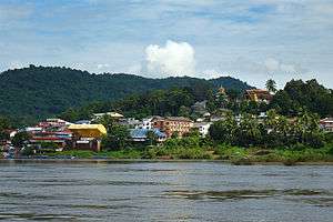 Ban Houayxay from the Mekong River | |
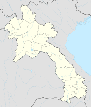 Houayxay Location in Laos | |
| Coordinates: 20°15′47″N 100°26′1″E | |
| Country | Laos |
| Admin. division | Bokeo Province |
| Elevation | 398 m (1,306 ft) |
| Population (2010) | |
| • Total | 17,687 |
| • Religions | Buddhism |
| Time zone | UTC+7 (ICT) |
| Climate | Aw |
The town lies on the Mekong River opposite Chiang Khong in Thailand. The Fourth Thai-Lao Friendship Bridge at Ban Houayxay, which opened in December 2013 and replaced ferry service across the river, is now the northernmost road border crossing between the two countries. Asian Highway 3, which runs through Ban Houayxay, extends north to Yunnan Province of China and south to Chiang Rai Province of Thailand.
Houayxay has a domestic airport (HOE) with regular flights to Vientiane and Luang Prabang (depending on the season). Boats (speed and slow boats, freighters, luxury cruisers for tourists and others) run down the Mekong to Pakbeng, Luang Prabang and other destinations.
Fort Carnot, an ancient French fort in ruins, sits on a hill overlooking the town and the Mekong River.

Town centre 
Stairs to the hill of the temple 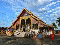
Vat Chom Khao Manilat 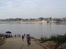
Border crossing to Thailand
Climate
| Climate data for Ban Houayxay (2010-) | |||||||||||||
|---|---|---|---|---|---|---|---|---|---|---|---|---|---|
| Month | Jan | Feb | Mar | Apr | May | Jun | Jul | Aug | Sep | Oct | Nov | Dec | Year |
| Daily mean °C (°F) | 18.9 (66.0) |
21.1 (70.0) |
24.1 (75.4) |
26.8 (80.2) |
27.0 (80.6) |
26.8 (80.2) |
26.4 (79.5) |
26.1 (79.0) |
25.8 (78.4) |
24.5 (76.1) |
22.0 (71.6) |
18.8 (65.8) |
24.0 (75.2) |
| Average rainy days | 1 | 1 | 2 | 8 | 15 | 16 | 19 | 21 | 15 | 10 | 4 | 2 | 114 |
| Source: [1] | |||||||||||||
External links

| Wikimedia Commons has media related to Ban Houayxay. |