Holland, Manitoba
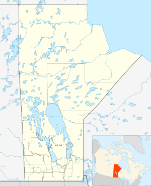
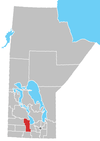
Holland, Manitoba is an unincorporated community recognized as a local urban district[2] in the Rural Municipality of Victoria, in Manitoba.
Holland | |
|---|---|
| Village of Holland | |
 Emmanuel Anglican Church. | |
 Holland Location of Steinbach in Manitoba | |
| Coordinates: 49°35′40″N 98°52′52″W | |
| Country | Canada |
| Province | Manitoba |
| Rural Municipality | Victoria |
| Established | 1878 |
| Government | |
| • MP (Portage—Lisgar) | Candice Bergen (CPC) |
| • MLA (Midland) | Blaine Pedersen |
| Area | |
| • Total | 25.59 km2 (9.88 sq mi) |
| Elevation | 380 m (1,250 ft) |
| Population (2011) | |
| • Total | 353[1] |
| • Density | 125.4/km2 (325/sq mi) |
| Time zone | UTC-6 (CST) |
| • Summer (DST) | UTC-5 (CDT) |
| Postal code span | Rxx |
| Area code(s) | 204 |
| Demonym | Hollander |
It is located at the junction of Highway 2 and Highway 34, along the Canadian Pacific Railway tracks.
It lies south of the Assiniboine River, at an elevation of 380 metres (1,250 ft). Spruce Woods Provincial Park is located north-west of the community.
Community facilities include an elementary school, a public library, fire department, a supermarket, a convenience store, a hardware, a post office and a medical clinic. A skating arena and curling rink are open during the winter months only. A farm machinery dealership lies opposite the town across Highway 2.
Residents of Holland are known as "Hollanders". Holland is the administrative centre of the surrounding municipality of Victoria and home to the LaSalle Redboine Conservation District and the Tiger Hills Arts Association.
Our Lady of the Prairies and Oka Cheese
A nearby Trappist monastery, Our Lady of the Prairies, makes the famous Oka cheese.[3]
References
- "Population data, Holland". Statistics Canada. Retrieved May 21, 2017.
- "Local Urban Districts Regulation". Government of Manitoba. April 23, 2016. Retrieved April 24, 2016.
- http://www.virtualmuseum.ca/sgc-cms/expositions-exhibitions/trappiste-trappist/english/index.html
External links
| Wikimedia Commons has media related to Holland, Manitoba. |
Division No. 8, Manitoba (Central Manitoba) | ||||
|---|---|---|---|---|
| Towns |
|  | ||
| Villages |
| |||
| Rural municipalities |
| |||
| First Nations | ||||
| Indian reserves |
| |||
| Unincorporated communities | ||||