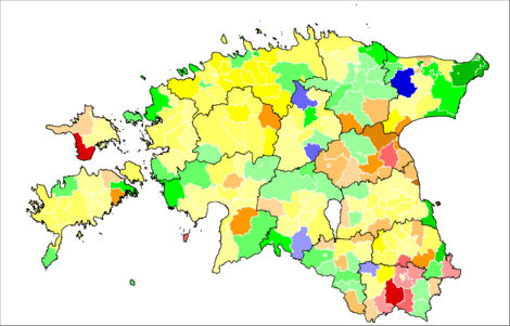
Hiiumaa
Hiiumaa (US: /ˈhiːʊmɑː, ˈhiːəmɑː/, Estonian: [ˈhiːumɑː])[2][3] is the second largest island in Estonia and is part of the West Estonian archipelago, in the Baltic Sea. It has an area of 989 km2 and is 22 km from the Estonian mainland. Its largest town is Kärdla. It is located within Hiiu County.[4][5]
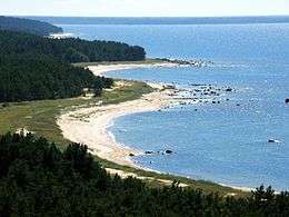 Tahkuna peninsula is the northernmost part of Hiiumaa | |
.jpg) | |
| Geography | |
|---|---|
| Location | Baltic Sea |
| Coordinates | |
| Archipelago | West Estonian archipelago |
| Area | 989 km2 (382 sq mi) |
| Highest elevation | 68 m (223 ft) |
| Highest point | Tornimägi |
| Administration | |
Estonia | |
| County, parish | Hiiu County, Hiiumaa Parish |
| Largest settlement | Kärdla (pop. 3,287 [as of 1 January 2012][1]) |
| Demographics | |
| Population | 9,558 (2019) |
| Pop. density | 9.1/km2 (23.6/sq mi) |
Hiiumaa was controlled by the Brothers of the Sword in the early 1200s (known as the Teutonic Knights from 1237). During this time it was first settled by Swedes and Germans. The island was ruled first from Denmark, then from Sweden, in the 1500s, and from Russia in the 1700s. It became part of Estonia briefly in 1920 before being incorporated into the Soviet Union till 1991, when Estonia again gained its independence.[4]
Names
Hiiumaa is the main island of Hiiu County, called Hiiumaa or Hiiu maakond in Estonian. The Swedish and German name of the island is Dagö or Dagden ("Day" island) and Dagø in Danish. In modern Finnish, it is called Hiidenmaa, literally Hiisi's Land. In Russian it is known as Khiuma. In Old Gutnish, it was Dagaiþ (day isthmus), from which the local North Germanic name "Daë" is derived.[4]
History
Prehistory
Hiiumaa emerged from the Baltic Sea 8500 years ago due to isostatic uplift after the retreat of the ice cap.[6][5] Mesolithic settlements are found on the island's Kõpu Peninsula from about 5500 BC.[5][7] These settlements seem to be related mostly to seal hunting and extend into the earliest Neolithic. As Hiiumaa is constantly uplifting the local sea level was 20 m higher than today at this time. For this reason these settlements are located far from the modern coastline. The pottery found at these sites is of the Narva Type and is similar to that found on Saaremaa and the Estonian mainland.[7]
A series of stone-cist graves are also present on the island from the Late Bronze Age through to the Late Iron Age.[7][8]
Crusades
The first documented record of the island of Dageida was made by contemporary chroniclers in 1228, when Hiiumaa and the rest of Estonia were conquered by Germanic crusaders. In 1254, Hiiumaa was divided between the Bishopric of Ösel-Wiek and the Livonian branch of the Teutonic Order, acting partly on behalf of the Hanseatic League.
Swedish Estonia
The island was part of Swedish Estonia from 1563 to 1721, after which it passed to the Russian Empire as part of the Governorate of Estonia, though Dagö's Swedish population kept most of their privileges. Most of the island's previously numerous Swedish-speaking population emigrated or were "Estonianised" during the period of Imperial Russian rule, although a minority remains to this day. Estonian Swedes are also known as "aibofolke" (meaning island people in Swedish) or "rannarootslased" (meaning coastal Swedes in Estonian).
World War I
Hiiumaa was occupied during World War I by the Imperial German Army, in Operation Albion. After the war, it became a part of independent Estonia.
World War II
The waters near Hiiumaa were active during World War II:[9]
- 23 June 1941- The Soviet destroyer Gnevny was sunk by a German seamine.
- 25 June- the Soviet minesweeper T-208 Shkiv was destroyed by a German seamine.
- 27 June- Two German motor torpedo boats, S43 and S106, were destroyed by Soviet seamines.
- 1 July- the Soviet submarine M-81 was destroyed by a German seamine north of Hiiumaa.
- 7 July- the Soviet minesweeper T-216 was sunk.
- 30 July- the Soviet minesweeper T-201 Zarjad was sunk.
- 10 August- the German submarine U-144 was sunk by a torpedo from the Soviet submarine SC-307.
- Hiiumaa Island was annexed by the Soviet Union in 1940, by Nazi Germany in 1941, and by the Soviets again in 1944.
Soviet
It was part of the Estonian Soviet Socialist Republic until the Soviet Union collapsed in 1991. During the Soviet era, Hiiumaa was declared a restricted zone, closed to foreigners and to most mainland Estonians. Since 1991, the island has been a part of independent Estonia. A number of derelict Soviet era forts and communication towers are still present on the islands northern coast.[10]
Natural environment
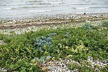
Hiiumaa is an island in Estonia located north of Saaremaa in the Baltic Sea. It is the northernmost island in the Muhu archipelago, which includes Saaremaa and Muhu.[4] Hiiumaa has a low relief (up to 68 m above sea level)[5] and is mostly formed of limestone, that is exposed in cliffs around parts of the islands coast.[4] In the North of the island there are a series of fossilized beaches preserved as uplift has occurred. The modern beaches are primarily on the northern and western coast lines.[11] The natural environment is protected within the Tahkuna Nature Reserve and West Estonian Archipelago Biosphere Reserve.
The Hiiu Shoal (Nekmangrund) is located off the northwestern shore of Hiiumaa Island. The Soela Strait separates Hiiumaa from Saaremaa to its south, and the Muhu Strait separates it from the mainland of Estonia.[4]
Ecology
The fauna and flora of Hiiumaa is similar to the Estonian mainland. The mammal fauna includes elk, red deer, roe deer, wild boars, foxes, lynxes and martens.[5] Wolves have recently started to repopulate the island after being made locally extinct.[12]
Minks were also reintroduced in 2000, after they were exterminated by trappers.[13] Since the end of the 1990s the island shelters a conservation project aimed at restoring populations of European mink, an endangered species of which there is about only 1,000 individual specimens left in Europe as of 2017. This project started with removing from the island all American minks that had escaped from breeding farms, and reintroducing some European minks. The latter started breeding.[14]
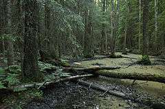
The bird species found on the island include black storks, golden eagles, cranes, avocets and swans. The forests are dominated by pine and deciduous trees, the rest of the uncultivated land is covered by swamps and dunes. The island has about 1000 species of large plants of which 50 are protected.[5]
Geology
The exposed geology of Hiiumaa is composed of Paleozoic Limestone which dips towards the South, covered by glacial sediments. In the North of the island the limestones are Ordovician and they young upwards to the Silurian in the South.[11] These limestones formed at 30 degrees South and have since been moving North with the rest of the Estonian block.[15] Bore holes have found Cambrian sedimentary rocks and a crystalline basement.[16]
In the Ordovician (c. 455 million years ago) the sea floor was hit by a meteorite forming the 4 km wide Kärdla Impact Structure.[16][15] This structure was then filled with Paleozoic sediment. It located about 4 km west-southwest of Kärdla and is barely visible in the modern geomorphology. The crater is well preserved at depth, with a clear rim, breccia and minerals and rocks formed from the heat and pressure of the impact.[16]
The limestone is overlain by Pleistocene glacial deposits that were deposited as the ice cap retreated 11 to 12 thousand years ago. These include terminal moraines, the two most prominent being one in the South of Island running towards the North-East and another forming the Kõpu Peninsula.[11]
Climate
| Climate data for Hiiumaa (Ristna, located in western part of the island) | |||||||||||||
|---|---|---|---|---|---|---|---|---|---|---|---|---|---|
| Month | Jan | Feb | Mar | Apr | May | Jun | Jul | Aug | Sep | Oct | Nov | Dec | Year |
| Record high °C (°F) | 8.4 (47.1) |
7.1 (44.8) |
13.5 (56.3) |
21.5 (70.7) |
27.8 (82.0) |
28.0 (82.4) |
31.5 (88.7) |
31.0 (87.8) |
24.6 (76.3) |
17.9 (64.2) |
11.5 (52.7) |
9.6 (49.3) |
31.5 (88.7) |
| Average high °C (°F) | 0.9 (33.6) |
−0.2 (31.6) |
2.0 (35.6) |
6.8 (44.2) |
12.3 (54.1) |
16.4 (61.5) |
20.2 (68.4) |
20.0 (68.0) |
15.1 (59.2) |
10.2 (50.4) |
5.3 (41.5) |
2.5 (36.5) |
9.3 (48.7) |
| Daily mean °C (°F) | −0.9 (30.4) |
−2.1 (28.2) |
−0.1 (31.8) |
3.7 (38.7) |
8.7 (47.7) |
13.1 (55.6) |
17.0 (62.6) |
16.8 (62.2) |
12.7 (54.9) |
8.3 (46.9) |
3.6 (38.5) |
0.8 (33.4) |
6.8 (44.2) |
| Average low °C (°F) | −3 (27) |
−4.4 (24.1) |
−2.4 (27.7) |
0.9 (33.6) |
5.4 (41.7) |
10.1 (50.2) |
14.1 (57.4) |
13.8 (56.8) |
9.9 (49.8) |
6.0 (42.8) |
1.6 (34.9) |
−1.3 (29.7) |
4.2 (39.6) |
| Record low °C (°F) | −28.4 (−19.1) |
−24.9 (−12.8) |
−19.9 (−3.8) |
−9.1 (15.6) |
−3 (27) |
0.6 (33.1) |
5.9 (42.6) |
4.6 (40.3) |
−2.3 (27.9) |
−5.6 (21.9) |
−15.1 (4.8) |
−17.3 (0.9) |
−28.4 (−19.1) |
| Average precipitation mm (inches) | 55 (2.2) |
39 (1.5) |
37 (1.5) |
31 (1.2) |
33 (1.3) |
47 (1.9) |
55 (2.2) |
69 (2.7) |
62 (2.4) |
72 (2.8) |
79 (3.1) |
60 (2.4) |
639 (25.2) |
| Average relative humidity (%) | 85 | 85 | 84 | 81 | 79 | 81 | 81 | 81 | 81 | 82 | 84 | 84 | 82 |
| Mean monthly sunshine hours | 28.2 | 59.3 | 119.4 | 190.9 | 293.1 | 297.6 | 303.2 | 251.0 | 166.2 | 96.1 | 36.3 | 19.0 | 1,864.4 |
| Source: Estonian Weather Service (sun, 1971–2000)[17][18][19][20] | |||||||||||||
Towns and buildings
The island has several small villages including Kärdla (pop. 3,287), Käina and Kõrgessaare. The oldest surviving church was built in Pühalepa in 1259, though it was rebuilt in the 18th century.[5] The Hanseatic League built a lighthouse in Kõpu near the start of the 16th century. It is the third oldest continuously operating lighthouse in the world.[5]
Employment and land-use
The islands economy is mostly tourism, livestock, farming, wrecking, fishing, and fish processing.[4][5] The tourism is mostly seasonal.[21][22]
Hiiumaa council agrees to the construction of a wind farm.[23] Recently there has been a trend towards smaller farms and more tourism [5]
Transport
Road transport from Estonian mainland to Hiiumaa involves a 90-minute (28 km) ferry crossing from Rohuküla to Heltermaa, which is 25 km by road from Kärdla. There are about 10 ferry departures a day operated by TS Laevad.[24] In the summer weekends, getting car space on the ferry usually requires advance booking. There are about 2 scheduled buses a day between Tallinn (the capital of Estonia) and Kärdla.[25] In the winter, the island can be reached, conditions permitting, via a 26.5 km ice road (the longest in Europe) across the frozen Baltic Sea.[26][27] A building of bridge to the mainland of Estonia has been occasionally proposed.[28]
Hiiumaa is served by Kärdla Airport, with regular flights to Tallinn. Bicycle rental is also available in Kärdla and there is a good bicycle path built from Kärdla towards Kõrgessaare.
Culture and politics
The island is part of the B7 Network, a loose grouping of the major island of the Baltic Sea.[29] There is a large percentage of Estonian Swedes living on the island. Smoked cooked plaice is a traditional summertime delicacy. There is a friendly rivalry with the neighboring island of Saaremaa.[30]
Notable people
- Aleksander Maaker (1890-1968), the last traditional player of the torupill (Estonian bagpipe)
- Juhan Maaker (1845-1930), Estonian folk musician
- Lydia Mei (1896-1965), Estonian artist
- Natalie Mei (1900-1975), Estonian artist
- Erkki-Sven Tüür (b. 1959), Estonian composer of contemporary classical music.
- Roman von Ungern-Sternberg (1885-1921), White military commander in the Russian Civil War.
Image gallery
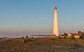
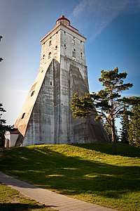
Tahkuna lighthouse 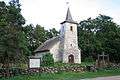
Church of Kassari 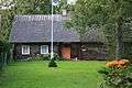
Old farmhouse 
Sõru museum 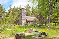
Malvaste chapel 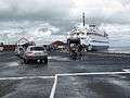 Cars boarding the ferry to mainland at Heltermaa
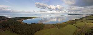 Coast of Hiiumaa
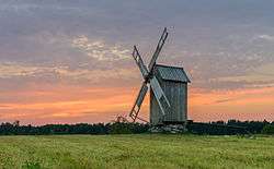 Tubala windmill
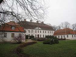 Suuremõisa Manor in Suuremõisa, Pühalepa Parish
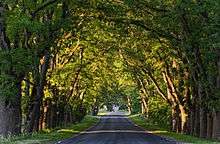 Avenue at Suuremõisa Park
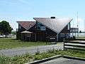 Café at Orjaku Harbor
 Nature trail near Orjaku
References
- Comparison of self-government units, Statistical Council's Regional Portal (checked November 7th, 2012)
- "Hiiumaa". Collins English Dictionary. HarperCollins. Retrieved 30 July 2019.
- "Hiiumaa". Merriam-Webster Dictionary. Retrieved 30 July 2019.
- "Hiiumaa | island, Estonia". Encyclopedia Britannica. Retrieved 18 April 2019.
- "Hiiumaa". www.b7.org. Retrieved 18 April 2019.
- Publishers, Estonian Academy (1994). Proceedings of the Estonian Academy of Sciences, Geology. Estonian Academy Publishers.
- "Coastal Adaption and Marine Exploitation of the Island Hiiumaa, Estonia, During the Stone Age with Special Emphasis on the Kõpu I Site". ethesis.helsinki.fi. Retrieved 18 April 2019.
- Laneman, Margot (2012). "Stone-Cist Grave at Kaseküla, Western Estonia in the Light of Ams Dates of the Human Bones". Eesti Arheoloogia Ajakiri. 16 (2): 91–117. doi:10.3176/arch.2012.2.01. ISSN 1406-2933.
- Jorma Mäntykoski, Kalevi Keskinen (1991). The Finnish Navy At War in 1939-1945 (Suomen Laivasto Sodassa 1939-1945). Espoo: Tietoteos Ky. p. 154. ISBN 978-951-8919-05-9. OL 1778118M.
- "Military Structures of Hiiumaa". Atlas Obscura. Retrieved 18 April 2019.
- Schwartz, Maurice; Bird, Eric; Orviku, Kaarel (9 January 1995). "The Provenance of Beaches on the Estonian Islands of Hiiumaa, Saaremaa and Muhu". Journal of Coastal Research. 11 (1). ISSN 0749-0208.
- Saarma, Urmas; Kübarsepp, Marko; Männil, Peep; Jõgisalu, Inga; Hindrikson, Maris; Remm, Jaanus; Keis, Marju; Plumer, Liivi (6 July 2016). "Wolves Recolonizing Islands: Genetic Consequences and Implications for Conservation and Management". PLOS ONE. 11 (7): e0158911. Bibcode:2016PLoSO..1158911P. doi:10.1371/journal.pone.0158911. ISSN 1932-6203. PMC 4934778. PMID 27384049.
- KaráthAug. 16, Kata; 2017; Am, 11:00 (15 August 2017). "Scientists think they can save the European mink—by killing its ruthless rivals". Science | AAAS. Retrieved 18 April 2019.CS1 maint: numeric names: authors list (link)
- The Baltic coast, video by Free High-Quality Documentaries, on youtube.com. For the European mink conservation project on Hiiumaa, see 32'20 - 34-02. For the American mink having supplanted the European mink and the former's removal from the island, see 33'40 - 34'02.
- Suuroja, Kalle (2002). "Natural Resources of the Kärdla Impact Structure, Hiiumaa Island, Estonia". Impacts in Precambrian Shields. Impact Studies. pp. 295–306. doi:10.1007/978-3-662-05010-1_12. ISBN 978-3-642-07803-3. ISSN 1612-8338.
- Puura, Väino; Suuroja, Kalle (1992). "Ordovician impact crater at Kärdla, Hiiumaa Island, Estonia". Tectonophysics. 216 (1–2): 143–156. Bibcode:1992Tectp.216..143P. doi:10.1016/0040-1951(92)90161-X. ISSN 0040-1951.
- "Climate normals-Temperature". Estonian Weather Service. Retrieved 28 September 2016.
- "Climate normals-Precipitation". Estonian Weather Service. Retrieved 28 September 2016.
- "Climate normals-Humidity". Estonian Weather Service. Retrieved 28 September 2016.
- "Kliimanormid-Päikesepaiste kestus" (in Estonian). Estonian Weather Service. Archived from the original on 22 February 2012. Retrieved 28 September 2016.CS1 maint: BOT: original-url status unknown (link)
- Ahas, Rein; Aasa, Anto; Mark, Ülar; Pae, Taavi; Kull, Ain (2007). "Seasonal tourism spaces in Estonia: Case study with mobile positioning data". Tourism Management. 28 (3): 898–910. doi:10.1016/j.tourman.2006.05.010. ISSN 0261-5177.
- "Hiiumaa - Official tourist activities". www.hiiumaa.ee. Retrieved 18 April 2019.
- ERR (10 June 2017). "Hiiumaa council agrees to construction of wind farm". ERR. Retrieved 18 April 2019.
- Praamid.ee. Ferry schedules and booking.
- "Bus schedules and booking". BussiReisid. Archived from the original on 13 September 2008.
- Estonia claims Europe's longest ice highway. The Independent. 19 February 2011. Retrieved 19 February 2011.
- "BBC: No seatbelts allowed on Europe's longest ice road". 7 April 2011. Retrieved 18 February 2014.
- ERR (18 September 2018). "10 companies ready to privately finance bridges to Saaremaa, Hiiumaa". ERR. Retrieved 18 April 2019.
- "B7 Steering Committee". www.b7.org. Retrieved 18 April 2019.
- "Rival Estonian islands drawn closer through 10km long tug-of-war battle". SBS News. Retrieved 18 April 2019.
External links
![]()

- Hiiumaa County government Official site
- Hiiumaa at Curlie
- Pictures of Coastal batteries World War I and World War II in Hiiumaa Official site