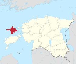
Hiiu County
Hiiumaa is one of 15 counties of Estonia, being the smallest county both in terms of area and population. It consists of Hiiumaa (German, Swedish: Dagö), the second largest island of Estonia, and several smaller islands near it. The county borders Lääne County to the east and Saare County to the south.
Hiiumaa | |
|---|---|
 | |
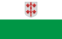 Flag 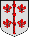 Coat of arms | |
 | |
| Country | Estonia |
| Capital | Kärdla |
| Government | |
| • Governor | Riho Rahuoja[1] |
| Area | |
| • Total | 1,023.2 km2 (395.1 sq mi) |
| Population (2017[2]) | |
| • Total | 9,550 |
| • Rank | 15th |
| • Density | 9.3/km2 (24/sq mi) |
| Ethnicity | |
| • Estonians | 98.5% |
| • Russians | 0.6% |
| • Finns | 0.2% |
| ISO 3166 code | EE-39 |
| Vehicle registration | H |
| Website | hiiu |
History
Human habitation of Hiiumaa can be traced back to the 5th millennium BC. Mesolithic sites in Kõpu peninsula are exemplified by the seal-hunters' settlements. There are several well-preserved grave fields of the Iron Age. In 1228, the island was first mentioned in written annals under the name Dageida. In 1254, Hiiumaa was divided between the Livonian Order and the Bishopric of Ösel-Wiek. In 1563 Hiiumaa was annexed into Sweden. In 1710, as a result of the Great Northern War the island went under the control of the Russian Empire. During World War I, the German military forces occupied Hiiumaa in 1917. In 1918–1940 Hiiumaa was part of the Republic of Estonia, then until 1991 occupied by the Soviet Union.
On demands of the Hanseatic League a lighthouse was built in Kõpu (previously known as Dagerort) at the beginning of the 16th century. It is considered the third-oldest continuously operating lighthouse in the world, still showing its light to 35 miles (56 km) of the sea.
Most of the farm architecture comes from the 19th century. Examples are Mihkli farming complex and Soera farm-museum with historical national artefacts.
Sights
Most important sights:
- Suuremõisa manor
- Kõpu Lighthouse and ancient graves
- Suursadam port
- Tahkuna Lighthouse and coastal defences
- Ristna Lighthouse
- Sääretirp
- Saarnaki laid and other isles
- Kärdla town
- Käina church ruins
- Ristimägi hill
- Reigi church
- Kärdla meteorite crater
- Kassari chapel, Kassari
County government
The County Government (Estonian: Maavalitsus) is led by Governor (Estonian: maavanem), who is appointed by the Government of Estonia for a term of five years. Since March 2012, the Governor position is held by Riho Rahuoja.[1]
Municipalities
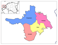
The county is subdivided into 1 rural municipalities (Estonian: vallad – parishes). The only urban settlement Kärdla is part of Hiiumaa Parish since 2017.
Rural municipalities:
- Hiiumaa Parish (includes the town of Kärdla)
Geography
The county includes the islands of Hiiumaa (980 km²) and Kassari (19 km²) and a number of surrounding islets. The highest point is Tornimägi hill (68 m), the longest river is Luguse (21 km), and the biggest lake is Tihu Suurjärv (850,000 m²).
In the landscapes there can be found pine forests, mixed spruce and deciduous forests, swampy thickets and juniper shrubs, coastal meadows and bogs. The most frequent tree is pine which makes about a half of forests. Pine is followed by birch, spruce and alder. In total, there are about 1,000 species of vascular plants, of which about 100 are under protection. The wildlife of Hiiumaa is remarkable. Out of 30 species of mammals, big game as elk, deer, fox, wild boar and lynx roam the island. There are about 250 species of birds on the island, 195 of them nesting.
Among the Estonian counties Hiiumaa is the richest in forest – nearly 60% of the island are wooded areas. There are large marsh areas in the middle of the island. The marshes cover about 7% of its area. Cultivated land and settlements take about 23% of the area of the county.
Gallery
 Kõrgessaare manor
 Kassari chapel
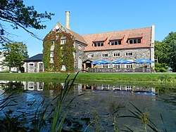
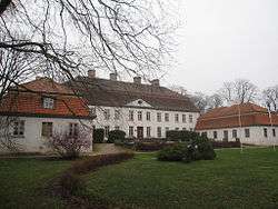 Suuremõisa manor
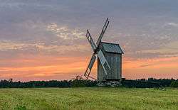 Tubala windmill and surrounding countryside
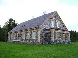 Kuri schoolhouse
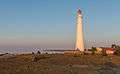
 Near the shore at Sõru
 Soera farm museum
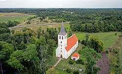 Pühalepa church
 Densely forested thicket on Saarnaki islet
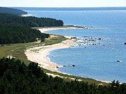 Tahkuna peninsula
 Heltermaa Port
See also
References
- "Maavanem". Archived from the original on 25 September 2015. Retrieved 24 September 2015.
- "Population by sex, age and administrative unit or type of settlement, 1 January". stat.ee. Statistics Estonia. 1 January 2015. Archived from the original on 18 May 2015. Retrieved 13 May 2015.
External links
| Wikimedia Commons has media related to Hiiu County. |
- Official website (in Estonian)
- Hiiumaa – Official tourist information
Geographic locale | ||||||||||||||||||||||
|---|---|---|---|---|---|---|---|---|---|---|---|---|---|---|---|---|---|---|---|---|---|---|
| ||||||||||||||||||||||