High West
High West (Chinese: 西高山) is a mountain in Hong Kong Island.

| High West | |
|---|---|
| 西高山 | |
 High West from Lung Fu Shan View Compass | |
| Highest point | |
| Elevation | 494 m (1,621 ft) Hong Kong Principal Datum |
| Coordinates | 22°16′20.83″N 114°8′10.65″E |
| Naming | |
| Native name | 西高山 (Chinese) |
| Geography | |
 High West Location of High West in | |
| Location | Hong Kong Island |
Geography

The mountain has a height of 494 m (1,621 ft). It is west of Victoria Peak, north of Pok Fu Lam and south of Lung Fu Shan.[1] Queen Mary Hospital is at its west slope. Harlech, Hatton and Lugard Roads terminate at a junction in the pass on its north slope between it and Victoria Peak. The mountain is located within Pok Fu Lam Country Park.[2] On clear days, Tai Mo Shan to the north, Castle Peak to the north-west, Lantau Peak to the west, Tate's Cairn to the north-east and Lamma Island to the south are visible.
Access
Although not as high as nearby Victoria Peak, High West is worth a visit for the physically-fit because it is a much less-touristed location and offers panoramic views over the western and southern sides of the island, as well as Kowloon and parts of New Territories to the north. East of the summit, a small, but well-paved, trail near the junction of Hatton, Lugard and Harlech Roads leads to the top after about 400-500 steps. West of the summit starting from Lung Fu Shan View Compass, there is a rock climb of about 180 metres that leads to the top for rock-climbing experts. This climb is treacherous and is not safe on windy or wet days.
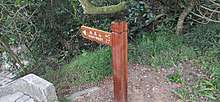
Gallery
 High West Triangulation Station on Summit, Recently Renovated
 High West Path to Summit
References
- "西高山 - 綠洲 Oasistrek". www.oasistrek.com. Retrieved 2019-10-26.
- "Hong Kong Hiking Web". www.hiking.com.hk. Retrieved 2019-10-26.
External links
![]()
| 900 meters or more | |
|---|---|
| 800 to 899 meters | |
| 700 to 799 meters | |
| 600 to 699 meters |
|
| 500 to 599 meters |
|
| 400 to 499 meters (excerpt) |
|
| 300 to 399 meters (excerpt) |
|
| 200 to 299 meters (excerpt) |
|
| 100 to 199 meters (excerpt) |
|
| 99 meters or less (excerpt) |
|
| Collectively |
|