Hatzor HaGlilit
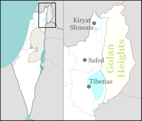
Hatzor HaGlilit (Hebrew: חָצוֹר הַגְּלִילִית) is a town in the Korazim Plateau in northern Israel near Rosh Pinna and Safed. It is named for the nearby biblical site of Tel Hazor. In 2018 it had a population of 9,165.
Hatzor HaGlilit
| |
|---|---|
| Hebrew transcription(s) | |
| • ISO 259 | Ḥaçor ha Glilit |
| • Also spelled | Hatzor HaGlilit (unofficial) |
 | |
 Hatzor HaGlilit | |
| Coordinates: 32°58′46.1″N 35°32′36.51″E | |
| District | Northern |
| Founded | 1953 |
| Government | |
| • Type | Local council |
| • Head of Municipality | Shimon Swisa |
| Area | |
| • Total | 5,170 dunams (5.17 km2 or 2.00 sq mi) |
| Population (2018)[1] | |
| • Total | 9,165 |
| • Density | 1,800/km2 (4,600/sq mi) |
| Website | http://www.hatzorg.co.il |
History

Hatzor was a Canaanite and later Israelite city within the tribe of Naphtali (Joshua 19:36)[2] during late Bronze and early Iron Ages, which was conquered by Assyrian ruler Tiglath-Pileser III in 732 BC and its population was deported,[3] while the city was burnt to the ground.[3][4]
Hatzor HaGlilit was founded in 1952–1953 as a transition camp.[5] The new founded camp was located on the land of the depopulated Palestinian village of Mughr al-Khayt, 1 km southeast of the village site.[6] The two adjacent transition camps were initially named "Hatzor A" and "Hatzor B", named for the nearby biblical site of Tel Hatzor, and housed immigrants and refugees, primarily Jews from North Africa.
In 1956, Hatzor HaGlilit was given the status of local council. By 1958, Hatzor HaGlilit had a population of 4,000 and received development town status.[7] Over time, the city preserved its Jewish religious-traditional demographic status and later a Jewish ultra-orthodox neighbourhood was also established, housing Gur Hassids.
In December 2011, according to the Central Bureau of Statistics, the town was populated by 8,705 residents, with 0.0% population growth.
Landmarks
One of the town's most well-known landmarks is the tomb of Honi the Circle-Maker, adjoining the burial sites of two of his grandsons, Abba Hilkiyah and Hanan HaNihba. According to Jewish legend, Honi HaM'agel had the power to bring rain through his prayers.[8] The presence of this shrine attracted a large Gerrer hassid population to the town.
References
| Wikimedia Commons has media related to Hatzor HaGlilit. |
- "Population in the Localities 2018" (XLS). Israel Central Bureau of Statistics. 25 August 2019. Retrieved 26 August 2019.
- It has to be distinguished from Hazor within the tribe of Judah (Joshua 15:23), after which Hatzor Ashdod was named.
- Israel Finkelstein, The Bible Unearthed
- "However, the correlation between the destruction of Stratum V with Tiglatpileser III's campaign has been challenged"; cf. P. James, "The Alleged 'Anchor Point' of 732 BC for the Destruction of Hazor V", AntOr 6 (2008).
- Vilnay (1976), p. 2489
- Khalidi, 1992, p479
- HaReuveni (1999), p. 327
- "Chatzor Ha-Gelilit – Tomb of the Circle Maker". OHR. Retrieved October 16, 2009.
Bibliography
- HaReuveni, Immanuel (1999). Lexicon of the Land of Israel (in Hebrew). Miskal - Yedioth Ahronoth Books and Chemed Books. ISBN 965-448-413-7.
- Khalidi, Walid (1992), All That Remains: The Palestinian Villages Occupied and Depopulated by Israel in 1948, Washington D.C.: Institute for Palestine Studies, ISBN 0-88728-224-5
- Vilnai, Ze'ev (1976). "Hatzor (5)". Ariel Encyclopedia (in Hebrew). Volume 3. Tel Aviv, Israel: Am Oved.