Harris Township, Michigan
Harris Township is a civil township of Menominee County in the U.S. state of Michigan. The population was 1,895 at the 2000 census.
Harris Township, Michigan | |
|---|---|
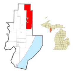 Location within Menominee County | |
 Harris Township Location within the state of Michigan | |
| Coordinates: 45°44′54″N 87°23′32″W | |
| Country | United States |
| State | Michigan |
| County | Menominee |
| Government | |
| • Supervisor | Peter Kleiman |
| Area | |
| • Total | 143.2 sq mi (371.0 km2) |
| • Land | 143.1 sq mi (370.6 km2) |
| • Water | 0.1 sq mi (0.4 km2) |
| Elevation | 850 ft (259 m) |
| Population (2000) | |
| • Total | 1,895 |
| • Density | 13.2/sq mi (5.1/km2) |
| Time zone | UTC-6 (Central (CST)) |
| • Summer (DST) | UTC-5 (CDT) |
| ZIP code(s) | 49845 |
| Area code(s) | 906 |
| FIPS code | 26-36760[1] |
| GNIS feature ID | 1626437[2] |
| Website | Official website |
Communities
- Harris is an unincorporated community in the township on US 2 and US 41 at 45°42′13″N 87°20′43″W.[3] A post office named "DeLoughary" was first established here on July 8, 1880, named for its first postmaster, George W. DeLoughary, a local farmer. The office was closed on May 4, 1883, after DeLoughary resigned. The office reopened on July 13, 1883, with postmaster Michael B. Harris, a lumberman who had settled here in 1875 and was later a state legislator. On September 6, 1900, the office was renamed for him.[4]
- Perronville is an unincorporated community in the township on M-69 at 45°47′55″N 87°21′11″W.[5] A railroad was built through here in 1873 to haul ore and timber. The settlement was named for Menasippe Perron, who built a dam and sawmill here in 1883, and became the first postmaster on September 11, 1897.[4]
Geography
According to the United States Census Bureau, the township has a total area of 143.2 square miles (371 km2), of which 143.1 square miles (371 km2) is land and 0.1 square miles (0.26 km2) (0.10%) is water. Most of the Hannahville Indian Community Indian reservation is located within Harris Township.
Demographics
As of the census[1] of 2000, there were 1,895 people, 656 households, and 516 families residing in the township. The population density was 13.2 per square mile (5.1/km²). There were 862 housing units at an average density of 6.0 per square mile (2.3/km²). The racial makeup of the township was 76.20% White, 0.11% African American, 21.16% Native American, 0.11% Asian, 0.69% from other races, and 1.74% from two or more races. Hispanic or Latino of any race were 1.37% of the population.
There were 656 households out of which 38.4% had children under the age of 18 living with them, 61.7% were married couples living together, 12.0% had a female householder with no husband present, and 21.3% were non-families. 17.5% of all households were made up of individuals and 6.1% had someone living alone who was 65 years of age or older. The average household size was 2.89 and the average family size was 3.25.
In the township the population was spread out with 30.8% under the age of 18, 8.7% from 18 to 24, 28.8% from 25 to 44, 21.7% from 45 to 64, and 10.0% who were 65 years of age or older. The median age was 34 years. For every 100 females, there were 106.7 males. For every 100 females age 18 and over, there were 103.4 males.
The median income for a household in the township was $32,950, and the median income for a family was $38,382. Males had a median income of $26,908 versus $22,583 for females. The per capita income for the township was $14,764. About 8.7% of families and 14.5% of the population were below the poverty line, including 21.8% of those under age 18 and 11.0% of those age 65 or over.
Notes
- "U.S. Census website". United States Census Bureau. Retrieved 2008-01-31.
- U.S. Geological Survey Geographic Names Information System: Harris Township, Michigan
- U.S. Geological Survey Geographic Names Information System: Harris, Michigan
- Romig, Walter (1986) [1973]. Michigan Place Names. Detroit, Michigan: Wayne State University Press. ISBN 0-8143-1838-X.
- U.S. Geological Survey Geographic Names Information System: Perronville, Michigan
Municipalities and communities of Menominee County, Michigan, United States | ||
|---|---|---|
| Cities |  Map of Michigan highlighting Menominee County.svg | |
| Villages | ||
| Civil townships | ||
| Unincorporated communities | ||
| Indian reservation | ||
| Footnotes | ‡This populated place also has portions in an adjacent county or counties | |