Gresham, Wisconsin
Gresham is a village in Shawano County, Wisconsin, United States. The population was 586 at the 2010 census.
Gresham, Wisconsin | |
|---|---|
 Looking north in downtown Gresham | |
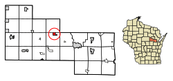 Location of Gresham in Shawano County, Wisconsin. | |
| Coordinates: 44°51′0″N 88°47′15″W | |
| Country | |
| State | |
| County | Shawano |
| incorporated | 1908 |
| Area | |
| • Total | 1.21 sq mi (3.14 km2) |
| • Land | 1.14 sq mi (2.96 km2) |
| • Water | 0.07 sq mi (0.18 km2) |
| Elevation | 928 ft (283 m) |
| Population | |
| • Total | 586 |
| • Estimate (2018)[4] | 565 |
| • Density | 495.18/sq mi (191.14/km2) |
| Time zone | UTC-6 (Central (CST)) |
| • Summer (DST) | UTC-5 (CDT) |
| Area code(s) | 715 & 534 |
| FIPS code | 55-31675[5] |
| GNIS feature ID | 1581552[2] |
| Website | www |
History
The community was named for Walter Q. Gresham, who was the Postmaster General at the time the post office opened in December, 1883.[6]
Geography
Gresham is located at 44°51′11″N 088°47′17″W (44.8530328, -88.7881604).[7]
According to the United States Census Bureau, the village has a total area of 1.24 square miles (3.21 km2), of which, 1.14 square miles (2.95 km2) of it is land and 0.10 square miles (0.26 km2) is water.[8]
Demographics
| Historical population | |||
|---|---|---|---|
| Census | Pop. | %± | |
| 1910 | 350 | — | |
| 1920 | 309 | −11.7% | |
| 1930 | 310 | 0.3% | |
| 1940 | 295 | −4.8% | |
| 1950 | 427 | 44.7% | |
| 1960 | 458 | 7.3% | |
| 1970 | 448 | −2.2% | |
| 1980 | 534 | 19.2% | |
| 1990 | 515 | −3.6% | |
| 2000 | 575 | 11.7% | |
| 2010 | 586 | 1.9% | |
| Est. 2018 | 565 | [4] | −3.6% |
| U.S. Decennial Census[9] | |||
2010 census
As of the census[3] of 2010, there were 586 people, 239 households, and 145 families living in the village. The population density was 514.0 inhabitants per square mile (198.5/km2). There were 280 housing units at an average density of 245.6 per square mile (94.8/km2). The racial makeup of the village was 67.9% White, 0.2% African American, 24.1% Native American, 0.7% from other races, and 7.2% from two or more races. Hispanic or Latino of any race were 3.2% of the population.
There were 239 households of which 31.4% had children under the age of 18 living with them, 39.3% were married couples living together, 16.3% had a female householder with no husband present, 5.0% had a male householder with no wife present, and 39.3% were non-families. 33.5% of all households were made up of individuals and 16.4% had someone living alone who was 65 years of age or older. The average household size was 2.45 and the average family size was 3.12.
The median age in the village was 36.7 years. 27.5% of residents were under the age of 18; 9% were between the ages of 18 and 24; 23.7% were from 25 to 44; 20.1% were from 45 to 64; and 19.6% were 65 years of age or older. The gender makeup of the village was 49.1% male and 50.9% female.
2000 census
As of the census[5] of 2000, there were 575 people, 233 households, and 143 families living in the village. The population density was 503.3 people per square mile (194.7/km²). There were 257 housing units at an average density of 225.0 per square mile (87.0/km²). The racial makeup of the village was 68.70% White, 0.17% African American, 23.48% Native American, 0.52% from other races, and 7.13% from two or more races. Hispanic or Latino of any race were 2.09% of the population.
There were 233 households out of which 32.2% had children under the age of 18 living with them, 41.2% were married couples living together, 15.0% had a female householder with no husband present, and 38.6% were non-families. 34.3% of all households were made up of individuals and 17.6% had someone living alone who was 65.
Images
 Welcome sign
 Post office
 Fire station
 Looking east at Gresham
References
- "2018 U.S. Gazetteer Files". United States Census Bureau. Retrieved Feb 15, 2020.
- "US Board on Geographic Names". United States Geological Survey. 2007-10-25. Retrieved 2008-01-31.
- "U.S. Census website". United States Census Bureau. Retrieved 2012-11-18.
- "Population and Housing Unit Estimates". Retrieved June 4, 2019.
- "U.S. Census website". United States Census Bureau. Retrieved 2008-01-31.
- Callary, Edward. Place Names of Wisconsin. Madison, WI: University of Wisconsin Press. p. 111. ISBN 978-0-299-30964-0.
- "Gresham". Geographic Names Information System. United States Geological Survey. Retrieved 2009-05-03.
- "US Gazetteer files 2010". United States Census Bureau. Archived from the original on 2012-01-24. Retrieved 2012-11-18.
- "Census of Population and Housing". Census.gov. Retrieved June 4, 2015.
External links
| Wikimedia Commons has media related to Gresham, Wisconsin. |
- Visit-Gresham, Official Village of Gresham Website
- Village of Gresham, Wisconsin website
- Gresham, Wisconsin is at coordinates 44°51′0″N 88°47′15″W.
Municipalities and communities of Shawano County, Wisconsin, United States | ||
|---|---|---|
| Cities | 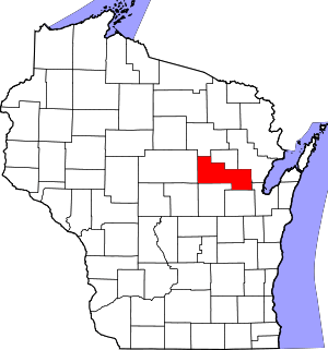 | |
| Villages | ||
| Towns | ||
| CDPs | ||
| Unincorporated communities | ||
| Indian reservations |
| |
| Footnotes | ‡This populated place also has portions in an adjacent county or counties | |
| Authority control |
|
|---|