Birnamwood, Wisconsin
Birnamwood is a village in Marathon and Shawano counties in the U.S. state of Wisconsin. It is part of the Wausau, Wisconsin Metropolitan Statistical Area. The population was 818 at the 2010 census.[6] Of this, 802 were in Shawano County, and 16 were in Marathon County. The village is located mostly within the town of Birnamwood in Shawano County; only a small portion extends into the town of Norrie in adjacent Marathon County. Until the 1990s, Birnamwood was home to the world's largest fiberglass badger.[7] U.S. Route 45 runs through the village.
Birnamwood, Wisconsin | |
|---|---|
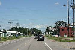 Looking north at downtown Birnamwood | |
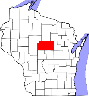
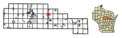 Location of Birnamwood in Shawano County, Wisconsin. | |
| Coordinates: 44°55′52″N 89°12′35″W | |
| Country | |
| State | |
| Counties | Shawano, Marathon |
| Area | |
| • Total | 2.20 sq mi (5.70 km2) |
| • Land | 2.20 sq mi (5.70 km2) |
| • Water | 0.00 sq mi (0.00 km2) |
| Elevation | 1,302 ft (397 m) |
| Population | |
| • Total | 818 |
| • Estimate (2018)[4] | 779 |
| • Density | 353.61/sq mi (136.55/km2) |
| Time zone | UTC-6 (Central (CST)) |
| • Summer (DST) | UTC-5 (CDT) |
| Area code(s) | 715 & 534 |
| FIPS code | 55-07600[5] |
| GNIS feature ID | 1561822[2] |
History
The village was named for Birnam Wood, a town in Scotland mentioned in Shakespeare's Macbeth.[8]
Geography
Birnamwood is located at 44°55′52″N 89°12′35″W (44.931199, -89.209643).[9]
According to the United States Census Bureau, the village has a total area of 2.21 square miles (5.72 km2), all of it land.[10]
Demographics
| Historical population | |||
|---|---|---|---|
| Census | Pop. | %± | |
| 1900 | 475 | — | |
| 1910 | 678 | 42.7% | |
| 1920 | 651 | −4.0% | |
| 1930 | 557 | −14.4% | |
| 1940 | 556 | −0.2% | |
| 1950 | 561 | 0.9% | |
| 1960 | 568 | 1.2% | |
| 1970 | 632 | 11.3% | |
| 1980 | 688 | 8.9% | |
| 1990 | 693 | 0.7% | |
| 2000 | 795 | 14.7% | |
| 2010 | 818 | 2.9% | |
| Est. 2018 | 779 | [4] | −4.8% |
| U.S. Decennial Census[11] | |||
2010 census
At the 2010 census there were 818 people, 343 households, and 217 families living in the village. The population density was 370.1 inhabitants per square mile (142.9/km2). There were 383 housing units at an average density of 173.3 per square mile (66.9/km2). The racial makeup of the village was 97.2% White, 0.5% African American, 0.7% Native American, 0.6% from other races, and 1.0% from two or more races. Hispanic or Latino of any race were 1.8%.[3]
Of the 343 households 30.3% had children under the age of 18 living with them, 47.5% were married couples living together, 9.9% had a female householder with no husband present, 5.8% had a male householder with no wife present, and 36.7% were non-families. 31.8% of households were one person and 18.4% were one person aged 65 or older. The average household size was 2.28 and the average family size was 2.88.
The median age in the village was 41.5 years. 22.6% of residents were under the age of 18; 8.1% were between the ages of 18 and 24; 23.9% were from 25 to 44; 22.6% were from 45 to 64; and 22.6% were 65 or older. The gender makeup of the village was 50.4% male and 49.6% female.
2000 census
At the 2000 census there were 795 people, 309 households, and 202 families living in the village. The population density was 360.4 people per square mile (138.9/km²). There were 328 housing units at an average density of 148.7 per square mile (57.3/km²). The racial makeup of the village was 97.61% White, 0.13% African American, 0.13% Native American, 1.26% Asian, and 0.88% from two or more races. Hispanic or Latino of any race were 0.13%.[5]
Of the 309 households 35.6% had children under the age of 18 living with them, 52.1% were married couples living together, 8.7% had a female householder with no husband present, and 34.6% were non-families. 31.4% of households were one person and 16.8% were one person aged 65 or older. The average household size was 2.48 and the average family size was 3.14.
The age distribution was 29.2% under the age of 18, 6.8% from 18 to 24, 25.8% from 25 to 44, 17.5% from 45 to 64, and 20.8% 65 or older. The median age was 37 years. For every 100 females, there were 89.3 males. For every 100 females age 18 and over, there were 82.2 males.
The median household income was $37,813 and the median family income was $47,574. Males had a median income of $32,500 versus $24,688 for females. The per capita income for the village was $17,740. About 5.0% of families and 7.9% of the population were below the poverty line, including 13.2% of those under age 18 and 2.4% of those age 65 or over.
Notable people
- Benjamin A. Cady, lawyer and legislator, lived in Birnamwood.[12]
- Earl W. Schmidt, farmer, jurist, and legislator, was born in Birnamwood.[13]
Images
 The sign for Birnamwood
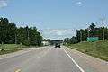
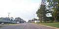 Traveling on U.S. 45 through Birnamwood
References
- "2018 U.S. Gazetteer Files". United States Census Bureau. Retrieved Feb 15, 2020.
- "US Board on Geographic Names". United States Geological Survey. 2007-10-25. Retrieved 2008-01-31.
- "U.S. Census website". United States Census Bureau. Retrieved 2012-11-18.
- "Population and Housing Unit Estimates". Retrieved June 4, 2019.
- "U.S. Census website". United States Census Bureau. Retrieved 2008-01-31.
- "Profile of General Population and Housing Characteristics: 2010 Demographic Profile Data (DP-1): Birnamwood village, Wisconsin". United States Census Bureau. Retrieved September 7, 2012.
- http://www.roadsideamerica.com/story/11919
- Chicago and North Western Railway Company (1908). A History of the Origin of the Place Names Connected with the Chicago & North Western and Chicago, St. Paul, Minneapolis & Omaha Railways. p. 44.
- "US Gazetteer files: 2010, 2000, and 1990". United States Census Bureau. 2011-02-12. Retrieved 2011-04-23.
- "US Gazetteer files 2010". United States Census Bureau. Archived from the original on 2012-01-25. Retrieved 2012-11-18.
- "Census of Population and Housing". Census.gov. Retrieved June 4, 2015.
- 'Wisconsin Blue Book 1909,' Biographical Sketch of Benjamin A. Cady, pg. 1139-1140
- 'Wisconsin Blue Book 1981-1982, Biographical Sketch of Earl William Schmidt, pg. 79
External links
Places adjacent to Birnamwood, Wisconsin | |
|---|---|
Municipalities and communities of Shawano County, Wisconsin, United States | ||
|---|---|---|
| Cities |  | |
| Villages | ||
| Towns | ||
| CDPs | ||
| Unincorporated communities | ||
| Indian reservations |
| |
| Footnotes | ‡This populated place also has portions in an adjacent county or counties | |