Greer County, Oklahoma
Greer County is a county located along the southwest border of the U.S. state of Oklahoma. As of the 2010 census, the population was 6,239.[1] Its county seat is Mangum.[2] From 1860 to 1896, the state of Texas claimed an area known as Greer County, Texas, which included present-day Greer County along with neighboring areas. In 1896 it was designated as a county in Oklahoma Territory under a ruling by the US Supreme Court.[3] The rural Greer County is home to Quartz Mountain Nature Park, near the community of Lone Wolf, Oklahoma (known until 2002 as Quartz Mountain State Park). It is also home to the Oklahoma State Reformatory, located in Granite.[4] Its population has declined since 1930 due to changes in agriculture and migration to cities for work.
Greer County | |
|---|---|
 Greer County Courthouse in Mangum | |
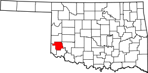 Location within the U.S. state of Oklahoma | |
 Oklahoma's location within the U.S. | |
| Coordinates: 34°56′N 99°34′W | |
| Country | |
| State | |
| Founded | 1896 |
| Seat | Mangum |
| Largest city | Mangum |
| Area | |
| • Total | 644 sq mi (1,670 km2) |
| • Land | 639 sq mi (1,660 km2) |
| • Water | 4.3 sq mi (11 km2) 0.7%% |
| Population | |
| • Estimate (2018) | 5,821 |
| • Density | 9.8/sq mi (3.8/km2) |
| Time zone | UTC−6 (Central) |
| • Summer (DST) | UTC−5 (CDT) |
| Congressional district | 3rd |
| Website | greer |
History
After a dispute over the 1819 Adams-Onís Treaty and the related 1828 Treaty of Limits, the governments of both the United States and the state of Texas claimed ownership of some 1.5 million acres (6,000 km²) in what was then operated as Greer County, Texas. The county was named for former Texas lieutenant governor, John A. Greer.[4] Litigation followed, and in the case of United States v. State of Texas 162 U.S. 1 (1896), with a ruling issued on March 16, the Supreme Court, having original jurisdiction over the case, decided in favor of the United States.
The county was assigned to the Oklahoma Territory on May 4, 1896. When Oklahoma was admitted as a state, Greer County was established according to its current boundaries; the remaining former county area was organized as Harmon, Jackson, and part of Beckham counties. The town of Mangum, designated as the county seat in 1886 when this was part of Texas, continued as the seat of Greer County, Oklahoma.[4] From its establishment until at least 1903, Greer County was a sundown county, prohibiting African Americans from living in the county.[5]
Originally developed for agriculture, the rural county had its peak of population in 1930. Mechanization of agriculture reduced the need for farm labor, and the population has declined as people migrated to cities for work.
Among the county attractions is Quartz Mountain Nature Park (known until 2002 as Quartz Mountain State Park), near the community of Lone Wolf.
Geography
According to the U.S. Census Bureau, the county has a total area of 644 square miles (1,670 km2), of which 639 square miles (1,660 km2) is land and 4.3 square miles (11 km2) (0.7%) is water.[6]
Western Greer County lies in the Gypsum Hills, while the eastern one-third is in the Red Bed Plains physiographic region. The county is drained by the North Fork Red River, Elm Fork Red River, and Salt Fork Red River.[4]
Major highways


Adjacent counties
- Beckham County (north)
- Kiowa County (east)
- Jackson County (south)
- Harmon County (west)
Demographics
| Historical population | |||
|---|---|---|---|
| Census | Pop. | %± | |
| 1910 | 16,449 | — | |
| 1920 | 15,836 | −3.7% | |
| 1930 | 20,282 | 28.1% | |
| 1940 | 14,550 | −28.3% | |
| 1950 | 11,749 | −19.3% | |
| 1960 | 8,877 | −24.4% | |
| 1970 | 7,979 | −10.1% | |
| 1980 | 7,028 | −11.9% | |
| 1990 | 6,559 | −6.7% | |
| 2000 | 6,061 | −7.6% | |
| 2010 | 6,239 | 2.9% | |
| Est. 2018 | 5,821 | [7] | −6.7% |
| U.S. Decennial Census[8] 1790-1960[9] 1900-1990[10] 1990-2000[11] 2010-2013[1] | |||
As of the census[12] of 2000, there were 6,061 people, 2,237 households, and 1,442 families residing in the county. The population density was 10 people per square mile (4/km²). There were 2,788 housing units at an average density of 4 per square mile (2/km²). The racial makeup of the county was 81.46% White, 8.78% Black or African American, 2.47% Native American, 0.26% Asian, 0.02% Pacific Islander, 3.99% from other races, and 3.02% from two or more races. 7.44% of the population were Hispanic or Latino of any race.
There were 2,237 households out of which 25.60% had children under the age of 18 living with them, 51.00% were married couples living together, 9.60% had a female householder with no husband present, and 35.50% were non-families. 33.40% of all households were made up of individuals and 19.80% had someone living alone who was 65 years of age or older. The average household size was 2.27 and the average family size was 2.87.
In the county, the population was spread out with 20.00% under the age of 18, 9.10% from 18 to 24, 28.40% from 25 to 44, 22.40% from 45 to 64, and 20.00% who were 65 years of age or older. The median age was 40 years. For every 100 females there were 123.80 males. For every 100 females age 18 and over, there were 129.60 males.
The median income for a household in the county was $25,793, and the median income for a family was $30,702. Males had a median income of $24,318 versus $18,641 for females. The per capita income for the county was $14,053. About 15.00% of families and 19.60% of the population were below the poverty line, including 28.40% of those under age 18 and 14.80% of those age 65 or over.
Politics
| Voter Registration and Party Enrollment as of January 15, 2019[13] | |||||
|---|---|---|---|---|---|
| Party | Number of Voters | Percentage | |||
| Democratic | 1,546 | 55.85% | |||
| Republican | 890 | 32.15% | |||
| Others | 332 | 11.99% | |||
| Total | 2,768 | 100% | |||
| Year | Republican | Democratic | Third parties |
|---|---|---|---|
| 2016 | 78.2% 1,482 | 17.0% 323 | 4.8% 91 |
| 2012 | 73.4% 1,344 | 26.6% 488 | |
| 2008 | 73.2% 1,548 | 26.8% 566 | |
| 2004 | 68.0% 1,529 | 32.0% 719 | |
| 2000 | 59.8% 1,287 | 39.0% 839 | 1.2% 26 |
| 1996 | 36.0% 905 | 49.3% 1,240 | 14.8% 372 |
| 1992 | 34.7% 964 | 41.8% 1,162 | 23.5% 653 |
| 1988 | 48.9% 1,225 | 50.2% 1,256 | 0.9% 22 |
| 1984 | 57.4% 1,664 | 42.1% 1,220 | 0.6% 17 |
| 1980 | 49.5% 1,535 | 48.1% 1,492 | 2.3% 72 |
| 1976 | 35.2% 1,164 | 63.9% 2,113 | 0.9% 31 |
| 1972 | 66.4% 2,154 | 31.0% 1,004 | 2.7% 86 |
| 1968 | 35.3% 1,225 | 40.9% 1,419 | 23.9% 830 |
| 1964 | 31.8% 1,247 | 68.2% 2,671 | |
| 1960 | 56.0% 2,158 | 44.0% 1,698 | |
| 1956 | 44.0% 1,499 | 56.0% 1,907 | |
| 1952 | 48.1% 2,147 | 52.0% 2,321 | |
| 1948 | 19.0% 713 | 81.0% 3,044 | |
| 1944 | 26.5% 1,075 | 73.4% 2,984 | 0.1% 5 |
| 1940 | 25.2% 1,195 | 74.4% 3,524 | 0.4% 21 |
| 1936 | 16.9% 766 | 82.8% 3,745 | 0.2% 11 |
| 1932 | 9.0% 418 | 91.0% 4,240 | |
| 1928 | 57.5% 2,262 | 41.8% 1,645 | 0.7% 28 |
| 1924 | 19.5% 551 | 70.1% 1,982 | 10.4% 293 |
| 1920 | 32.8% 1,013 | 59.9% 1,854 | 7.3% 226 |
| 1916 | 14.6% 369 | 66.3% 1,675 | 19.1% 483 |
| 1912 | 16.8% 351 | 63.9% 1,334 | 19.3% 404 |
Economy
The county's economy has been based on farming and raising livestock. In 1907, the main crops were cotton, corn, oats, wheat and alfalfa. Livestock raised includes cattle, horses, mules, swine, sheep and goats.[4]
The Oklahoma State Reformatory is located in Granite in the county and provides some jobs.[4]
Communities
Cities
Mangum (county seat)
Notable people
- Edward Everett Dale (1879-1972), historian; professor at The University of Oklahoma [4]
- William T. Ponder, World War I flying ace[4]
- Victor E. Wickersham, (1906-1988) U.S. politician; member of the U.S. House of Representatives[4]
See also
References
- "State & County QuickFacts". United States Census Bureau. Archived from the original on June 6, 2011. Retrieved November 9, 2013.
- "Find a County". National Association of Counties. Archived from the original on 2011-05-31. Retrieved 2011-06-07.
- "Oklahoma: Individual County Chronologies". Oklahoma Atlas of Historical County Boundaries. The Newberry Library. Retrieved February 24, 2015.
- Wilson, Linda D. Encyclopedia of Oklahoma History and Culture. "Greer County. Retrieved March 5, 2015.
- "Ban Placed on Negroes". Scott County Kicker. Benton, Missouri. September 5, 1903. p. 2 – via Chronicling America.
Because the ban has been placed on the negroes by the citizens of Greer county, Okla., there will be an estimated loss of 5,000 bales of this year's cotton crop. Greer county, which, until a few years ago, was a part of Texas, is one of the big cotton producers of the territory. This year the farmers raised 20 per cent. increased acreage and a 15-per-cent. increase yield, but there is a labor famine. The growers have been threatened by the citizens in general upon every attempt to import negroes, but unless the necessary laborers are secured in the immediate future the financial loss will be great. The growers now have a movement on foot to bring 100 Mexican families to pick the cotton crop. Since the organization of Greer county no negroes have been allowed to live within its boundaries.
- "2010 Census Gazetteer Files". United States Census Bureau. August 22, 2012. Retrieved February 21, 2015.
- "Population and Housing Unit Estimates". Retrieved December 28, 2019.
- "U.S. Decennial Census". United States Census Bureau. Retrieved February 21, 2015.
- "Historical Census Browser". University of Virginia Library. Retrieved February 21, 2015.
- Forstall, Richard L., ed. (March 27, 1995). "Population of Counties by Decennial Census: 1900 to 1990". United States Census Bureau. Retrieved February 21, 2015.
- "Census 2000 PHC-T-4. Ranking Tables for Counties: 1990 and 2000" (PDF). United States Census Bureau. April 2, 2001. Retrieved February 21, 2015.
- "U.S. Census website". United States Census Bureau. Retrieved 2008-01-31.
- "Oklahoma Registration Statistics by County" (PDF). OK.gov. January 15, 2019. Retrieved 2019-02-27.
- Leip, David. "Dave Leip's Atlas of U.S. Presidential Elections". uselectionatlas.org. Retrieved 2018-03-29.
External links
| Wikisource has the text of the 1879 American Cyclopædia article Greer. |
- Mangum Main Street
- Greer County Chamber of Commerce
- Old Greer County Museum & Hall of Fame
- Greer County Extension Service
- Encyclopedia of Oklahoma History and Culture - Greer County
- Oklahoma Digital Maps: Digital Collections of Oklahoma and Indian Territory
Places adjacent to Greer County, Oklahoma | ||||||||||
|---|---|---|---|---|---|---|---|---|---|---|
| ||||||||||
Municipalities and communities of Greer County, Oklahoma, United States | ||
|---|---|---|
| City | Greer County map | |
| Towns | ||
| Unincorporated community | ||
| Ghost town | ||
Oklahoma City (capital) | ||
| Topics |
|  |
| Society |
| |
| Regions | ||
| Largest cities | ||
| Counties |
| |
| Authority control |
|
|---|