Green Line (Cleveland)
The Green Line (formerly known as the Shaker Line) is a light rail line of the RTA Rapid Transit system in Cleveland and Shaker Heights, Ohio, running from Tower City Center downtown, then east to Green Road near Beachwood. 2.6 miles (4.2 km) of track, including two stations (Tri-C–Campus District and East 55th), are shared with the rapid transit Red Line, the stations have low platforms for the Green Line and high platforms for the Red Line. The Green Line shares the right-of-way with the Blue Line in Cleveland, and splits off after passing through Shaker Square. The Green Line also operates through service to the Waterfront Line. All RTA light rail lines use overhead lines and pantographs to draw power.
| Green Line | ||||||||||||||||||||||||||||||||||||||||||||||||||||||||||||||||||||||||||||||||||||||||||||||||||||||||||||||||||||||||||||||||||||||||||||||||||||||||||||||||||||||||||||||||||||||||||||||||||||||||||||||||||||||||||||||||||||||
|---|---|---|---|---|---|---|---|---|---|---|---|---|---|---|---|---|---|---|---|---|---|---|---|---|---|---|---|---|---|---|---|---|---|---|---|---|---|---|---|---|---|---|---|---|---|---|---|---|---|---|---|---|---|---|---|---|---|---|---|---|---|---|---|---|---|---|---|---|---|---|---|---|---|---|---|---|---|---|---|---|---|---|---|---|---|---|---|---|---|---|---|---|---|---|---|---|---|---|---|---|---|---|---|---|---|---|---|---|---|---|---|---|---|---|---|---|---|---|---|---|---|---|---|---|---|---|---|---|---|---|---|---|---|---|---|---|---|---|---|---|---|---|---|---|---|---|---|---|---|---|---|---|---|---|---|---|---|---|---|---|---|---|---|---|---|---|---|---|---|---|---|---|---|---|---|---|---|---|---|---|---|---|---|---|---|---|---|---|---|---|---|---|---|---|---|---|---|---|---|---|---|---|---|---|---|---|---|---|---|---|---|---|---|---|---|---|---|---|---|---|---|---|---|---|---|---|---|---|---|---|
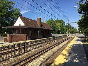
 The Green Line at South Park station | ||||||||||||||||||||||||||||||||||||||||||||||||||||||||||||||||||||||||||||||||||||||||||||||||||||||||||||||||||||||||||||||||||||||||||||||||||||||||||||||||||||||||||||||||||||||||||||||||||||||||||||||||||||||||||||||||||||||
| Overview | ||||||||||||||||||||||||||||||||||||||||||||||||||||||||||||||||||||||||||||||||||||||||||||||||||||||||||||||||||||||||||||||||||||||||||||||||||||||||||||||||||||||||||||||||||||||||||||||||||||||||||||||||||||||||||||||||||||||
| Type | Light rail/Tram | |||||||||||||||||||||||||||||||||||||||||||||||||||||||||||||||||||||||||||||||||||||||||||||||||||||||||||||||||||||||||||||||||||||||||||||||||||||||||||||||||||||||||||||||||||||||||||||||||||||||||||||||||||||||||||||||||||||
| System | RTA Rapid Transit | |||||||||||||||||||||||||||||||||||||||||||||||||||||||||||||||||||||||||||||||||||||||||||||||||||||||||||||||||||||||||||||||||||||||||||||||||||||||||||||||||||||||||||||||||||||||||||||||||||||||||||||||||||||||||||||||||||||
| Locale | Cleveland and Shaker Heights, Cuyahoga County, Ohio | |||||||||||||||||||||||||||||||||||||||||||||||||||||||||||||||||||||||||||||||||||||||||||||||||||||||||||||||||||||||||||||||||||||||||||||||||||||||||||||||||||||||||||||||||||||||||||||||||||||||||||||||||||||||||||||||||||||
| Termini | Tower City Green Road | |||||||||||||||||||||||||||||||||||||||||||||||||||||||||||||||||||||||||||||||||||||||||||||||||||||||||||||||||||||||||||||||||||||||||||||||||||||||||||||||||||||||||||||||||||||||||||||||||||||||||||||||||||||||||||||||||||||
| Stations | 18 | |||||||||||||||||||||||||||||||||||||||||||||||||||||||||||||||||||||||||||||||||||||||||||||||||||||||||||||||||||||||||||||||||||||||||||||||||||||||||||||||||||||||||||||||||||||||||||||||||||||||||||||||||||||||||||||||||||||
| Operation | ||||||||||||||||||||||||||||||||||||||||||||||||||||||||||||||||||||||||||||||||||||||||||||||||||||||||||||||||||||||||||||||||||||||||||||||||||||||||||||||||||||||||||||||||||||||||||||||||||||||||||||||||||||||||||||||||||||||
| Opened | December 17, 1913[1] | |||||||||||||||||||||||||||||||||||||||||||||||||||||||||||||||||||||||||||||||||||||||||||||||||||||||||||||||||||||||||||||||||||||||||||||||||||||||||||||||||||||||||||||||||||||||||||||||||||||||||||||||||||||||||||||||||||||
| Owner | Cleveland & Youngstown Railroad (1913–1920) Cleveland Interurban Railroad (1920–1929) Metropolitan Utilities (1929–1935) Union Properties (47%), Guardian Savings and Trust (33%) and Cleveland Trust (20%) (1935–1944) City of Shaker Heights (1944–1975) GCRTA (1975–present) | |||||||||||||||||||||||||||||||||||||||||||||||||||||||||||||||||||||||||||||||||||||||||||||||||||||||||||||||||||||||||||||||||||||||||||||||||||||||||||||||||||||||||||||||||||||||||||||||||||||||||||||||||||||||||||||||||||||
| Operator(s) | Cleveland Railway (1913–1930) Cleveland Interurban Railroad (1930–1944) City of Shaker Heights (1944–1975) GCRTA (1975–present) | |||||||||||||||||||||||||||||||||||||||||||||||||||||||||||||||||||||||||||||||||||||||||||||||||||||||||||||||||||||||||||||||||||||||||||||||||||||||||||||||||||||||||||||||||||||||||||||||||||||||||||||||||||||||||||||||||||||
| Technical | ||||||||||||||||||||||||||||||||||||||||||||||||||||||||||||||||||||||||||||||||||||||||||||||||||||||||||||||||||||||||||||||||||||||||||||||||||||||||||||||||||||||||||||||||||||||||||||||||||||||||||||||||||||||||||||||||||||||
| Number of tracks | 2 | |||||||||||||||||||||||||||||||||||||||||||||||||||||||||||||||||||||||||||||||||||||||||||||||||||||||||||||||||||||||||||||||||||||||||||||||||||||||||||||||||||||||||||||||||||||||||||||||||||||||||||||||||||||||||||||||||||||
| Track gauge | 4 ft 8 1⁄2 in (1,435 mm) standard gauge | |||||||||||||||||||||||||||||||||||||||||||||||||||||||||||||||||||||||||||||||||||||||||||||||||||||||||||||||||||||||||||||||||||||||||||||||||||||||||||||||||||||||||||||||||||||||||||||||||||||||||||||||||||||||||||||||||||||
| Electrification | Overhead catenary, 600 volts DC[2] | |||||||||||||||||||||||||||||||||||||||||||||||||||||||||||||||||||||||||||||||||||||||||||||||||||||||||||||||||||||||||||||||||||||||||||||||||||||||||||||||||||||||||||||||||||||||||||||||||||||||||||||||||||||||||||||||||||||
| ||||||||||||||||||||||||||||||||||||||||||||||||||||||||||||||||||||||||||||||||||||||||||||||||||||||||||||||||||||||||||||||||||||||||||||||||||||||||||||||||||||||||||||||||||||||||||||||||||||||||||||||||||||||||||||||||||||||
History
The Green Line is the direct, continuously operating descendant of the privately-owned Cleveland & Youngstown Railroad, Cleveland Interurban Railroad and later the municipally owned Shaker Heights Rapid Transit, built as a branch of the Shaker Heights streetcar lines to connect the streetcar suburb of Shaker Heights to downtown Cleveland. This line, along with the Blue Line, were the only ones to survive the bustitution of Cleveland's transit system, partly due to their use of grade-separated trackage to across much of the east side of Cleveland.
Cleveland & Youngstown Railroad

The Van Sweringen brothers purchased the land of what is now Shaker Heights in 1906 intending to create a planned suburban community. They knew that the success of their plans depended upon the availability of streetcar service to downtown Cleveland, so they persuaded the Cleveland Railway to extend its Euclid Heights trolley line along Fairmount Boulevard from Cedar Road to Lee Road, which was completed by 1907.
To improve travel times to downtown, the Vans organized the Cleveland and Youngstown Railroad. On October 27, 1911, with a population of only 200, the Village of Shaker Heights was incorporated, and two years later on December 17, 1913, the first section of the C&Y opened, 1.6 miles (2.6 km) from Coventry Road east down the median of the future Shaker Boulevard (then part of Coventry Road) to Fontenay Road (west of Eaton Road). The line connected to downtown Cleveland via a line along Coventry Road, north to the 1907 Shaker Heights streetcar line on Fairmount Boulevard in Cleveland Heights. On May 20, 1915, the eastern terminus of the C&Y was extended from Fontenay Road to Courtland Boulevard.
Cleveland Interurban Railroad
Initially, the Shaker Line operated independently, being in operation seven years prior to the opening of what is now the Blue Line from Lynnfield to East 55th. When the Moreland (later Van Aken) line opened in April of 1920, the Shaker line continued to use the old line through Cleveland Heights. With the opening of the connection from Coventry to Shaker Square on August 16, 1920, the old line became a shuttle to Fairmount, and later closed on March 12, 1923.
There have been several other proposals to connect the Shaker Boulevard rapid transit line with the streetcar line on Fairmount Boulevard. The Fairmount line was perpetually plagued with low ridership, and a connection to the Shaker line was seen as a way to improve service and make the Fairmount line more attractive to riders. In 1922, Cleveland Railway proposed a connection from Moreland Circle (now Shaker Square) along North Moreland Boulevard and what is now Fairhill Road (then called Fairmount Road) to the existing tracks on Coventry Road. The trackage for the entire connection would run in the median of divided boulevards.[3][4]
As the Van Sweringens' railroad plans grew, they constructed a new Union Terminal for Cleveland. Cleveland Union Terminal (CUT) opened in 1930, along with a new grade-separated right-of-way with side-by-side lines for steam railroads and interurban streetcars, including the CIRR. Although their plans for another interurban line never materialized (the right-of-way was later used for the Red Line), the CIRR immediately began operations via the new right-of-way into the north part of CUT specially reserved for interurban train service. The CIRR no longer needed to run on city streetcar tracks and the ramp to Broadway and East 34th Street was removed. The first CIRR trains rolled into CUT on July 20. A further extension of the Shaker Boulevard line moved the eastern terminus to Green Road in 1936.[5]
Shaker Heights Rapid Transit
On September 6, 1944, the City of Shaker Heights took over the financially struggling lines and began operating them as Shaker Heights Rapid Transit. The city lacked funds for major line extensions. However, it did modernize the fleet with the purchase of PCC cars beginning in 1947.

Prior to the conversion of the Fairmount streetcar line to bus service in 1948, the Cleveland Transit System (CTS), which had taken over operation of the Cleveland streetcar lines in 1941 attempted to have the Shaker Heights Rapid Transit (then operated by the City of Shaker Heights) take over the Fairmount line from Coventry Road to its terminus at Canterbury Road. The same route as in 1922 was proposed to connect the lines, and CTS further proposed extending the Fairmount line eastward to Fairmount Circle where it could attract more riders from John Carroll University. However, Shaker Heights lacked the money to undertake the work, and Fairmount Boulevard streetcar service soon ended.[6]
In 1955 the Cleveland Transit System (which was formed in 1942 when the City of Cleveland took over the Cleveland Railway Company) opened the first section of the city's new rapid transit line, now known as the Red Line. It used much of the right-of-way and some of the catenary poles from the Van Sweringen's planned east-west interurban line adjacent to the NYC&StL tracks. The first section of the CTS rapid transit east from Cleveland Union Terminal included 2.6 miles (4.2 km) and two stations shared with the Shaker Heights Rapid Transit line, necessitating split platforms with low-level sections (for Shaker Heights rapid transit cars) and high-level sections (for CTS rapid transit cars).
Greater Cleveland Regional Transit Authority
By the 1970s the City of Shaker Heights was struggling to maintain the Shaker Heights Rapid Transit and in Cleveland, CTS was facing financial problems with its rapid transit and bus system. Significant federal money was available, but only if a regional transit system was formed. In 1974, the Greater Cleveland Regional Transit Authority (or RTA) was organized to take over the municipal transit system in Cleveland and others throughout Cuyahoga County. Voters approved a county-wide sales tax increase to help subsidize the transit system and RTA officially took over the Shaker Heights Rapid Transit lines on July 14, 1975. On September 30, 1979, RTA adopted a new designation for the rapid transit lines. The Airport-Windermere Line became the Red Line, while the Shaker Rapid Transit lines (Shaker and Van Aken) became the Green and Blue Lines.
In 1980, RTA undertook a complete renovation of the Green Line, with new track, ballast, poles and overhead wiring. Existing stations were demolished and new stations constructed. The project necessitated closing the Green Line east of Shaker Square for most of the summer of 1980, with substitute bus shuttles and single-tracking along the remainder of the line from East 55th Street to Shaker Square. To run on the renovated lines, a fleet of new LRVs were purchased from an Italian firm, Breda Costruzioni Ferroviarie, to replace the aging PCC cars. The new line was dedicated on October 30, 1981.
Fare collection
Fares are paid upon entering when traveling eastbound (southbound on the Waterfront Line) and upon leaving when traveling westbound (northbound on the Waterfront Line). Fares are collected on board the train except at Tower City Station, where they are collected at faregates entering or leaving the station. Certain other stations, notably those on the Waterfront Line, have facilities for collecting fares, but those facilities are not used except during special events, such as during Cleveland Browns games at West 3rd Street Station.
Schedule
Blue and Green Line trains operate from approximately 3:40 a.m. to 1:00 a.m. daily. On weekdays, each line operates every 10 minutes during rush hour and every 30 minutes at other times. Service between Tower City and Shaker Square operates every 5 minutes during rush hour and every 15 minutes at other times. Service on the Waterfront Line is limited to approximately every three westbound trains from 6:35 a.m. to 8:50 a.m. and again from 3:35 p.m. through 7:20 p.m. Between 8:50 a.m. and 3:35 p.m. and again between 7:20 p.m. and 10:20 p.m., all westbound trains travel along the Waterfront Line. No Waterfront Line service is provided between 10:45 p.m. and 6:35 a.m.
On weekends, each line operates every 30 minutes. Service between Tower City and Shaker Square operates every 15 minutes and all westbound trains from 9:20 a.m. through 10:20 p.m. operate on the Waterfront Line.
Rail Replacement Bus
During rail shutdowns, RTA uses replacement buses with the destination signs "67R GREEN LINE TO ______". Green Line shuttle buses run between Tower City and Green Road.
Rolling stock
| Year | Make | Model | Length mm /( in) | Width mm /( in) | Gauge | Numbers |
|---|---|---|---|---|---|---|
| 1980–1981 | Breda | LRV | 23,504 mm (925.35 in) | 2,818 mm (110.94 in) | 4 ft 8 1⁄2 in (1,435 mm) standard gauge | 48 |
The Blue and Green Lines use a fleet of 48 light rail vehicles (LRVs) manufactured by Breda Costruzioni Ferroviarie in 1980 and 1981. Each car is 77.13 feet (23,509 mm) long, 11.32 feet (3,450 mm) high, and 9.3 feet (2,835 mm) wide and is articulated with operator cabs at each end, seating 84 passengers in 42 double transverse seats. The units are numbered 801–848.[7] RTA needs 34 of the cars for regular use, and requires only 17 to operate currently scheduled service.[8]
The cars originally had white exteriors with broad orange and red stripes, and an interior finished in earth tones with faux wood paneling and orange and brown vinyl padded seats. With the opening of the Waterfront Line in 1996, RTA renovated five cars with blue and white exteriors, gray interiors with new gray and blue fabric-covered seats, and portraits of famous Clevelanders.
The fleet is over 25 years old, and RTA is currently renovating up to 34 cars with the hope of making them last for another 15 years. The renovated cars have silver exteriors with blue and red stripes, and gray and silver interiors with blue and red seats.
The Breda LRV cars replaced a fleet of PCC cars, some built for the Shaker Rapid Transit in 1947 and some purchased in 1953 and 1959.
Stations
Stations between East 55th and Shaker Square were not served by the Green Line until August 16, 1920.
| Station[9][10] | Date opened | Date rebuilt | Location | Connections / notes[11][9][10] |
|---|---|---|---|---|
| Tower City |
July 20, 1930 | December 17, 1990[1] | Downtown | RTA Rapid Transit: Red Line, Blue Line, Waterfront Line, HealthLine RTA Bus: B-Line, C-Line and E-Line Trolleys; 1, 3, 8, 11, 14, 15, 19, 22, 26, 38, 39, 39F, 45, 51, 51A, 51B, 51C, 53F, 55A, 55B, 55C, 76, 77F, 79, 79A, 81, 90F, 246, 251, 263 METRO RTA: 60, 61 PARTA: 100 SARTA: 4 Laketran 10, 11, 12 |
| Tri-C–Campus District |
August 18, 2003 September 24, 2018 |
Central | RTA Rapid Transit: Red Line, Blue Line
RTA Bus: 15, 19, 76 Formerly East 34th–Campus | |
| East 55th |
April 11, 1920[5] | October 11, 2011[12] | North Broadway | RTA Rapid Transit: Red Line, Blue Line RTA Bus: 16 |
| East 79th | October 30, 1981[5] | Kinsman | RTA Rapid Transit: Blue Line RTA Bus: 2 | |
| Buckeye–Woodhill |
October 30, 1981[5] October 23, 2012 |
Kinsman / Woodland Hills |
RTA Rapid Transit: Blue Line
RTA Bus: 10, 11 Formerly Woodhill | |
| East 116th–St. Luke's |
October 30, 1981[5] March 8, 2019 |
Woodland Hills | RTA Rapid Transit: Blue Line
RTA Bus: 8 Formerly East 116th | |
| Shaker Square |
October 1952 July 1986[5] |
Buckeye–Shaker | RTA Rapid Transit: Blue Line
RTA Bus: 11, 48, 48A Formerly Moreland Circle | |
| Coventry | December 17, 1913[5] | October 11, 1980[5] | Shaker Heights | |
| Southington | ||||
| South Park | ||||
| Lee–Shaker |
October 11, 1980[5] October 17, 2017 |
RTA Bus: 40 | ||
| Attleboro | October 11, 1980[5] | |||
| Eaton | May 20, 1915[5] | |||
| Courtland | ||||
| Warrensville–Shaker |
December 6, 1928[13] | October 11, 1980.[5] November 22, 2016 |
RTA Bus: 41, 41F | |
| Belvoir | November 1, 1936[14] | October 11, 1980[5] | ||
| West Green |
||||
| Green Road |
October 11, 1980[5] 2001 |
RTA Bus: 34, 94 |
References
- "History of public transit in Greater Cleveland". Cleveland, Ohio: Greater Cleveland Regional Transit Authority. 2012. Retrieved April 12, 2015.
- "Catalog of "Common Use" Rail Corridors" (PDF). Office of Research and Development, Federal Railroad Administration, United States Department of Transportation. April 2003. Archived from the original (PDF) on September 16, 2008. Retrieved July 19, 2008.
- Landgraf, Robert J. (1978). "Pre-Metro: Conversion Now or Never" (PDF). Transportation Research Board. p. 62. Retrieved February 22, 2020.
- Toman, James A.; Toman, Jim; Hays, Blaine S. (1996). Cleveland's Transit Vehicles: Equipment and Technology. Kent State University Press. p. 41. ISBN 978-0-87338-548-0.
- Toman, James (1990). The Shaker Heights Rapid Transit. Glendale, California: Interurban Press. ISBN 0-916374-95-5.
- Toman, James A.; Blaine S. Hays (1996). Horse Trails to Regional Rails: The Story of Public Transit in Greater Cleveland. Kent, Ohio: Kent State University Press. pp. 223–224. ISBN 0-87338-547-0.
- For time, there was a car 849 after one end each of 818 and 840 were damaged in a collision at the RTA yard. 849 was the front half of 840 and the rear half of 818. These combination was later renumbered 840 while the front half of 818 and the rear half of 840 became 818. Source: "Cleveland's Rapid Transit Vehicles" by James Toman and Blaine Hayes, Kent State University Press, 1996.
- Exner, Rich (June 3, 2005). "Rebuild is anything but rapid RTA's first Breda-car renovations: over budget and behind schedule". The Plain Dealer. p. B3. Retrieved 2007-06-11.
- "Green Line (Shaker) / Blue Line (Van Aken)" (PDF). Cleveland, Ohio: Greater Cleveland Regional Transit Authority. December 15, 2013. Retrieved April 11, 2015.
- "Major Stations". Cleveland, Ohio: Greater Cleveland Regional Transit Authority. 2012. Retrieved April 12, 2015.
- "Rapid Transit System Map" (PDF). www.riderta.com. RTA Rapid Transit. Retrieved 28 December 2019.
- "New E. 55th Rapid Station official grand opening". Greater Cleveland Regional Transit Authority (via Archive.org). October 7, 2011. Archived from the original on January 3, 2012. Retrieved April 12, 2015.
- "Extend Rapid Transit". Cleveland Plain Dealer (Morning). December 5, 1928. Retrieved 21 January 2019.
- "New Rapid Service Set". Cleveland Plain Dealer (Morning). 27 October 1936. Retrieved 21 January 2019.
External links
| Wikimedia Commons has media related to Green Line (Cleveland). |
- Routes - Greater Cleveland Regional Transit Authority - Rail
- Jon Bell - Cleveland, Ohio: Green and Blue Lines
- Northern Ohio Railway Museum
| Rapid transit | ||
|---|---|---|
| Light rail | ||
| Bus rapid transit | ||