Grade II* listed buildings in the London Borough of Waltham Forest
There are over 20,000 Grade II* listed buildings in England. This page is a list of these buildings in the London Borough of Waltham Forest.
Buildings
| Name | Location | Type | Completed [note 1] | Date designated | Grid ref.[note 2] Geo-coordinates |
Entry number [note 3] | Image |
|---|---|---|---|---|---|---|---|
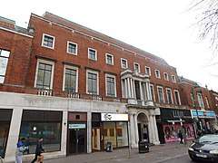
| ABC Cinema | Walthamstow | Shop | Late C20 | 24 February 1987 | TQ3724389311 51°35′09″N 0°01′14″W |
1065590 | 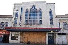 ABC Cinema |
| Chestnuts House | Walthamstow | House | 1745-7 | 19 October 1951 | TQ3747988447 51°34′41″N 0°01′03″W |
1191062 |  |
| Church of All Saints | Chingford | Parish Church | 12th century | 28 June 1954 | TQ3737293382 51°37′21″N 0°01′01″W |
1065596 | |
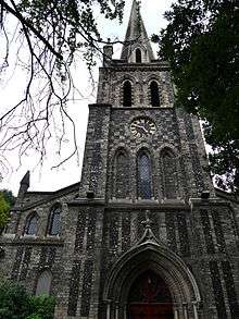
| Church of St Barnabas and St James the Greater | Walthamstow | Church | 1902 | 24 February 1981 | TQ3722488298 51°34′37″N 0°01′16″W |
1065600 | 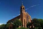 Church of St Barnabas and St James the Greater |
| Church of St Peter and St Paul | Chingford | Church | 1844 | 28 June 1954 | TQ3860494383 51°37′52″N 0°00′04″E |
1065582 | |
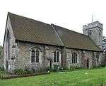
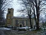
| Parish Church of St Mary the Virgin | Leyton | Parish Church | 1658 | 27 May 1954 | TQ3768186857 51°33′50″N 0°00′54″W |
1293623 |  Parish Church of St Mary the Virgin |
| Parish Church of St Mary's | Walthamstow | Church | 16th century | 19 October 1951 | TQ3784289229 51°35′06″N 0°00′43″W |
1357600 | |
| Leytonstone Library | Leytonstone | Library | 1934 | 28 April 2014 | TQ3943387392 51°34′05″N 0°00′37″E |
1418380 | |
| Queen Elizabeth's Hunting Lodge | Chingford | Hunting Lodge | Early 16th century | 28 June 1954 | TQ3972494776 51°38′04″N 0°01′03″E |
1293481 | |
| The United Free Church | Woodford Green | Church | 1904 | 24 February 1987 | TQ4001692188 51°36′40″N 0°01′15″E |
1081029 | |
| The Water House, Lloyd Park (William Morris Gallery) | Walthamstow | House | 1762 | 19 October 1951 | TQ3722989902 51°35′29″N 0°01′13″W |
1065620 | |
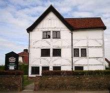
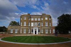
| Walnut Tree House | Leyton | House | Mid 16th century or earlier | 27 May 1954 | TQ3802787126 51°33′58″N 0°00′36″W |
1065586 | 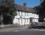 Walnut Tree House |
| Walthamstow House (Corpus Christi School) | Walthamstow | House | Mid 18th century | 19 October 1951 | TQ3810189745 51°35′23″N 0°00′28″W |
1065601 | |
Notes
- The date given is the date used by Historic England as significant for the initial building or that of an important part in the structure's description.
- Sometimes known as OSGB36, the grid reference is based on the British national grid reference system used by the Ordnance Survey.
- The "List Entry Number" is a unique number assigned to each listed building and scheduled monument by Historic England.
External links

| Districts |
|  |
|---|---|---|
| Attractions |
| |
| Street markets | ||
| Parks and open spaces |
| |
| Constituencies |
| |
| Tube and rail stations | ||
| Other topics | ||
| ||
This article is issued from Wikipedia. The text is licensed under Creative Commons - Attribution - Sharealike. Additional terms may apply for the media files.