Glenmoor, Ohio
Glenmoor is a census-designated place (CDP) in Columbiana County, Ohio, United States. The population was 1,987 at the 2010 census.[3]
Glenmoor, Ohio | |
|---|---|
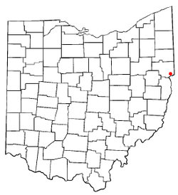 Location of Glenmoor, Ohio | |
| Coordinates: 40°39′55″N 80°36′47″W | |
| Country | United States |
| State | Ohio |
| County | Columbiana |
| Township | St. Clair |
| Area | |
| • Total | 2.8 sq mi (7.2 km2) |
| • Land | 2.8 sq mi (7.2 km2) |
| • Water | 0.0 sq mi (0.0 km2) |
| Elevation | 1,122 ft (342 m) |
| Population (2010) | |
| • Total | 1,987 |
| • Density | 711/sq mi (274.4/km2) |
| Time zone | UTC-5 (Eastern (EST)) |
| • Summer (DST) | UTC-4 (EDT) |
| FIPS code | 39-30520[2] |
| GNIS feature ID | 1040911[1] |
| School District | East Liverpool City |
Geography
Glenmoor is located in southeastern Columbiana County at 40°39′55″N 80°36′47″W (40.665198, -80.613044),[4] in the southwest corner of St. Clair Township. Its northeast border is formed by U.S. Route 30, across which is the CDP of Calcutta. It is bordered to the south by La Croft in Liverpool Township and to the west by Madison Township. The city of East Liverpool on the Ohio River is 4 miles (6 km) to the southeast.
According to the United States Census Bureau, the Glenmoor CDP has a total area of 2.8 square miles (7.2 km2), all land.[3]
Demographics
| Historical population | |||
|---|---|---|---|
| Census | Pop. | %± | |
| 1980 | 2,588 | — | |
| 1990 | 2,307 | −10.9% | |
| 2000 | 2,192 | −5.0% | |
| 2010 | 1,987 | −9.4% | |
| U.S. Decennial Census[5] | |||
At the 2000 census there were 2,192 people in 877 households, including 637 families, in the CDP. The population density was 783.6 people per square mile (302.3/km²). There were 913 housing units at an average density of 326.4/sq mi (125.9/km²). The racial makeup of the CDP was 97.54% White, 1.19% African American, 0.27% Native American, 0.14% Asian, 0.09% from other races, and 0.78% from two or more races. Hispanic or Latino of any race were 0.73%.[2]
Of the 877 households 28.6% had children under the age of 18 living with them, 56.6% were married couples living together, 11.9% had a female householder with no husband present, and 27.3% were non-families. 22.8% of households were one person and 12.8% were one person aged 65 or older. The average household size was 2.50 and the average family size was 2.92.
The age distribution was 23.6% under the age of 18, 6.3% from 18 to 24, 27.9% from 25 to 44, 24.0% from 45 to 64, and 18.2% 65 or older. The median age was 41 years. For every 100 females there were 94.7 males. For every 100 females age 18 and over, there were 89.3 males.
The median household income was $30,383 and the median family income was $36,667. Males had a median income of $32,452 versus $17,209 for females. The per capita income for the CDP was $14,809. About 4.6% of families and 6.9% of the population were below the poverty line, including 15.3% of those under age 18 and 4.2% of those age 65 or over.
References
- "US Board on Geographic Names". United States Geological Survey. 2007-10-25. Retrieved 2008-01-31.
- "U.S. Census website". United States Census Bureau. Retrieved 2008-01-31.
- "Geographic Identifiers: 2010 Demographic Profile Data (G001): Glenmoor CDP, Ohio". U.S. Census Bureau, American Factfinder. Archived from the original on January 26, 2015. Retrieved January 26, 2015.
- "US Gazetteer files: 2010, 2000, and 1990". United States Census Bureau. 2011-02-12. Retrieved 2011-04-23.
- "Census of Population and Housing" (PDF). Census.gov. Retrieved July 17, 2018.
Municipalities and communities of Columbiana County, Ohio, United States | ||
|---|---|---|
| Cities | 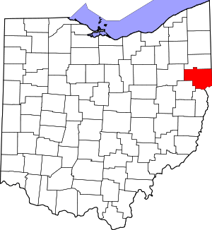 Map of Ohio highlighting Columbiana County | |
| Villages | ||
| Townships | ||
| CDPs | ||
| Unincorporated communities |
| |
| Ghost town | ||
| Footnotes | ‡This populated place also has portions in an adjacent county or counties | |