Georgia State Route 165
State Route 165 (SR 165) is a 37.5-mile-long (60.4 km) state highway that runs south-to-north, with a west-to-east middle section, through portions of Telfair, Dodge, and Laurens counties in the central part of the U.S. state of Georgia.
| ||||
|---|---|---|---|---|
 | ||||
| Route information | ||||
| Maintained by GDOT | ||||
| Length | 37.5 mi[1] (60.4 km) | |||
| Major junctions | ||||
| South end | ||||
| North end | ||||
| Location | ||||
| Counties | Telfair, Dodge, Laurens | |||
| Highway system | ||||
| ||||

Route description
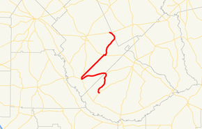
SR 165 begins as Mount Zion Street at an intersection with SR 132 southeast of Rhine, in Telfair County. It heads to the northeast to the town of Milan, where it intersects U.S. Route 280 (US 280)/SR 30. The three highways head to the west-southwest concurrently and enter Dodge County. In Rhine, they meet SR 117, where SR 165 departs to the north, concurrent with SR 117. Shortly afterward, SR 165 departs to the northeast along the Chauncey-Rhine Highway and eventually enters Chauncey. There, they meet US 23/US 341/SR 27. The four have a brief wrong-way concurrency in the town, until the blinker-light intersection with Milan-Chauncey Road and Chauncey-Dublin Highway, the latter of which is where SR 165 departs to the northeast. It continues to the northeast and very briefly enters Laurens County. Then, it re-enters Dodge County and meets its northern terminus, an intersection with SR 46 northeast of Eastman.[1]
SR 165 is not part of the National Highway System.[2]
Major intersections
| County | Location | mi[1] | km | Destinations | Notes | |||
|---|---|---|---|---|---|---|---|---|
| Telfair | | 0.0 | 0.0 | Southern terminus | ||||
| Milan | 7.8 | 12.6 | Southern end of US 280/SR 30 concurrency | |||||
| Dodge | Rhine | 16.3 | 26.2 | Northern end of US 280/SR 30 concurrency; southern end of SR 117 concurrency | ||||
| 16.9 | 27.2 | Northern end of SR 117 concurrency | ||||||
| Chauncey | 27.5 | 44.3 | Southern end of US 23/US 341/SR 27 concurrency | |||||
| 28.0 | 45.1 | Northern end of US 23/US 341/SR 27 concurrency | ||||||
| Laurens |
No major junctions | |||||||
| Dodge | | 37.5 | 60.4 | Northern terminus | ||||
1.000 mi = 1.609 km; 1.000 km = 0.621 mi
| ||||||||
See also
.svg.png)

References
- Google (June 23, 2013). "Route of SR 165" (Map). Google Maps. Google. Retrieved June 23, 2013.
- "National Highway System: Georgia" (PDF). United States Department of Transportation. October 1, 2012. Retrieved June 23, 2013.
External links

- Georgia Roads (Routes 161 - 180)