Georgia State Route 132
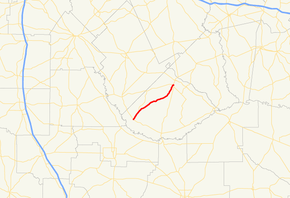
State Route 132 (SR 132) is a 18.6-mile-long (29.9 km) state highway that runs south-to-north through south-central portions of Telfair County in the central part of the U.S. state of Georgia.
| ||||
|---|---|---|---|---|
 | ||||
| Route information | ||||
| Maintained by GDOT | ||||
| Length | 18.6 mi[1] (29.9 km) | |||
| Major junctions | ||||
| South end | ||||
| North end | ||||
| Location | ||||
| Counties | Telfair | |||
| Highway system | ||||
| ||||

Route description
The route begins at an intersection with SR 117 near China Hill (about thirteen miles (21 km) northeast of Fitzgerald). It heads northeast to an intersection with SR 165 before it meets its northern terminus, an intersection with US 319/US 441/SR 31 in the southern part of McRae.[1]
SR 132 is not part of the National Highway System.[2]
Major intersections
The entire route is in Telfair County.
| Location | mi[1] | km | Destinations | Notes | |
|---|---|---|---|---|---|
| | 0.0 | 0.0 | Southern terminus | ||
| | 3.6 | 5.8 | |||
| McRae | 18.6 | 29.9 | Northern terminus | ||
| 1.000 mi = 1.609 km; 1.000 km = 0.621 mi | |||||
See also
.svg.png)

References
- Google (June 14, 2013). "Route of SR 132" (Map). Google Maps. Google. Retrieved June 14, 2013.
- "National Highway System: Georgia" (PDF). United States Department of Transportation. May 8, 2009. Retrieved June 14, 2013.
External links
This article is issued from Wikipedia. The text is licensed under Creative Commons - Attribution - Sharealike. Additional terms may apply for the media files.