Geography of the British Virgin Islands
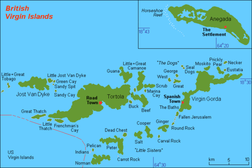
The British Virgin Islands are located in the Caribbean, between the Caribbean Sea and the North Atlantic Ocean, east of Puerto Rico. Its geographic coordinates are 18°30′N 64°30′W. Map references include Central America and the Caribbean. The area totals 151 km² (about 0.9 times the size of Washington, DC) and comprises 16 inhabited and more than 20 uninhabited islands; includes the islands of Tortola, Anegada, Virgin Gorda and Jost van Dyke. Maritime claims include 3 nmi (5.6 km; 3.5 mi) of territorial sea and exclusive a 200 nmi (370.4 km; 230.2 mi) fishing zone. In terms of land use, it is 20% arable land, 6.67% permanent crops and 73.33% other as of a 2005 figure. It has strong ties to nearby U.S. Virgin Islands and Puerto Rico.
- See also: British Virgin Islands
Terrain
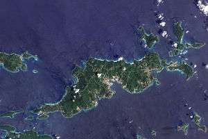
The islands' terrain consists of coral islands, and is relatively flat. The volcanic islands are steep and hilly. Its lowest point is the Caribbean Sea and its highest point is Mount Sage at 521 metres (1,709 ft) above sea level. The country contains 80 km of coastline. There is limited natural fresh water resources (except for a few seasonal streams and springs on Tortola, most of the islands' water supply comes from wells and rainwater catchments).
Climate
The British Virgin Islands have a tropical savanna climate, moderated by the trade winds. Temperatures vary little throughout the year. In the capital, Road Town, typical daily maxima are around 32 °C (89.6 °F) in the summer and 29 °C (84.2 °F) in the winter. Typical daily minima are around 24 °C (75.2 °F) in the summer and 21 °C (69.8 °F) in the winter. Rainfall averages about 1,150 mm (45.3 in) per year, higher in the hills and lower on the coast. Rainfall can be quite variable, but the wettest months on average are September to November and the driest months on average are February and March. Hurricanes occasionally hit the islands, with the hurricane season running from June to November.
References

| Sovereign states |  | |
|---|---|---|
Dependencies and other territories |
| |