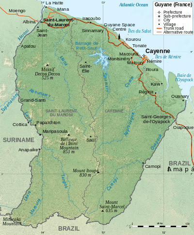
Geography of French Guiana
French Guiana is an overseas region of France, located on the northern coast of South America between Suriname and Brazil. The country is part of Caribbean South America and borders the North Atlantic Ocean.
Statistics
Area
Total: 91,000 km²
Land: 89,150 km²
Water: 1,850 km²
Land boundaries
Total: 1,183 km
Border countries: Brazil 673 km, Suriname 510 km (disputed)
Coastline: 378 km
Maritime claims
Exclusive economic zone: 200 nmi (370.4 km; 230.2 mi) territorial sea: 12 nmi (22.2 km; 13.8 mi).
Land use
Arable land: 0%
Other: 10% (1996 est.)
Irrigated land: 20 km² (1993 est.)
Geography - note: mostly an unsettled wilderness.
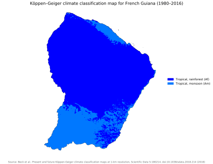
Climate
French Guiana's climate is tropical and hot with a Köppen climate classification of tropical rainforest (Af) throughout most of the country. Heavy showers, severe thunderstorms, and flooding frequent.
Terrain
French Guiana comprises low-lying coastal plains, rising to hills and small mountains in the south. See Guiana Shield.
Extreme Points
- Northernmost point – Pointe Isère
- Southernmost point – Border with Brazil, Maripasoula
- Westernmost point –
- Easternmost point –
- Highest point – Bellevue de l'Inini: 851 m
- Lowest point – Atlantic Ocean: 0 m
See also
References
![]()