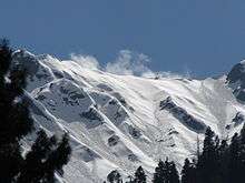
Gabral, Kohistan
Gabral (also spelled Gabrāl) is a village and Hill station in the Swat District of Khyber Pakhtunkhwa province, Pakistan. It is located on the slopes of the western end of the Himalayas, at the lower end of the Gabral Valley, where the Gabral River joins the Utror River, a tributary of the Swat River. Gabral is located at an elevation of 2,286 metres (7,500 ft).[2][3] It is about 7 km northwest (by road) from Utror, 20 km west of Kalam, and 120 km of Saidu Sharif.[4]
Gabral گبرال | |
|---|---|
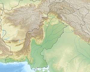 Gabral Location in Pakistan 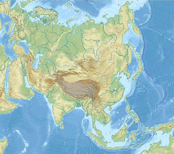 Gabral Gabral (Asia) | |
| Coordinates: 35.5275°N 72.4120°E | |
| Country | |
| Province | Khyber Pakhtunkhwa |
| District | Swat |
| Elevation | 2,286 m (7,500 ft) |
| Population (2017) | |
| • Total | 3,263[1] |
| Time zone | UTC+5 (PST) |
Gabral | |
|---|---|
| Population (2017) | |
| • Total | 23,673[1] |
The downtown area is located about 500 m north of the mouth of the Gabral River. The village consists of a few hundred houses scattered along the valley bottom, in a band 200-500 m wide, on both sides of the Gabral River, starting about 7 km north of the junction, and continuing down the Utror valley until it merges with the town of Utror. The main road of the town runs next to the river and up the valley, for about 14 km. A few farms are seen up to that point.[4]
Gabral is a Village council of the Union Council Utror.
References
- "POPULATION AND HOUSEHOLD DETAIL FROM BLOCK TO DISTRICT LEVEL | KHYBER PAKHTUNKHWA (SWAT DISTRICT)" (PDF). pbs.gov.pk. Pakistan Bureau of Statistics. Retrieved 10 November 2019.
- "Gabral Elevation". Tourism.kp.gov. Retrieved 2 August 2018.
- "Gabral - Weather Forecast". Pakistanhighlands.com. Retrieved 2 August 2018.
- "Gabral". Google Maps at 35.5275 N E. Accessed on 2019-03-18.