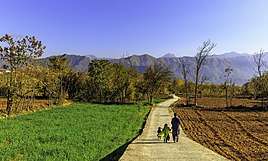
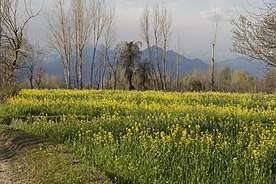
Charbagh, Swat
Charbagh (Pashto: چارباغ) is a town in Tehsil Charbagh, in the Khyber Pakhtunkhwa province of Pakistan. It is part of Swat District and is located at 34°50'0"N 72°26'30"E with an average altitude of 1,032 meters (3,386 feet).[2]It is located on the N-95 National Highway some 15 km from mingora in Khyber Pakhtunkhwa.
Charbagh | |
|---|---|
 Charbagh | |
| Coordinates: 34.50°N 72.26°E | |
| Country | |
| Province | Khyber Pakhtunkhwa |
| Elevation | 980 m (3,220 ft) |
| Population | |
| • Total | 39,605 |
| Time zone | UTC+5 (PST) |
Tehsil Charbagh is also known as Matorizi Tehsil and it borders with Babuzai tehsil and Azikhel Tehsil. Some of the villages included in Tehsil Charbagh are:
- Jehanabad (Pashto: جان آباد)
- Taligram (Pashto: تليګرام)
- Sair (Pashto: سير)
- Shin Kad (Pashto: شين کډ)
- Ganajir (Pashto: ګناجر)
Malam Jaba (Pashto: ملم جبه
- Koat (Pashto: کوټ)
- Amanabad (Pashto: آمان کوټ)
- Roshanabad (Pashto: روشن آباد)
- Charbagh (Pashto: چارباغ)
- Mangultan (Pashto: منګولتان)
- Asharbanr (Pashto: اشاربنړ)
- Toha (Pashto: توهه)
- Kandaw (Pashto: کنډؤ)
- Khadang (Pashto: خاندګ)
- Alabad (Pashto: آله آباد)
- Dakorak (Pashto: دکوړک)
- Rorya (Pashto: روريا)
- Landakey (Pashto: لنډا کې)
- Gulibagh (Pashto: ګلي باغ)
- Alamganj (Pashto: الم ګنج)
- Landey (Pashto: لنډې)
- Navy Kali (Pashto: نوي کلي)
- Facebook Page ({https://www.facebook.com/swat.rocks123/?ref=bookmarks})
The University of Swat is 800 meters away from Charbagh bazaar situated in Allahabad, Cadet College Swat, a premier educational institution of the province, is in Gulibagh and also the Private University Town are in this Tehsil. The town was also a stronghold of the Taliban in Pakistan, in May 2009 Pakistan government had the town in their sights after routing the Taliban elsewhere in the district.[3]
Population
The population Charbagh is 39,605[4].According to the 2017 census the population of tehsil Charbagh is 126,115.[5] [4]Charbagh tehsil has a population density of 934.9/km2 .[6]
See also
References
- "POPULATION AND HOUSEHOLD DETAIL FROM BLOCK TO DISTRICT LEVEL: KHYBER PAKHTUNKHWA" (PDF). Pakistan Bureau of Statistics. 2018-01-03. Archived from the original (PDF) on 2018-04-17. Retrieved 2018-04-23.
- Google Earth
- Pakistan 'nearing Swat victory'
- "Swat District – Population of Cities, Towns and Villages 2017-2018". Pakistan's Political Workers Helpline. 2018-05-27. Retrieved 2019-01-20.
- "Swat (District, Pakistan) - Population Statistics, Charts, Map and Location". www.citypopulation.de. Retrieved 2019-01-20.
- "Swat (District, Pakistan) - Population Statistics, Charts, Map and Location". www.citypopulation.de. Retrieved 2019-01-20.