Frankland River (North West Tasmania)
The Frankland River is a major perennial river located in the north-west region of Tasmania, Australia.
| Frankland | |
|---|---|
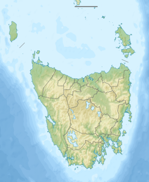 Location of the Frankland River mouth in Tasmania | |
| Etymology | George Frankland |
| Location | |
| Country | Australia |
| State | Tasmania |
| Region | North-west |
| Physical characteristics | |
| Source confluence | Horton and Lindsay rivers |
| ⁃ location | Sumac Forest Reserve |
| ⁃ coordinates | 41°15′4″S 144°57′25″E |
| ⁃ elevation | 164 m (538 ft) |
| Mouth | Arthur River |
⁃ location | east of the town of Arthur River |
⁃ coordinates | 41°04′29″S 144°46′19″E |
⁃ elevation | 22 m (72 ft) |
| Length | 41 km (25 mi) |
| Basin features | |
| River system | Arthur River catchment |
| [1] | |
Location and features
Formed by the confluence of the Horton and Lindsay rivers, the Frankland River rises in the Sumac Forest Reserve and flows generally west by north. The Frankland River reaches its mouth in remote country east of the settlement of Arthur River where it empties into the Arthur River. The river descends 142 metres (466 ft) over its 41-kilometre (25 mi) course.[1]
The river draws its name from George Frankland, an English surveyor and Surveyor-General of Van Diemen's Land between 1827 and 1838.
References
- "Map of Frankland River, TAS". Bonzle Digital Atlas of Australia. 2015. Retrieved 27 June 2016.
River systems and rivers of Tasmania, Australia | |||||
|---|---|---|---|---|---|
| |||||
| |||||
| |||||
|
This article is issued from Wikipedia. The text is licensed under Creative Commons - Attribution - Sharealike. Additional terms may apply for the media files.