Fowlerville, Livingston County, New York
Fowlerville is a hamlet and census-designated place (CDP) in the town of York in Livingston County, New York, United States.[1] The population of the CDP was 227 at the 2010 census.[3]
Fowlerville, New York | |
|---|---|
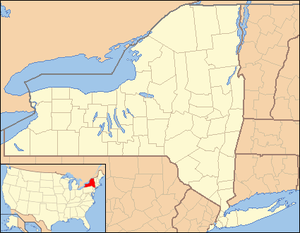 Fowlerville Location in New York | |
| Coordinates: 42°53′36″N 77°50′44″W[1] | |
| Country | United States |
| State | New York |
| County | Livingston |
| Town | York |
| Area | |
| • Total | 0.901 sq mi (2.33 km2) |
| • Land | 0.901 sq mi (2.33 km2) |
| • Water | 0.0 sq mi (0 km2) |
| Elevation | 636 ft (194 m) |
| Population | |
| • Total | 227 |
| • Density | 251.9/sq mi (97.3/km2) |
| Time zone | UTC-5 (Eastern (EST)) |
| • Summer (DST) | UTC-4 (EDT) |
| Area code | 585 |
| FIPS code[1] | 36-27133 |
| GNIS feature ID[1] | 950550 |
The community is named for Wells Fowler, the first settler.[4]
It should not be confused with other New York hamlets named Fowlerville in Erie County[5] and Sullivan County,[6] or with the similarly named hamlet of Fowlersville in Lewis County[7]
Geography
Fowlerville is located in northwestern Livingston County at 42°53′36″N 077°50′44″W (42.8933955, -77.8455608), in the northeast part of the town of York, at an elevation of 636 feet (194 m).[1] It is 3 miles (5 km) northeast of York hamlet, 8 miles (13 km) northwest of Geneseo, the Livingston county seat, 6 miles (10 km) west of Avon, and 24 miles (39 km) southwest of Rochester.
According to the 2010 United States Census, the Fowlerville CDP has a total area of 0.90 square miles (2.33 km2), all of which is land.[2]
References
- "Fowlerville (Livingston County, NY)". Geographic Names Information System. United States Geological Survey. Retrieved January 13, 2013.
- "U.S. Gazetteer Files: 2019: Places: New York". U.S. Census Bureau Geography Division. Retrieved June 18, 2020.
- "Total Population: 2010 Census DEC Summary File 1 (P1), Fowlerville CDP, New York". data.census.gov. U.S. Census Bureau. Retrieved June 18, 2020.
- Gannett, Henry (1905). The Origin of Certain Place Names in the United States. Govt. Print. Off. pp. 130.
- "Fowlerville (Erie County, NY)". Geographic Names Information System. United States Geological Survey. Retrieved January 13, 2013.
- "Fowlerville (Sullivan County, NY)". Geographic Names Information System. United States Geological Survey. Retrieved January 13, 2013.
- "Fowlersville (Lewis County, NY)". Geographic Names Information System. United States Geological Survey. Retrieved January 13, 2013.
Municipalities and communities of Livingston County, New York, United States | ||
|---|---|---|
| Towns | 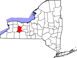 Map of New York highlighting Livingston County | |
| Villages | ||
| CDPs | ||
| Other hamlet | ||