Fort Clark Springs, Texas
Fort Clark Springs is an unincorporated community and census-designated place (CDP) in Kinney County, Texas, United States. The population was 1,228 at the 2010 census.[1] It is the site of the former Fort Clark, now a historic district.
Fort Clark Springs, Texas | |
|---|---|
 Fort Clark Springs Location in Texas and the United States  Fort Clark Springs Fort Clark Springs (the United States) | |
| Coordinates: 29°17′57″N 100°25′21″W | |
| Country | United States |
| State | Texas |
| County | Kinney |
| Area | |
| • Total | 2.98 sq mi (7.73 km2) |
| • Land | 2.97 sq mi (7.70 km2) |
| • Water | 0.01 sq mi (0.03 km2) |
| Elevation | 1,150 ft (350 m) |
| Population (2010) | |
| • Total | 1,228 |
| • Density | 413/sq mi (159.5/km2) |
| Time zone | UTC-6 (Central (CST)) |
| • Summer (DST) | UTC-5 (CDT) |
| ZIP Code | 78832 (Brackettville) |
| Area code(s) | 830 |
| FIPS code | 48-26680[1] |
| GNIS feature ID | 1357581[2] |
Geography
The community is located in central Kinney County and is bordered to the north by Brackettville, the county seat. U.S. Route 90 runs along the border between the two communities, leading east 39 miles (63 km) to Uvalde and west 30 miles (48 km) to Del Rio. Texas State Highway 131 runs along the east edge of the CDP, leading south 33 miles (53 km) to U.S. Route 277 in the Rio Grande valley.
According to the United States Census Bureau, the CDP has a total area of 3.0 square miles (7.7 km2), of which 0.01 square miles (0.03 km2), or 0.36%, are water.[1]
References
- "Geographic Identifiers: 2010 Census Summary File 1 (G001), Fort Clark Springs CDP, Texas". American FactFinder. U.S. Census Bureau. Archived from the original on February 13, 2020. Retrieved May 10, 2019.
- "Fort Clark Springs". Geographic Names Information System. United States Geological Survey.
Municipalities and communities of Kinney County, Texas, United States | ||
|---|---|---|
| Cities | 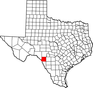 Kinney County map | |
| CDP | ||