Expressway S1 (Poland)
Expressway S1 or express road S1 is an expressway under construction in Poland with a planned length of 130 km (81 mi), which is located in the Silesian and Lesser Poland voivodeships. Upon completion, it will connect the A1 motorway near the Katowice International Airport in Pyrzowice with the A4 motorway and the border of Slovakia in Zwardoń along with the D3 Motorway in Slovakia. The main part of the route is the Eastern beltway of Upper Silesian Industrial Region.
| ||||
|---|---|---|---|---|
| Droga ekspresowa S1 | ||||
 | ||||
| Route information | ||||
| Part of | ||||
| Maintained by GDDKiA | ||||
| Length | 93.1 km (57.8 mi) 132.81 km (82.52 mi) planned | |||
| Major junctions | ||||
| From | ||||
| ||||
| To | ||||
| Location | ||||
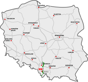
| Major cities | Dąbrowa Górnicza, Sosnowiec, Mysłowice, Tychy, Bielsko-Biała, Żywiec | |||
| Highway system | ||||
National roads in Poland
| ||||

Expressway route description
Pyrzowice-Tychy[1]
| Number of exit (facility) | Exits, facilities | Mileage from beginning | 1st carriageway state | 2nd carriageway state | History of construction/preparation | Notes |
|---|---|---|---|---|---|---|
| 1) | Pyrzowice |
0 km | Done | Done | Opened in June 2012 | Terminus |
| 2) | Pyrzowice-Lotnisko |
1.9 km (1.18 mi) | Was the terminus till June 2012 | From here to Podwarpie one-carriageway | ||
| 3) | Mierzęcice | 5.5 km (3.42 mi) | Tendered | Opened in November 2006 | ||
| 4) | Podwarpie
|
12.8 km (7.95 mi) | 4-laned starting 1 km before interchange | |||
| 5) | Ząbkowice |
20.2 km (12.55 mi) | With environmental decision | Planned, 4-laned road at the moment | ||
| 6) | No name (Dąbrowa-Górnicza-Laski) | 22.6 km (14.04 mi) | Done | Completed 1978-1983 | ||
| 7) | No name (Dąbrowa-Górnicza-Golonóg) | 24.3 km (15.10 mi) | ||||
| 8) | No name |
25.2 km (15.66 mi) | ||||
| 9) | No name(Dąbrowa-Górnicza-Porąbka) | 28.9 km (17.96 mi) | ||||
| (1) | Petrol station | 31.8 km (19.76 mi) | Koniczyna | |||
| 10) | No name | 33.2 km (20.63 mi) | Completed 1978-1983 | Entrance/exit northbound only | ||
| 11) | Brzęczkowice-I |
36.9 km (22.93 mi) | ||||
| 12) | Brzęczkowice-II |
39.2 km (24.36 mi) | Entrance to toll road | |||
| 13) | Brzezinka |
41.2 km (25.60 mi) | Droga wójewodzka 934 goes parallel with S1 | |||
| 14) | No name(Mysłowice-Kosztowy-I) | 42.1 km (26.16 mi) | ||||
| 15) | No name Other name: Kosztowy-II |
43.3 km (26.91 mi) | Exit only southbound, entrance only northbound | |||
| 16) | No name(Lędziny) | 46.2 km (28.71 mi) | ||||
| (2) | MOP Lędziny | 48.8 km (30.32 mi) | Petrol station, restaurant | |||
| 17) | Tychy |
54.8 km (34.05 mi) | Terminus | |||
Kosztowy-II-Bielsko-Biała
As of the end of May 2016 there were 6 road options proposed, five of which were already available by June 2008.
At first option IV(D) was preferable. It had to go parallel to Brzeszcze – Oświęcim railway tracks. However, UNESCO protested against the choice, as, in their opinion, it would have crossed the quietness line around the former German concentration camp Auschwitz-Birkenau, and, as the result, UNESCO would have put the camp into the endangered list.
At the beginning of August 2009, the head of Miedźna commune has announced to media his option of the S1 (option VI), that would have gone on the borders of the Miedźna i Bojszowy communes, through the forest. In November 2009, it was accepted by all the local communes. However, GDDKiA rseignated from option VI because of environmental issues. The road would have passed through the "Stawy w Brzeszczach" reserve for birds conservation, which was not acceptable.[2]
Option VI
Communes through which the road would have passed according to the option VI
- Mysłowice (Kosztowy)
- Lędziny
- Bieruń
- Oświęcim (Stare Stawy)
- Brzeszcze
- Dankowice
- Stara Wieś
- Bielsko-Biała (Suchy Potok) In 2013 the Economical, Technical and Environmental Institution has proposed 4 choices (A, B, C, and D), of which choices A and C were preferred. However, the mining company "Brzeszcze" was against choice C, and "SILESIA" mining enterprise against A. As a compromise, GDDKIA promised to work on the additional option "E". Preparatory works for DŚU were done by 7 January 2015. In March 2015 choice "E" was chosen as preferred. In June the same year Regional Directorate of the Environment Protection in Katowice has asked GDDKiA to give out the environmental decision for the section.
Option V
Communes through which the road would have passed according to the option V
- Mysłowice (Kosztowy)
- Lędziny
- Bieruń
- Międzyrzecze
- Gilowice
- Miedźna
- Bestwinka
- Kaniów
- Dankowice
- Stara Wieś
- Bielsko-Biała (Suchy Potok)
The project will cost approximately 1,437 bln złotych.[3]
Interchanges
- „Kosztowy II"(after construction the road to Tychy will br signed as S1A)
- „Lędziny"
- „Bieruń"

- „Oświęcim"(future connection to Oświęcim bypass)
- „Wola”
- „Brzeszcze"

- „Stara Wieś"
- „Suchy Potok"

4 options from 2012
- Option A [39.7 km] would have run through the next communes:
- Mysłowice
- Lędziny
- Imielin
- Bieruń
- Bojszowy
- Miedźna
- Bestwina
- Wilamowice
- Bielsko-Biała
- Option B (40.4 km)would have run through the next communes:
- Mysłowice
- Lędziny
- Imielin
- Bieruń
- Bojszowy
- Oświęcim
- Bestwina
- Brzeszcze
- Wilamowice
- Bielsko-Biała
- Option C (40.8 km)would have run through the next communes:
- Mysłowice
- Lędziny
- Imielin
- Bieruń
- Bojszowy
- Oświęcim
- Bestwina
- Brzeszcze
- Wilamowice
- Bielsko-Biała
- Option D (42.1 km)would have run through the next communes:
In 2013 a new option, presented by the mining companies "SILESIA" and "Brzeszcze" and by Miedźna, Brzeszcze and Bestwina communes, was proposed. The option "H"(or hybrid), as it is known, was an initial compromise between the companies and communes and GDDKiA. It didn't come into life, however.
| Number of exit(facility) | Name | Mialeage from beginning | State | Notes |
|---|---|---|---|---|
| 1) | Kosztowy-II | 0 km | With environmental decision | Connection with S1 to Tychy |
| 2) | Lędziny | ca. 6 km (3.73 mi) | ||
| (1) | MOP | 7.5 km (4.66 mi) | ||
| 3) | Bieruń | ca. 12.3 km (7.64 mi) | ||
Route description
| Number of exit (facility) | Name | Mialeage from beginning | History of construction | Notes |
|---|---|---|---|---|
| 1) | Bielsko-Biała-Komorowice |
0 km | Works from here to Suchy Potok interchange were allowed in May 2009 | To Suchy Potok interchange concurrency with |
| 2) | Bielsko-Biała-Rosta |
2.9 km (1.80 mi) | ||
| 3) | Suchy Potok |
4.5 km (2.80 mi) | Contract was signed in October 2008 to the Bielsko-Biała-Mikuszowice-II interchange | |
| 4) | Bielsko-Biała-Lipnik |
6.8 km (4.23 mi) | ||
| 5) | Bielsko-Biała-Mikuszowice-I |
11 km (6.84 mi) | ||
| 6) | Bielsko-Biała-Mikuszowice-II |
11.5 km (7.15 mi) | ||
| 7) | Wilkowice | 14.2 km (8.82 mi) | From here to Żywiec interchange: first contract signed in 2010, which was cancelled two years later, and signed with other company in July 2014. Done in July 2015. | |
| 8) | Buczkowice | 17.7 km (11.00 mi) | ||
| 9) | Łodygowice | 21 km (13.05 mi) | ||
| 10) | Żywiec Soła |
26.5 km (16.47 mi) | From here to Przybędza interchange: signed in June 2005, done by November 2006 | |
| 11) | Żywiec Browar | 29 km (18.02 mi) | ||
| 12) | Przybędza | 33.7 km (20.94 mi) | Section to be completed in August 2023 | |
| 13) | Milówka | 45.5 km (28.27 mi) | ||
| 14) | Laliki |
50.1 km (31.13 mi) | No exit of eastbound traffic on the road | |
| 15) | Laliki II | 52.9 km (32.87 mi) | ||
| 16) | Zwardoń |
55.5 km (34.49 mi) | Last interchange before border | |
| 17) | Country border
|
56.7 km (35.23 mi) | Entrance to Slovakia |
See also
References
- "Mapy Google". Mapy Google. Retrieved 2015-11-20.
- Droga ekspresowa S1 (Polska)
- "S-1 od w. "Kosztowy II" w Mysłowicach do w. "Suchy Potok" w Bielsku-Białej :: Generalna Dyrekcja Dróg Krajowych i Autostrad - Serwis informacyjny". www.gddkia.gov.pl. Retrieved 2015-11-20.
| Wikimedia Commons has media related to Expressway S1 (Poland). |