A4 autostrada (Poland)
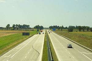
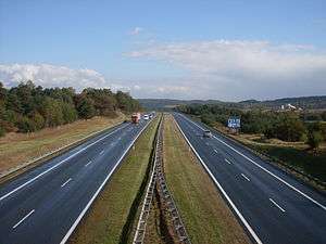
The autostrada A4 in Poland is a 672 km (418 mi) long east–west motorway that runs through southern Poland, along the north side the Sudetes and Carpathian Mountains, from the Polish-German border at Zgorzelec-Görlitz (connecting to A4 autobahn), through Wrocław, Opole, Gliwice, Katowice, Kraków, Tarnów and Rzeszów, to the Polish-Ukrainian border at Korczowa-Krakovets (connecting to M10). It is a part of European route E40.
| ||||
|---|---|---|---|---|
 | ||||
| Route information | ||||
| Part of | ||||
| Length | 672.75 km (418.03 mi) | |||
| Major junctions | ||||
| From | ||||
| ||||
| To | border Poland-Ukraine at Korczowa-Krakovets - | |||
| Location | ||||
| Regions | Lower Silesian Voivodeship Opole Voivodeship Silesian Voivodeship Lesser Poland Voivodeship Podkarpackie Voivodeship | |||
| Major cities | Wrocław, Gliwice, Katowice, Kraków, Rzeszów | |||
| Highway system | ||||
National roads in Poland
| ||||

.jpg)

The motorway between Wrocław and Kraków (270 km) was constructed in years 1976 – 2005. Most of this part is tolled, with fees being collected in toll booths across the motorway.
The section from the German border to Wrocław (151 km, not tolled) was constructed in years 2002 – 2009, in large part as a repavement of the old concrete motorway constructed in years 1933 – 1937 (then the territory of Nazi Germany). The repaved parts are substandard due to lack of emergency lanes and the speed limit is decreased to 110 km/h.
The motorway from Kraków to the Ukrainian border (251 km, not tolled) was constructed in years 2010 – 2016, making A4 the first Polish complete border-to-border highway connection.
History of construction
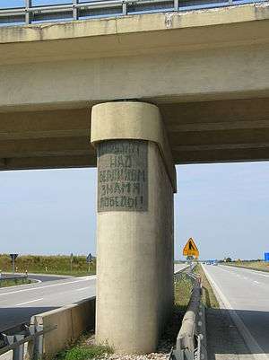
Some western stretches of this motorway were initially built as a Reichsautobahn by Nazi Germany in the 1930s under her pre-war borders. After World War II and the takeover of Poland by the communist regime, with new borders, the existing roads received minimal maintenance and upgrades and became notorious for their poor quality, a phenomenon similar to that observed in East Germany. In effect, the original road served in a virtually unchanged state throughout the whole communist period and the first years afterwards. A reconstruction conducted in years 2002 – 2006 removed the old concrete road surface (earlier, a short fragment of A18 was reconstructed in 1993 – 1995, of which 10 km are now part of A4), but some aspects of the 1930s standards of construction remain on the stretch from Krzyżowa to Wrocław; for example, the aforementioned section does not have emergency lanes, a feature that is to be added in the future.
The section between Katowice and Kraków was constructed in years 1976 – 1996, and the section between Wrocław and Katowice in 1996 – 2005.
In 2006 – 2009, the section from the German border to the junction with A18 motorway was constructed, which completed a continuous connection from Germany to Kraków. Also completed in 2009 was the first portion of the motorway east of Kraków (ending on national road 75 junction, near Szarów). The original plan was to finish the rest of the motorway by about 2013, but because of the UEFA decision to host the 2012 UEFA European Football Championship in Poland and Ukraine and the resulting need to improve the road infrastructure connecting the two countries, the date for opening the motorway to traffic was moved up to June 2012. This ambitious target was not attained after multiple delays, some caused by the floods of 2010.[1]
In July 2016, the last missing 41 km between Rzeszów and Jarosław were completed. This meant the entire length of the A4 from the German border to the Ukrainian border was completed, making the A4 the first complete major motorway in Poland (second overall, behind a very short A8) and the first completed continuous border-to-border highway connection.
Sections of the motorway
| Motorway section | Length | Constructed | Note |
|---|---|---|---|
| Jędrzychowice (border) - Zgorzelec | 1.7 km (1.1 mi) | 1994–1996 | heavy-load trucks only in 1994, all cars since 1996 |
| Zgorzelec - Krzyżowa | 50 km (31 mi) | 2007–2009 | |
| Krzyżowa - Bielany Wrocławskie | 99 km (62 mi) | 1933–1937 | repaved in 2002 – 2006 (short fragment in 1993 – 1995); section without emergency lanes |
| Bielany Wrocławskie - Przylesie(Brzeg) | 40.7 km (25.3 mi) | 1997–2000 | first carriageway built 1936 – 1938; reconstructed and second carriageway added in 1997 – 2000; tolls since 1 June 2012 |
| Przylesie(Brzeg) - Nogowczyce | 84.5 km (52.5 mi) | 2000–2003 | some construction before 1945; tolls since 1 June 2012 |
| Nogowczyce - Kleszczów | 17.9 km (11.1 mi) | 2001–2003 | first carriageway built 1936 – 1942[lower-alpha 1]; reconstructed and second carriageway added in 2001 – 2003; tolls since 1 June 2012 |
| Kleszczów - Katowice-Murckowska | 43 km (27 mi) | 1996–2005 | |
| Katowice-Murckowska - Mysłowice | 6.3 km (3.9 mi) | 1989–1996 | |
| Mysłowice - Kraków/Balice | 53.7 km (33.4 mi) | 1976–1991 | private operator and tolls since 2000 |
| Kraków/Balice - Kraków/Wieliczka | 24 km (15 mi) | 1979–2003 | |
| Kraków/Wieliczka - Szarów | 20 km (12 mi) | 2007–2009 | |
| Szarów - Tarnów | 57 km (35 mi) | 2010–2013 | opened to traffic in November, 2012, in part with single carriageway only.[2] Both carriageways were fully opened in May, 2013.[3] |
| Tarnów Północ - Dębica Wschód[4] | 34.8 km (21.6 mi) | 2010–2014 | opened Oct 30/31, 2014.[5][6] |
| Dębica (interchange Dębica Wschód) - Rzeszów (Centralny)[7][8] | 41 km (25 mi) | 2010–2013 | opened in October, 2013 |
| Rzeszów (Centralny) - Rzeszów(Wschód)[9] | 6.9 km (4.3 mi) | 2010–2012 | opened in September, 2012 |
| Rzeszów(Wschód) - Jarosław[10] | 41.2 km (25.6 mi) | 2010–2016 | originally planned to finish in 2012, delayed until 2014, then contractor abandoned the contract in January 2014 when 70% complete due to dispute with the government over financing. New contract was awarded in September,[11] with construction beginning in October 2014. Opened in July, 2016.[12] |
| Jarosław - Radymno | 24.5 km (15.2 mi) | 2010–2013 | Jarosław Wschód - Radymno: opened in May, 2013; Jarosław Zachód - Jarosław Wschód: opened in December, 2013. |
| Radymno - Korczowa[13] | 22.6 km (14.0 mi) | 2010–2013 | originally planned to finish in 2012,[14] opened December 23, 2013[15] |
- It continued from Kleszczów into Gliwice and today that section is National Road 88, while A4 bypasses Gliwice to the south
Route description
| Route | ||
| Number of exit, facility | Kilometers | |
| (0) | Border crossing PL-DE Jędrzychowice | |
| (1.8) | Zgorzelec | |
| Rest area(1) | (7.8) | Żarska Wieś, restaurant and motel eastbound, petrol station both ways |
| (17.9) | Godzieszów | |
| Parking area(1) | (26) | Czerna; parking only |
| (44.6) | Bolesławiec | |
| Rest area(2) | (46.2) | Kraśnik Dolny(eastbound only), restaurant, motel and petrol station |
| (49.8) | Krzyżowa | |
| (56) | Krzywa (secondary road to Szczytnica, restaurant and petrol station) | |
| (62) | Krzywa | |
| (66.6) | Jadwisin | |
| (73) | Chojnów | |
| Parking area(2) | (76.6) | near Strupice |
| (79.9) | Lubiatów | |
| (83.6) | Złotoryja | |
| (91.9) | Legnica | |
| (97) | Legnickie Pole (exit and entrance only eastbound) | |
| (99.6) | Mikołajowice | |
| (104.7) | Wądroże Wielkie | |
| (112.1) | Budziszów | |
| (115.9) | Udanin | |
| Rest area(3) | (119.7) | eastbound only; parking, restaurant, and shower facilities |
| (120.1) | Jarosław (Dolnośląskie) | |
| (120.6) | Kostomłoty | |
| (137.4) | Kąty Wrocławskie | |
| (147.4) | Pietrzykowice | |
| (150.3) | Wrocław-Południe | |
| (153.1) | Bielany Wrocławskie | |
| Toll booth(1) | (156) | |
| (164.3) | Wyjazd 164(no name) | |
| Parking area(3) | (166) | |
| (178.5) | Wyjazd 178(no name) | |
| Rest area(4) | (183.7) | Witowice(restaurant) |
| (193.1) | Entrance to wójewodstwo Opolskie | |
| (193.7) | Wyjazd 194 | |
| Parking area(4) | (200.3) | Jankowice Wielkie(eastbound only) |
| Rest area(5) | (218.7) | Młyński Staw(Motel and petrol station) |
| (222) | Prądy | |
| Parking area(5) | (237.2) | Przysiecz |
| (244.1) | Wyjazd 241(Dąbrówka) | |
| (251.2) | Wyjazd 248(Krapkowice, Gogolin) | |
| Rest area Góra Św. Anny(eastbound)/Wysoka(westbound)(6) | (264.2) | Shower,restaurant and petrol station, KFC |
| (272.1) | Wyjazd 269(Olszowa) | |
| (278) | Szymiszów | |
| (281) | Entrance to wójewodstwo śląskie | |
| (287.2) | Łany | |
| (295.8) | Kleszczów | |
| Rest area(7) | (299.7) | Rachowice(restaurant, petrol station) |
| (303.5) | Gliwice - Ostropa | |
| (310.1) | Gliwice - Bojków | |
| Toll booth(2) | (311.7) | Gliwice |
| (315.5) | Gliwice - Sośnica | |
| (320.8) | Ruda Śląska - Wspólna | |
| (324) | Ruda Śląska - Wirek | |
| Rest area(8) | (326.9) | Halemba (restaurant, petrol station and shower) |
| (331.5) | Chorzów - Batory (exit to Batorego str.) | |
| (334.1-335.6) | Katowice - Mikołowska | |
| (337.2) | Katowice - Francuska | |
| (339.5) | Katowice - Murckowska | |
| (345.8) | Mysłowice | |
| (348.7) | Brzęczkowice | |
| Toll booth(3) | (350.6) | Mysłowice |
| (359) | Jaworzno - Jeleń | |
| Rest area(9) | (361.2) | Zastawie(westbound)/Kępnica(eastbound)(petrol station, motel, TIR, restaurant, carwash) |
| (364.6) | Byczyna(entrance eastbound, exit westbound only), entrance to wójewodswo małopolskie | |
| (388.4) | Balin | |
| (370.6) | Chrzanów | |
| (380.9) | Rudno, exit and entrance eastbound & westbound | |
| Rest area(10) | (397.5) | (petrol station, motel, restaurant, carwash) |
| Toll booth(4) | (399.2) | Kraków |
| (400.2) | Balice I | |
| (401.7) | Balice II | |
| (406.4) | Kraków - Mirowska | |
| (408.1) | Kraków - Tyniec | |
| (411.6) | Kraków - Sidzina | |
| (416.1) | Zakopiańska | |
| (418.2) | Kraków - Łagiewniki | |
| (424) | Kraków - Wieliczka | |
| (427.3) | Kraków - Bieżanów | |
| (443.5) | Szarów/Targowisko | |
| Rest area(11) | (448.3) | Kłaj(restaurant and petrol station) |
| (457.1) | Bochnia | |
| (466.9) | Brzesko | |
| (487.5) | Tarnów Zachód | |
| (500.8) | Tarnów Północ | |
| (516.2) | Entrance to wójewodstwo podkarpackie' | |
| (530.5) | Dębica <Zachód | |
| (536.9) | Dębica Wschód | |
| (551.6) | Ropczyce - Sędziszów | |
| Rest area(12) | (564.9) | Bratkowice, facilities(parking and toilet); further planned |
| (570.3) | Rzeszów Zachód | |
| (574.4) | Rzeszów Północ | |
| (581.2) | Rzeszów Wschód | |
| () | Łańcut | |
| () | Przeworsk | |
| (622.5) | Jarosław Zachód | |
| (631.7) | Jarosław Wschód | |
| (646.7) | Przemyśl | |
| (666.3) | Korczowa | |
| (672.75) | Border checkpoint PL-UA Korczowa | |
See also
References
- "Nowak: autostrad na Euro 2012 nie będzie".
- Budowa autostrady A4 pod Tarnowem na finiszu
- http://www.gddkia.gov.pl/pl/a/12401/Dwie-jezdnie-na-A4-miedzy-Brzeskiem-a-Wierzchoslawicami Dwie jezdnie na A4 między Brzeskiem a Wierzchosławicami
- GDDKiA info on A4 w. Krzyż - w. Dębica Pustynia
- http://www.gddkia.gov.pl/pl/a/16919/Dwoma-jezdniami-po-estakadzie-na-odcinku-A4-Tarnow-Debica
- http://wyborcza.biz/biznes/1,100896,16842239,Znamy_date_otwarcia_odcinka_A4_Tarnow___Debica_.html
- GDDKiA info on A4 w. Rzeszów Zachód - w. Rzeszów Centralny
- GDDKiA info on A4 w. Dębica Pustynia - w. Rzeszów Zachód
- GGDDKiA information page for A4 w. Rzeszów Centralny - w. Rzeszów Wschód
- GGDDKiA information page for A4 Rzeszów Wschód - Jarosław (w. Wierzbna)
- "Radio Rzeszow". Archived from the original on 2016-05-06. Retrieved 2016-05-09.
- GGDDKiA information page for A4 Radymno - Korczowa
- Podkarpacie: Mobilizacja na budowie A4 Radymno – Korczowa
- Autostradą A4 do granicy - GDDKiA announcement
- "Mapy Google". Mapy Google. Retrieved 2015-11-06.
External links
| Wikimedia Commons has media related to Freeway A4 (Poland). |