Eunpyeong District
Eunpyeong District (은평구, Eunpyeong-gu) is one of the 25 districts of Seoul, South Korea.
Eunpyeong 은평구 | |
|---|---|
| 은평구 · 恩平區 | |
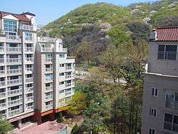 Jingwan-dong Residential Area in Eunpyeong | |
 Location of Eunpyeong-gu in Seoul | |
| Country | South Korea |
| Region | Sudogwon |
| Special City | Seoul |
| Administrative dong | 16[1] |
| Government | |
| • Mayor | Kim Mi-kyung |
| Area | |
| • Total | 29.7 km2 (11.5 sq mi) |
| Population (2010[2]) | |
| • Total | 450,583 |
| • Density | 15,000/km2 (39,000/sq mi) |
| Time zone | UTC+9 (Korea Standard Time) |
| Postal code | 03300 ~ 03599 |
| Area code | +82-2-300~ |
| Website | Eunpyeong-gu official website |
Eunpyeong has a population of 450,583 (2010) and has a geographic area of 29.7 km2 (11.5 sq mi), and is divided into 16 dong (administrative neighborhoods). Eunpyeong is located in northwestern Seoul, bordering the Gyeonggi Province city of Goyang to the west, and the Seoul city districts of Mapo to the southwest, Seodaemun to the south, and Jongno to the east.
Kim Uyeong (김우영) of the Democratic Party has been the mayor of Eunpyeong since July 2010.
Administrative divisions
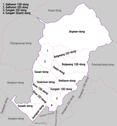
Administrative divisions
- Bulgwang-dong (불광동, 佛光洞)
- Daejo-dong (대조동, 大棗洞)
- Eungam-dong (응암동, 鷹岩洞)
- Galhyeon-dong (갈현동, 葛峴洞)
- Gusan-dong (구산동, 龜山洞)
- Jeungsan-dong (증산동, 繒山洞)
- Jingwan-dong (진관동, 津寬洞)
- Nokbeon-dong (녹번동, 碌磻洞)
- Sinsa-dong (신사동, 新寺洞)
- Susaek-dong (수색동, 水色洞)
- Yeokchon-dong (역촌동, 驛村洞)
Transportation
Sister cities
References
- "은평구(Eunpyeong-gu, 恩平區)" (in Korean). Eunpyeong-gu. Retrieved 2015-01-06.
- Korean Statistical Information Service (Korean) > Population and Household > Census Result (2010) > Population by Administrative district, Sex and Age / Alien by Administrative district and Sex, Retrieved 2010-06-02.
External links
| Wikimedia Commons has media related to Eunpyeong-gu, Seoul. |
| Districts |
|  | ||||
|---|---|---|---|---|---|---|
| Neighbourhoods |
| |||||
This article is issued from Wikipedia. The text is licensed under Creative Commons - Attribution - Sharealike. Additional terms may apply for the media files.