Escuintla, Chiapas
Escuintla is a town and one of the 119 Municipalities of Chiapas, in southern Mexico. It covers an area of 206.2 km².
Escuintla | |
|---|---|
Municipality | |
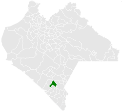 Municipality of Escuintla in Chiapas | |
Escuintla Location in Mexico | |
| Coordinates: 15°20′N 92°38′W | |
| Country | |
| State | Chiapas |
| Area | |
| • Total | 79.6 sq mi (206.2 km2) |
| Population (2010) | |
| • Total | 30,068 |
As of 2010, the municipality had a total population of 30,068,[1] up from 28,064 as of 2005.[2]
As of 2010, the town of Escuintla had a population of 9,570.[1] Other than the town of Escuintla, the municipality had 239 localities, the largest of which (with 2010 populations in parentheses) were: El Triunfo (2,719), classified as urban, and San Felipe Tizapa (1,087), classified as rural.[1]
Just west of it is the Chantuto Archaeological Site of Acapetahua, which is considered to be the location of the Chantuto people 3000 years BC. Voorhies
References
- "Escuintla". Catálogo de Localidades. Secretaría de Desarrollo Social (SEDESOL). Retrieved 23 April 2014.
- "Escuintla". Enciclopedia de los Municipios de México. Instituto Nacional para el Federalismo y el Desarrollo Municipal Gobierno del Estado de Chiapas. Archived from the original on September 30, 2007. Retrieved July 25, 2008.

This article is issued from Wikipedia. The text is licensed under Creative Commons - Attribution - Sharealike. Additional terms may apply for the media files.