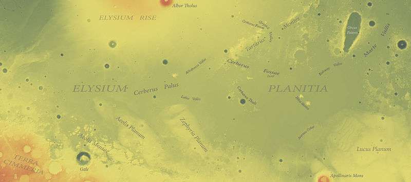
Elysium Planitia
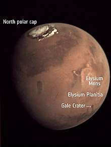
Elysium Planitia, located in the Elysium and Aeolis quadrangles, is a broad plain that straddles the equator of Mars, centered at 3.0°N 154.7°E.[1] It lies to the south of the volcanic province of Elysium, the second largest volcanic region on the planet, after Tharsis. Elysium contains the major volcanoes Elysium Mons, Albor Tholus and Hecates Tholus. Another more ancient shield volcano, Apollinaris Mons, is situated just to the south of eastern Elysium Planitia.
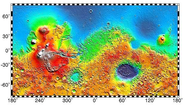
 MOLA topographical map of Elysium Planitia (spacecraft landing sites are annotated in Commons) | |
| Coordinates | 3.0°N 154.7°E |
|---|---|
The largest craters in Elysium Planitia are Eddie, Lockyer, and Tombaugh. The planitia also has river valleys—one of which, Athabasca Valles may be one of the youngest on Mars. On the north east side is an elongated depression called Orcus Patera, and this and some of the eastern plains were imaged in the 1965 Mariner 4 flyby.[2]
A 2005 photo of a locale in Elysium Planitia at 5°N, 150°E by the Mars Express spacecraft shows what may be ash-covered water ice. The volume of ice is estimated to be 800 km (500 mi) by 900 km (560 mi) in size and 45 m (148 ft) deep, similar in size and depth to the North Sea.[3] The ice is thought to be the remains of water floods from the Cerberus Fossae fissures about 2 to 10 million years ago. The surface of the area is broken into 'plates' like broken ice floating on a lake (see below). Impact crater counts show that the plates are up to 1 million years older than the gap material, showing that the area solidified much too slowly for the material to be basaltic lava.[4]
Overview
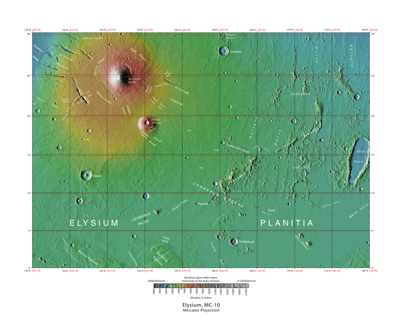 Elysium quadrangle MOLA map, with Elysium Planitia at bottom
 Aeolis quadrangle MOLA map, with Elysium Planitia at top
MOLA
Exploration
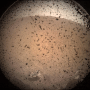
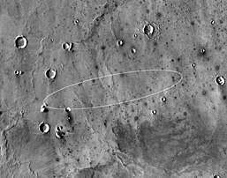
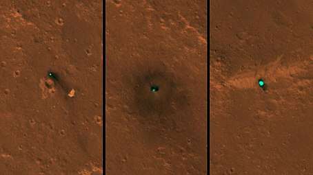
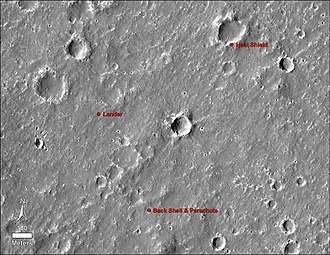
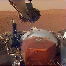
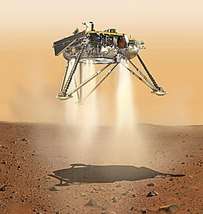
NASA's InSight mission landed in Elysium Planitia on November 26, 2018.[5] It took off from Earth on the 5th May 2018. The probe will study the internal structure of Mars and by so doing improve understanding of the planet's evolution. InSight Mars lander was able to take color pictures from the surface Elysium Planitia and sent them by radio signal back to Earth. During the descent sequence two additional items were jettisoned, the backshell with parachute, and heat shield, and they impacted in the vicinity of the lander.
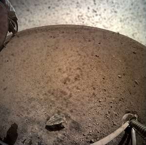
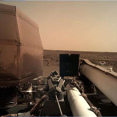
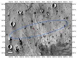
In March 2017, scientists from the Jet Propulsion Laboratory announced that the landing site had been selected. It is located in western Elysium Planitia at 4.5°N 135.9°E.[6] The landing site is about 600 km (370 mi) north from where the Curiosity rover is operating in Gale Crater.[7]
(13 December 2018)
(26 November 2018)
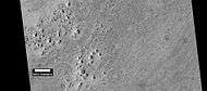
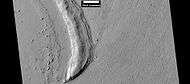
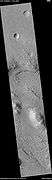
Fractured ground
 Wide view of fractured ground, as seen by HiRISE under HiWish program
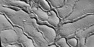 Close view of fractured ground, as seen by HiRISE under HiWish program
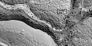 Close view of fractured ground, as seen by HiRISE under HiWish program Box shows size of football field. The boulders are the size of houses.
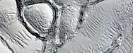 Close, color view of fractured ground, as seen by HiRISE under HiWish program
Mesas
 Wide view of layered buttes and small mesas, as seen by HiRISE under HiWish program Some dark slope streaks are visible.
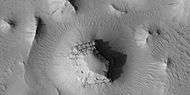 Layered mesa and mounds with dark slope streaks, as seen by HiRISE under HiWish program
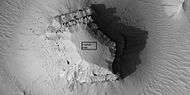 Close view of layered small mesa with dark slope streak, as seen by HiRISE under HiWish program Box shows the size of a football field.
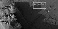 Very close view of individual blocks breaking off layer in a butte, as seen by HiRISE under HiWish program Blocks have angular shapes. Box shows size of football field.
 Layered mesas, as seen by HiRISE under HiWish program
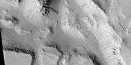 Layered mesas, as seen by HiRISE under HiWish program Dark slope streaks are also visible.
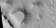 Mesas, as seen by HiRISE under HiWish program Top layer, the cap rock is breaking up into boulders.
 Close view of cap rock breaking up into boulders, as seen by HiRISE under HiWish program
Cones
 Cones, as seen by HiRISE under HiWish program These cones probably formed when hot lava flowed over ice-rich ground.
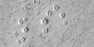 Close view of cones, as seen by HiRISE under HiWish program These cones probably formed when hot lava flowed over ice-rich ground.
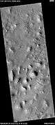
Gallery
 MOLA map showing boundaries of Elysium Planitia and other nearby regions.
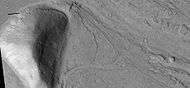
 Layers in old crater rim, in Marte Vallis as seen by HiRISE under HiWish program
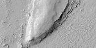 Close view of layers from previous image, as seen by HiRISE under HiWish program Some dark slope streaks are visible.
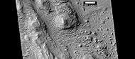 Mounds with layers, as seen by HiRISE under HiWish program. Location is east of Gale Crater in the Aeolis quadrangle.
.png) These icy plates moved to the left, and obstacles (crater rims) turned them into piles of pieces.
These icy plates moved to the left, and obstacles (crater rims) turned them into piles of pieces.
 Mound showing layers at the base, as seen by HiRISE under HiWish program. Location is east of Gale Crater in the Aeolis quadrangle.
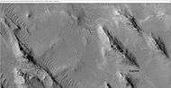 Yardangs showing layers, as seen by HiRISE under HiWish program. Location is east of Gale Crater in the Aeolis quadrangle.
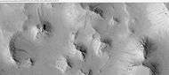 Mesas and eroded parts of mesas showing layers and dark slope streaks, as seen by HiRISE under HiWish program. Image is located in eastern Avernus Colles.
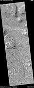 Wide view of layered terrain, as seen by HiRISE under HiWish program Location is northeast of Gale Crater.
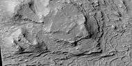 Close view of mound with layers, as seen by HiRISE under HiWish program Note: this is an enlargement from the previous image.
 Close view of mound with layers, as seen by HiRISE under HiWish program Note: this is an enlargement from a previous image.
 Wide view of layered terrain, as seen by HiRISE under HiWish program Note: parts of this image are enlarged in the next three images.
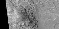 Close view of layers in a mound, from previous image, as seen by HiRISE under HiWish program
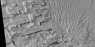 Close view of layers in a mound, from a previous image, as seen by HiRISE under HiWish program
 Close view of layers in a mound, from a previous image, as seen by HiRISE under HiWish program
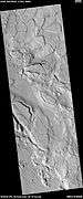
 Lava field on Elysium Planitia resembling an elephant
 Lava flow and dark slope streaks, as seen by HiRISE under HiWish program
Interactive Mars map
See also
References
- "Elysium Planitia". Gazetteer of Planetary Nomenclature. USGS Astrogeology Science Center. Retrieved 2018-05-07.
- Williams, Dave; Friedlander, Jay. "The Orcus Patera region on Mars". Mars - Mariner 4. NASA. Retrieved December 20, 2015.
- Young, Kelly (2005-02-25). "'Pack ice' suggests frozen sea on Mars". New Scientist. Retrieved 2007-01-30.
- Murray, JB; Muller, JP; Neukum, G; Werner, SC; Van Gasselt, S; Hauber, E; Markiewicz, WJ; Head Jw, 3rd; et al. (17 March 2007). "Evidence ... for a frozen sea close to Mars' equator". Nature. 434 (7031): 352–355. Bibcode:2005Natur.434..352M. doi:10.1038/nature03379. PMID 15772653.
- "Landing Status | Landing – NASA's InSight Mars Lander". NASA's InSight Mars Lander.
- Golombek, M.; et al. (2017). Selection of the 2018 Insight Landing Site. 48th Lunar and Planetary Science Conference. 20–24 March 2017. The Woodlands, Texas. Bibcode:2017LPI....48.1515G. LPI Contribution No. 1964, id.1515.
- "InSight's Landing Site: Elysium Planitia". NASA. 25 January 2018. Archived from the original on 2019-01-02. Retrieved 1 February 2018.
External links
- Google Mars – zoomable map centered on Elysium Planitia, with three main volcanoes of Elysium visible
- Google Mars – Cerebrus Fossae fissures
- High resolution video by Seán Doran of overflight of an impact crater in Elysium Planitia with a lava vent (1.1° S, 159.7° E)
| Geography | |||||||||
|---|---|---|---|---|---|---|---|---|---|
| Astronomy |
| ||||||||
| Exploration |
| ||||||||
| Related | |||||||||
| |||||||||
| Payload |
|   |
|---|---|---|
| Landing site | ||
| Launch related | ||
| Related | ||