Elmas
Elmas, Su Masu in Sardinian language, is a comune (municipality) of the Metropolitan City of Cagliari in the Italian region of Sardinia, located about 8 kilometres (5 mi) northwest of Cagliari.
Elmas Su Masu | |
|---|---|
| Comune di Elmas | |
 Church of San Sebastiano | |
 Coat of arms | |
Location of Elmas 
| |
 Elmas Location of Elmas in Sardinia 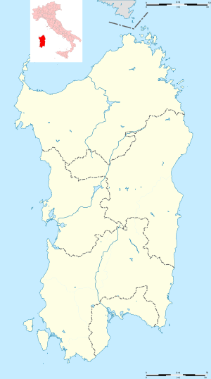 Elmas Elmas (Sardinia) | |
| Coordinates: 39°16′N 9°3′E | |
| Country | Italy |
| Region | Sardinia |
| Metropolitan city | Cagliari (CA) |
| Government | |
| • Mayor | Antonio Ena |
| Area | |
| • Total | 13.72 km2 (5.30 sq mi) |
| Elevation | 7 m (23 ft) |
| Population | |
| • Total | 8,222 |
| • Density | 600/km2 (1,600/sq mi) |
| Demonym(s) | Masesi |
| Time zone | UTC+1 (CET) |
| • Summer (DST) | UTC+2 (CEST) |
| Postal code | 09067 |
| Dialing code | 070 |
| Patron saint | St. Sebastian |
| Saint day | 20 January |
| Website | Official website |
Until 1989 Elmas was a district of Cagliari. It is best known locally as the location for the airport which serves Cagliari, some 7 kilometres (4 mi) to the east to the town. According to 2011 census, it has 8,949 inhabitants.
Climate
Elmas has a hot-summer Mediterranean climate (Köppen: Csa) with summers being very hot and dry and winter mild and humid, associated with high subtropical pressure. The snow turns out to be a rare phenomenon, unlike mountains not so distant.[4] Its precipitation values also bring it closer to semi-arid conditions.[5][6]
| Climate data for Elmas-Cagliari (Elmas Airport), elevation: 5 m or 16 ft, 1981-2010 normals and extremes | |||||||||||||
|---|---|---|---|---|---|---|---|---|---|---|---|---|---|
| Month | Jan | Feb | Mar | Apr | May | Jun | Jul | Aug | Sep | Oct | Nov | Dec | Year |
| Record high °C (°F) | 21.0 (69.8) |
22.4 (72.3) |
26.2 (79.2) |
29.0 (84.2) |
34.6 (94.3) |
39.0 (102.2) |
43.6 (110.5) |
41.4 (106.5) |
35.4 (95.7) |
31.8 (89.2) |
26.4 (79.5) |
23.4 (74.1) |
43.6 (110.5) |
| Average high °C (°F) | 14.4 (57.9) |
15.0 (59.0) |
17.1 (62.8) |
19.5 (67.1) |
23.8 (74.8) |
28.2 (82.8) |
31.4 (88.5) |
31.7 (89.1) |
27.9 (82.2) |
23.7 (74.7) |
18.8 (65.8) |
15.5 (59.9) |
22.3 (72.1) |
| Daily mean °C (°F) | 9.9 (49.8) |
10.2 (50.4) |
12.1 (53.8) |
14.5 (58.1) |
18.4 (65.1) |
22.5 (72.5) |
25.6 (78.1) |
25.9 (78.6) |
22.7 (72.9) |
18.9 (66.0) |
14.3 (57.7) |
11.1 (52.0) |
17.2 (63.0) |
| Average low °C (°F) | 5.4 (41.7) |
5.5 (41.9) |
7.2 (45.0) |
9.4 (48.9) |
13.1 (55.6) |
16.8 (62.2) |
19.7 (67.5) |
20.2 (68.4) |
17.5 (63.5) |
14.1 (57.4) |
9.9 (49.8) |
6.8 (44.2) |
12.2 (54.0) |
| Record low °C (°F) | −4.8 (23.4) |
−3.0 (26.6) |
−2.2 (28.0) |
−0.4 (31.3) |
4.8 (40.6) |
8.8 (47.8) |
11.8 (53.2) |
12.6 (54.7) |
9.0 (48.2) |
5.0 (41.0) |
−2.0 (28.4) |
−3.4 (25.9) |
−4.8 (23.4) |
| Average precipitation mm (inches) | 40.7 (1.60) |
40.4 (1.59) |
33.6 (1.32) |
42.2 (1.66) |
20.7 (0.81) |
10.0 (0.39) |
3.1 (0.12) |
7.5 (0.30) |
35.7 (1.41) |
49.1 (1.93) |
62.7 (2.47) |
49.6 (1.95) |
395.3 (15.55) |
| Average precipitation days (≥ 1.0 mm) | 7 | 6 | 6 | 7 | 4 | 2 | 1 | 1 | 5 | 6 | 8 | 8 | 61 |
| Average relative humidity (%) | 79 | 77 | 75 | 73 | 71 | 67 | 65 | 65 | 71 | 77 | 79 | 80 | 73 |
| Mean monthly sunshine hours | 150 | 163 | 209 | 218 | 270 | 311 | 342 | 321 | 243 | 209 | 150 | 127 | 2,726 |
| Source: Meteo Climat,[7] Servizio Meteorologico[5] and WeatherBase[8] | |||||||||||||
| Climate data for Elmas-Cagliari (Elmas Airport), elevation: 5 m or 16 ft, 1971-2000 normals[lower-alpha 1] | |||||||||||||
|---|---|---|---|---|---|---|---|---|---|---|---|---|---|
| Month | Jan | Feb | Mar | Apr | May | Jun | Jul | Aug | Sep | Oct | Nov | Dec | Year |
| Average high °C (°F) | 14.3 (57.7) |
14.8 (58.6) |
16.5 (61.7) |
18.6 (65.5) |
22.9 (73.2) |
27.3 (81.1) |
30.4 (86.7) |
30.8 (87.4) |
27.4 (81.3) |
23.1 (73.6) |
18.3 (64.9) |
15.4 (59.7) |
21.7 (71.1) |
| Daily mean °C (°F) | 9.9 (49.8) |
10.3 (50.5) |
11.8 (53.2) |
13.8 (56.8) |
17.7 (63.9) |
21.8 (71.2) |
24.7 (76.5) |
25.2 (77.4) |
22.3 (72.1) |
18.4 (65.1) |
13.8 (56.8) |
11.0 (51.8) |
16.7 (62.1) |
| Average low °C (°F) | 5.5 (41.9) |
5.8 (42.4) |
7.1 (44.8) |
8.9 (48.0) |
12.4 (54.3) |
16.2 (61.2) |
18.9 (66.0) |
19.6 (67.3) |
17.1 (62.8) |
13.7 (56.7) |
9.3 (48.7) |
6.6 (43.9) |
11.8 (53.2) |
| Average precipitation mm (inches) | 49.7 (1.96) |
53.3 (2.10) |
40.4 (1.59) |
39.7 (1.56) |
26.1 (1.03) |
11.9 (0.47) |
4.1 (0.16) |
7.5 (0.30) |
34.9 (1.37) |
52.6 (2.07) |
58.4 (2.30) |
48.9 (1.93) |
428 (16.9) |
| Average precipitation days (≥ 1.0 mm) | 6.8 | 6.8 | 6.8 | 7.0 | 4.4 | 2.1 | 0.8 | 1.3 | 4.3 | 6.5 | 7.4 | 7.4 | 61.6 |
| Mean monthly sunshine hours | 136.4 | 139.2 | 186.0 | 213.0 | 269.7 | 288.0 | 334.8 | 310.0 | 246.0 | 198.4 | 147.0 | 127.1 | 2,596 |
| Source: Servizio Meteorologico[10] and Hong Kong Observatory (sunshine hours)[9] | |||||||||||||
Notes
- Except sunshine hours [9]
References
- "Superficie di Comuni Province e Regioni italiane al 9 ottobre 2011". Istat. Retrieved 16 March 2019.
- Data from Istat
- "Popolazione Residente al 1° Gennaio 2018". Istat. Retrieved 16 March 2019.
- "Cagliari/Elmas Airport - SKYbrary Aviation Safety". www.skybrary.aero. Retrieved 2019-05-28.
- "Climatologia - Ricerca Dati". Servizio Meteorologico dell'Aeronautica Militare. Retrieved 2019-05-28.
- Wickens, Gerald E. (1998), "Arid and Semi-arid Environments of the World", in Wickens, Gerald E. (ed.), Ecophysiology of Economic Plants in Arid and Semi-Arid Lands, Adaptations of Desert Organisms, Springer Berlin Heidelberg, pp. 5–15, doi:10.1007/978-3-662-03700-3_2, ISBN 9783662037003
- "moyennes 1981/2010".
- "Cagliari, Italy Travel Weather Averages (Weatherbase)". Weatherbase. Retrieved 2019-05-28.
- "Climatological Normals of Cagliari". Weather.gov.hk. 2012-12-20. Archived from the original on 2015-02-09. Retrieved 2015-05-03.
- "Tabelle climatiche 1971-2000 della stazione meteorologica di Cagliari-Elmas Ponente dall'Atlante Climatico 1971-2000" (PDF). Servizio Meteorologico dell'Aeronautica Militare. Retrieved 2015-05-03.
This article is issued from Wikipedia. The text is licensed under Creative Commons - Attribution - Sharealike. Additional terms may apply for the media files.