Eliot station
Eliot is a light rail station on the MBTA Green Line D branch located just north of Route 9 (Boylston Street) between the Newton Highlands and Newton Upper Falls villages of Newton, Massachusetts. The station has a parking lot at the end of Lincoln Street, a pedestrian entrance from Meredith Avenue, and pedestrian entrances from both sides of Route 9. A footbridge, built in 1977, crosses Route 9 adjacent to the railroad bridge.
Eliot | |||||||||||||
|---|---|---|---|---|---|---|---|---|---|---|---|---|---|
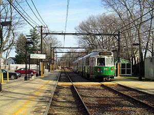 Inbound train at Eliot in March 2016 | |||||||||||||
| Location | 248 Lincoln Street, Newton, Massachusetts | ||||||||||||
| Coordinates | 42°19′08″N 71°12′59″W | ||||||||||||
| Owned by | Massachusetts Bay Transportation Authority | ||||||||||||
| Line(s) | Highland Branch | ||||||||||||
| Platforms | 2 side platforms | ||||||||||||
| Tracks | 2 | ||||||||||||
| Connections | |||||||||||||
| Construction | |||||||||||||
| Parking | 55 spaces ($6.00 daily) | ||||||||||||
| Bicycle facilities | 8 spaces | ||||||||||||
| History | |||||||||||||
| Opened | July 4, 1959[1] | ||||||||||||
| Traffic | |||||||||||||
| Passengers (2011) | 814 (weekday average boardings)[2] | ||||||||||||
| Services | |||||||||||||
| |||||||||||||
| |||||||||||||
References
- Belcher, Jonathan. "Changes to Transit Service in the MBTA district" (PDF). NETransit.
- "Ridership and Service Statistics" (PDF) (14th ed.). Massachusetts Bay Transportation Authority. 2014.
External links
![]()
- MBTA - Eliot
- Google Maps Street View: Lincoln Street entrance, Boylston Street entrance
This article is issued from Wikipedia. The text is licensed under Creative Commons - Attribution - Sharealike. Additional terms may apply for the media files.