East Kilbride
East Kilbride (/ˌiːst kɪlˈbraɪd/; Scottish Gaelic: Cille Bhrìghde an Ear) is the largest town in South Lanarkshire in Scotland and the country's 6th-largest settlement. It was also designated Scotland's first new town on 6 May 1947. The area lies on a raised plateau to the south of the Cathkin Braes, about 8 miles (13 km) south-east of Glasgow and close to the boundary with East Renfrewshire. East Kilbride is twinned with the Danish city Ballerup.
East Kilbride
| |
|---|---|
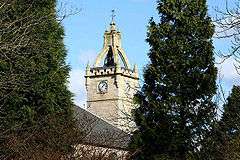 Kilbride parish church tower | |
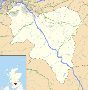 East Kilbride Location within South Lanarkshire | |
| Area | 26.8 km2 (10.3 sq mi) |
| Population | 75,120 [1] |
| • Density | 2,803/km2 (7,260/sq mi) |
| OS grid reference | NS635545 |
| • Edinburgh | 40 mi (64 km) |
| • London | 338 mi (544 km) |
| Civil parish |
|
| Council area | |
| Lieutenancy area | |
| Country | Scotland |
| Sovereign state | United Kingdom |
| Post town | GLASGOW[3] |
| Postcode district | G74-75 |
| Dialling code | 01355 & 0141 |
| Police | Scotland |
| Fire | Scottish |
| Ambulance | Scottish |
| UK Parliament | |
| Scottish Parliament | |
The town is enclosed by the White Cart Water to the west and the Rotten Calder Water to the east, the latter flowing northwards adjacent to Blantyre, before joining the River Clyde opposite Daldowie near Cambuslang.[4] This area was previously the site of the small village of East Kilbride, prior to its post-war development into a New Town. The old village still survives and is integrated with the town close to its town centre.
History and prehistory
The earliest-known evidence of occupation in the area dates as far back as the late Neolithic and Early Bronze Age, as archaeological investigation has demonstrated that burial cairns in the district began as ceremonial or ritual sites of burial during the Neolithic, with the use of cup-marked, and other inscribed stones at key elevated sites, only to be later built upon with earth and re-used for burial into the Bronze Age.[5] These findings have found further support through ongoing research indicating that many East Kilbride Cairns first noticed by the Reverend David Ure in his History of Rutherglen and East Kilbride (1793), are embedded, alongside other monuments, into a ritual landscape related to ancestor cults and relationships with key topographical features and annual solar events.[6][7][8] A flint arrow head was discovered by Allan Forrest, a then child resident whilst groundworks were taking place in his family's garden at Glen Bervie, St Leonards in 1970 which later was identified as dating to 1500 BC (Bronze Age).[9] Ancient graves have also been found near the Kype Water to the south of the town near Strathaven, and Roman coins, lamps, and footwear have also been found in the area.[10][11]
East Kilbride traditionally takes its name from an Irish saint named St Bride (or Brigit), who was alleged to have founded a monastery for nuns and monks in Kildare in Leinster, Ireland, in the 6th century. Dál Riatan monks afterwards introduced her order to Scotland. The anglicisation Kil takes its root from the early Celtic monastics that St. Brigit is representative of: the Culdees or Céli Dé. The Céile Dé were 'the clients or companions of God'. In modern Gaelic, Cille Bhrìghde translates similarly as 'the clients or companions of Brigit', and can be interpreted as the 'church of Bride' or 'burial place dedicated to Bride'.[12] Alternatively the later dedication may commemorate the Scottish St Bryde, born in 451 AD and then dying at Abernethy 74 years later.[11] Culdee type Christian settlements were essential to the spread of the Celtic church in Scotland, with small pagan sites being converted and chapels or cells forming little more than crude shelters, or timber and turf buildings with crude circular enclosures.[13][14] The evidence of Culdee type small-scale habitation is supported by the number of early stone cross sites around East Kilbride, and their associated holy fonts, springs, and both with pre-canonisation saintly dedications.[15][16]
The original parish church was located on what is believed to be the site of a pre-Christian sacred area, which is possibly the origin of the association with St. Brigit, since the site may be dedicated to the Celtic goddess Brigid, whose traditions have been continued through the reverence of St. Brigit brought on by the Celtic Church. Many sites in mainland Britain associated with Saint Bridget involve early dedications to sacred wells, the number of which in East Kilbride may indicate that the chosen site for the early Christian settlement centered around a sacred spring, although such a feature has not yet been identified close to the church.
East Kilbride grew from a small village of around 900 inhabitants in 1930 to eventually become a large burgh.[11] The rapid industrialisation of the twentieth century underpins this growth and left much of the working population throughout Scotland's Central Belt, from Glasgow to Edinburgh, living in the housing stock built at the end of the previous century. The Great War postponed any housing improvements, as did the Treaty of Versailles and the period of post-war settlement it created. In turn, this was followed by the Great Depression. After the Second World War, Glasgow, already suffering from chronic housing shortages, incurred bomb damage from the war.
From this unlikely backdrop a new dawn emerged which would bring East Kilbride to its unlikely success. In 1946, the Clyde Valley Regional Plan allocated sites where overspill satellite "new towns" could be constructed to help alleviate the housing shortage.[17] Glasgow would also undertake the development of its peripheral housing estates. East Kilbride was the first of six new towns in Scotland to be designated, in 1947, followed by Glenrothes (1948), Cumbernauld (1956), Livingston (1962), Irvine (1964) and Stonehouse (1972), although Stonehouse new town was never built.[18][19]
The town has been subdivided into residential precincts, each with its own local shops, primary schools and community facilities. The housing precincts surround the shopping centre, which is bound by a ring road. Industrial estates are concentrated on the outskirts of the town, in northern, western and southern directions.[20]
The Calderglen gorge bordering the eastern fringe of East Kilbride, was celebrated in a high number of printed works as a picturesque forest and 'magnificent in its grouping of craggy heights, sprinkled with trees and [...] the richly wooded and festooned valley', and with 'delightful cascades', and described as indescribable, or as 'the GRAND, the ROMANTIC, and BEAUTIFUL' - the latter being the only part of David Ure's book where he emphasised the descriptive characteristics of a place in bold characters.[21][4][22] The northern part of the gorge and adjoining Calderwood, the gorge's namesake, was the home of an ancient family known as the 'Maxwells of Calderwood' who resided in Calderwood Castle, and were the oldest branch of the Maxwells of Pollok.[23] The remnants of Calderwood Castle were demolished in 1951 and only a few parts of the structure remain.[24] Calderglen Heritage formally constituted in early 2017 as a body to protect, record, and restore local and national interest in the areas of the former Calderwood and Torrance estates of Calderglen.[25]
The story of how workers at the Rolls Royce factory in East Kilbride prevented engines for military jets being serviced and supplied between 1974 until 1978 to the Chilean military dictatorship is told in the 2018-released documentary, Nae Pasaran. The factory itself was scheduled for closure in 2018.[26] It has since been demolished and the land it was built on is now having housing built on it.
Geography
East Kilbride forms part of the Greater Glasgow conurbation. However, the urban area is not directly connected to any other, being designed from the outset to serve as a self-contained town with some commute requirements to Glasgow.[20] The hamlets of Nerston, Kittochside, Auldhouse and Jackton which were once separate settlements are now on the periphery of the expanding town.
The nearest Glasgow district of Castlemilk is about 3 miles to the north-west, with the village of Carmunnock in between (a bypass has been built in recent years to remove Glasgow traffic from Carmunnock). Rutherglen and Cambuslang lie about the same distance to the north-east and are linked to East Kilbride via the dual carriageway A749 road which continues into Glasgow.
Clarkston and Busby are also about 3 miles away to the north-west, with Thorntonhall much closer. Eaglesham lies to the west (again this is about 3 miles from East Kilbride centre). Another modern bypass keeps East Kilbride traffic heading for the M77 motorway away from Eaglesham.
The closest town to the south of East Kilbride is Strathaven, about 7 miles away. The majority of land in the area in between is taken up by Whitelee Wind Farm on the moorland hills to the southwest, including Elrig close to where one of the principal feeder burns of the Calder Water originates.[27]
Hamilton, the administrative headquarters for South Lanarkshire Council is about 5 miles to the east of East Kilbride. The road linking the towns also leads via Blantyre and with links to Bothwell and ultimately to the M74 motorway.
Governance
From 1975 East Kilbride lent its name to a local government district in the Strathclyde region. From creation until 1980 the East Kilbride district council was governed by the Scottish National Party (SNP), subsequently, until dissolution, the district was under the control of Labour. In 1996, administrative functions were taken over by the South Lanarkshire unitary council.
There is an East Kilbride constituency of the Scottish Parliament. From the opening of the Scottish Parliament, the constituency was represented by Andy Kerr MSP (Labour), until May 2011 when the seat was won by Linda Fabiani MSP (Scottish National Party).
East Kilbride was formerly a constituency of the UK Parliament. In 2005 it was replaced by the constituency of East Kilbride, Strathaven and Lesmahagow. The seat was held from 1987 to 2010 by Labour politician, Adam Ingram. In the 2010 election Labour politician, Michael McCann, previously a South Lanarkshire Councillor was elected as the MP for the area. In the 2015 election, Lisa Cameron for the SNP was elected as part of the landslide victory the party had in Scotland, the seat was held with a reduced majority in 2017.
Leisure and culture
East Kilbride as a new town was designed to provide elements culture, sport, and heritage for residents so as to create a sense of belonging and place.[28] Key cultural facilities in the town include the Dollan Aqua centre. This building is regarded as an outstanding and rare example of a mid-20th century public amenity building in a striking internationally inspired design. It was the first champion-sized swimming pool in Scotland and was inspired by Pier Luigi Nervi's Olympic complex in Rome; it is also very similar to the Olympic complex built for the 1964 Japanese Olympic Games.[29]
The town is also home to the popular arts and performance venue The East Kilbride Arts Centre, as well as the longstanding Village Theatre. The town contains several open pockets of land which have been utilised as outdoor football pitches, public parks, a boating loch, several sports centres, 3G pitches and three golf courses.
East Kilbride is home to the National Museum of Rural life, located at Wester Kittochside farm. A visit gives an opportunity for visitors to get back to the land and experience the traditional way of life as it was on the rural and partly mechanised Scottish farm of the 1950s.
The only other museum in East Kilbride was the Hunter House Museum, which closed after the financial crash to later open again as a cafe. East Kilbride Central Library holds the reference collections and some archival materials representing some of the history of both East Kilbride new town and the earlier village, whilst South Lanarkshire Archives based as College Milton holds more extensive original documents for public consultation.[30][31]
The town also hosted the National Mòd in 1975.[32]
Economy

The town centre is occupied by a large shopping centre comprising 6 linked malls, developed in phases. The malls are known by local residents as "The Centre".
The six malls are The Plaza (development started in 1972), Princes Mall (1984), Olympia (1988), Southgate (1989), Princes Square (1997) and Centre West (2003). The shopping centre has come under recent criticism for losing major retail chains in light of rising rental prices. This coupled with the Centre West expansion and decreasing shopper numbers has allowed swathes of properties within the centre to remain closed for months at a time, notably on the first floor of Centre West and the Plaza.
A £400m redevelopment of East Kilbride shopping centre was approved in 2006 by South Lanarkshire Council. The plan proposed demolishing some existing buildings to create a new civic centre, health centre, library and shopping facilities.[33][34] It would also see a "landmark" arts and culture complex with a 1,000-seat theatre, a 500-seat conference centre, a museum and a new town square. However, the project has been indefinitely delayed.

A branch of the government's Department for International Development is located on the western edge of East Kilbride at Hairmyres.[35]
The newly renovated Olympia opened late 2016, renamed "The Hub". It contains several restaurants and a new 'sky trail' with a soft play area above the ice rink.
Local areas
East Kilbride is divided into a number of smaller neighbourhoods bordered by main through-roads. Part of the new town design was that each of these would be a self-contained entity, with local shops and primary schools, and accessed safely via paths and underpasses separate from main roads.[20] This is true for the original areas of the town but newer developments, such as Stewartfield, Lindsayfield and Mossneuk do not adhere to this model.
Religion
There are approximately 30 Christian churches in East Kilbride. This includes nine Church of Scotland churches, three Baptist churches, and four Roman Catholic churches. St. Bride's RC church is a category A listed building. St. Mark's Episcopal church is situated in the Murray. There is one Lutheran parish of the Evangelical Lutheran Church of England, which is located in the Westwoodhill area. An Evangelical Christian congregation is also located in the Westwood area.[36] The Church of Jesus Christ of Latter Day Saints meeting hall is situated in Vancouver Drive, Westwood. Two congregations of Jehovah's Witnesses share a Kingdom Hall near the centre of the town. The Christadelphians meet in Calderwood Community Centre.[37] There are two United Reformed Churches, one in the Village,[38] and one in the Murray.[39] In the Greenhills area is a congregation of the Methodist church, whose premises are currently shared by the Seventh Day Adventist church.
Transport

East Kilbride is connected to Glasgow city centre by road and rail. Three main roads connect East Kilbride with surrounding suburbs and the city, one being the A727 (formerly A726) leading west to Busby and on to Clarkston Toll. Another route being the A749 which runs north into Rutherglen. Recently, the addition of the Glasgow Southern Orbital road links the west of the town directly with Newton Mearns and the M77. This road has taken over the designation A726. Similar to other New Towns, the road network within the area is populated by many roundabouts;[40] Glaswegians jokingly refer to East Kilbride as "Polo mint City" after the round, mint sweet.[41] The main dual carriageway road running north–south through the town is known as the Kingsway, while the main east–west road is known as the Queensway.
Public transport
East Kilbride bus station, at the East Kilbride Shopping Centre, was rebuilt in June 2005 with modern facilities, including 14 rapid drive-through stances, allowing quick turnover of buses. East Kilbride railway station is situated in the Village, about a 10-minute walk from the bus station. Trains depart to Glasgow Central railway station every half-hour, with a journey time of about 27 minutes. The town is also served by Hairmyres railway station in Hairmyres.
East Kilbride's primary bus operator is First Glasgow which provides regular services to the city centre, Busby, Clarkston, Castlemilk, Rutherglen, Blantyre, Hamilton, Motherwell and to many other destinations across Greater Glasgow. Stagecoach West Scotland provide a half-hourly to hourly service to Ayr. Arriva Scotland West ran an hourly 600 service to the Airport via: Busby, Clarkston, Giffnock, Thornliebank, Silverburn Centre, Hurlet, and Paisley, but this was discontinued in late 2009. McGill's Bus Services and local company, Whitelaws Coaches, also run services in the area.[42]
East Kilbride bus station

East Kilbride bus station is managed and operated by the Strathclyde Partnership for Transport.[43] It is situated by East Kilbride Shopping Centre and is situated right outside the Princes Mall section of the Shopping Centre,[44] and is easily accessible from the Olympia Arcade section also. It is approximately a 10-minute walk from the town's rail station.
The current bus station went under a major £4 million expansion and re-planning of the existing site to form 14 rapid drive-through stances with new travel centre and CAB facility at the eastern gateway to the Town Centre. The bus station was designed by the architectural firm CDA. The brief given to the designers was that they were "to achieve a fast turn around of buses, safe pedestrian/vehicular segregation and a secure and accessible environment set within an attractive urban realm".[45] The new bus station was officially opened on 3 June 2005.
There are 14 stances (stands) at the bus station that are equipped with electronic displays showing the next few departures. There is also a Travel Centre which is open Monday to Saturdays between 8:30 a.m. and 5:30 p.m. The operators at the bus station are First Glasgow, Stagecoach West Scotland, Citylink.[43]
Cycling
Many of the busy roundabouts in East Kilbride feature underpasses which allow pedestrians and cyclists safe access across roads. On 19 June 2009, National Cycling Route 756, connecting East Kilbride and Rutherglen with the City Boundary, was opened.[46] In November 2007, South Lanarkshire Council published three cycle routes, named the "East Kilbride Cycle Network" which start at the East Kilbride Shopping Centre in the centre of the town and are signposted.[47] Route One is route is to Strathaven, via Newlandsmuir; Route Two to St. Leonard's Shopping Centre, and Route Three is to Calderglen Country Park. Incidentally East Kilbride prior to new town development was a prized health resort, with cycling being a popular pastime there from the late 19th to early 20th centuries.[48]
Landmarks
_(14785180935).jpg)
A seated statue of Sir Walter Scott, at the corner of Old Coach Rd and Markethill Rd, is locally known as "The White Man". Outside the Montgomery Arms in the village is a loupin'-on-stane or mounting block. The National Museum of Rural Life is a museum and working farm, featuring the farm seat of Wester Kittochside as it appeared in the 1950s, and with traditional types of various farm methods on display. The land was gifted by the last of a long line of the 'Reids of Kittochside' to the National Trust, and the Museum is currently run by National Museums of Scotland in partnership with the National Trust for Scotland. The James Hamilton Heritage Park is a 16-acre (6.5 ha) manmade loch with watersports facilities and surrounding nature sanctuary.
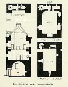
It is overlooked by Mains Castle, a privately owned tower house and former seat of the Lordship of Kilbride. The castle is situated beside the Laigh Mains Motte, the predecessor site of the early stronghold of Kilbride built by the Valloines family and later occupied by the Comyns, before it was confiscated by Robert the Bruce and later came into the possession of the Lindsays. St Bride's Church, by modernist architects Gillespie, Kidd and Coia, was built 1957–1964.
Dollan Aqua Centre

One of the most significant buildings of an earlier phase of development was Dollan Baths leisure complex (opened 1968) which has category A listed status. The Dollan Baths are the subject of a local urban myth, which told that the pool was built 5 cm short of Olympic size. In fact, the pool was built as 55 yards (50 m) long, but is only six lanes wide, rather than the Olympic standard of 50 m and ten lanes wide. The Aqua Centre re-opened on 28 May 2011 after a major refurbishment costing £6.5 million. Facilities include swimming pool with moveable floor, health suite and fitness gym. The famous glass wall allowing views from the reception area into the pool remains.
Long Calderwood Farm
Formerly Hunter House Museum, the building contained exhibits relating to the medical and veterinary pioneers, Drs William and John Hunter, who were born on the estate. In recent years the Hunter House was bought by the neighbouring Calderwood Baptist Church, with the building being refurbished, and is now used for meetings, groups and functions, as well as housing some exhibits from its previous life as a museum. The building's main daily function is as a café.
St. Brides's Church
St. Bride's Church is one of the buildings in East Kilbride and was designed by the architects Gillespie, Kidd and Coia and built between 1957 and 1964.
Langlands Moss
A local nature reserve which comprises a Lowland Raised Peat Bog, a UK BAP priority habitat. The reserve is owned by South Lanarkshire Council and maintained by The Friends of Langlands Moss L.N.R. A boardwalk allowed visitors to walk over the reserve safely while observing the wildlife which lives on the Moss prior to its destruction in 2016. Many species there occur only in bog habitats, making the site one of special interest. Located just south of East Kilbride, the reserve is accessed easiest by car from the A726 heading towards Langlands Golf Course & Auldhouse.
Parks and sports
East Kilbride YM FC is the town's oldest football club, founded in 1921. They currently have three men's, under-17s' and veterans' sides. EKYM are also part of the East Kilbride YMC Community Club which encompasses East Kilbride YM, East Kilbride Youth Club FC and East Kilbride Girls providing a football pathway from under-5s to adults.
East Kilbride Thistle Juniors also operate from The Show Park in The Village.
East Kilbride from the Scottish Lowland Football League, is based in the town, and play at the K-Park Training Academy at Calderglen Country Park.
East Kilbride RFC were formed in 1968 and are based at the Torrance House Arena, at Calderglen Country Park. From 1976 they rose steadily through the leagues, peaking for three years in Premier 2. They now play in the West Regional League 1, the fourth tier of club rugby. They run two senior men's teams and numerous youth teams which are linked to the local schools. Current Scotland national player, Alasdair Strokosch, played through all the youth levels at EKRFC.[49]
East Kilbride Lawn Tennis Club is one of the oldest tennis club in Scotland.
East Kilbride Pirates are the country's top American football team and play in the BAFA Community Leagues.
EK82 Handball Club Founded in 1972, they train at the John Wright Sports Centre and the Alistair McCoist Complex. They play in the Scottish National League.
Athletics in the town is covered by three athletics clubs: Whitemoss, East Kilbride and Calderglen. Both Whitemoss and East Kilbride Athletic Club are based at the John Wright.
EKNC, East Kilbride Netball Club, founded 1968, they train Alistair McCoist Complex, with a current membership of 76 players, under-13s, under-15s, under-17s and seniors with two current Scotland national players.
Education
Primary schools
|
|
Primary schools for those with additional support needs
- Glenburn Primary School, Calderwood Road
- West Mains School, Logie Park[72]
High schools
- Calderglen High School, High Common Road
- Duncanrig Secondary School, Winnipeg Drive
- St Andrew's and St Bride's High School, Platthorn Drive
High schools for those with additional support needs
- Sanderson High School, High Common Road[73]
Further education
- South Lanarkshire College, College Way
Notable people
- William Allison, former member of the Wisconsin State Assembly
- Alex Ferguson, former manager of Manchester United F.C., former resident of the town
- Joanna Baillie, important contributor to the Romantic movement of literature, and a pioneering female dramatic writer lived at Long Calderwood
- Kate Dickie, actress who appeared in the HBO series Game of Thrones and the 2012 film Prometheus, born in East Kilbride
- Blythe Duff, theatre and television actress of Taggart fame, born and raised in East Kilbride.
- Liam Fox, Conservative MP for North Somerset and Secretary of State for International Trade, born and raised in the town
- Roddy Frame, frontman of indie band Aztec Camera, born in the town
- Muriel Gray, journalist and broadcaster, born in the town
- John Hannah, actor, one time resident in East Kilbride in the Murray area
- Iain Harvie, guitarist with rock band Del Amitri, was an East Kilbride resident
- Hiding Place, rock band, were formed in East Kilbride
- William and John Hunter, medical pioneers, were born at Long Calderwood within the present-day area of East Kilbride
- Lorraine Kelly, television presenter for GMTV, moved to the town with her family when she was aged 13
- Charles McIntosh, the British chemist and famous pioneer of fabric waterproofing lived at Crossbasket and Mauchlinehole in East Kilbride, and conducted farm and mining experiments.
- James Livingston, 19th-century Canadian politician who was born and raised in the village before emigrating
- Ally McCoist, former professional footballer, lead actor in A Shot at Glory, and former manager of Rangers F.C., was brought up in the town
- Mark McGuigan, footballer for Albion Rovers, born in the town
- Ross Montgomery, darts player and resident of East Kilbride
- Julie Wilson Nimmo, actress who starred as children's favourite Miss Hoolie in the BBC TV programme Balamory, was born in the town
- George Orwell wrote part of his novel Nineteen Eighty-Four while convalescing from tuberculosis at Hairmyres Hospital in East Kilbride in late 1947 and much of 1948
- David Proctor, footballer, former Dundee United and Inverness Caledonian Thistle defender
- Jim and William Reid, brothers and the principal members of alternative rock band The Jesus and Mary Chain, were born and brought up in the town and the band were formed there
- David R. Ross, writer and historian, moved to East Kilbride as a child and resided in the town until his death
- Allan Scott, athlete who represented Great Britain at the 2008 Beijing Olympics, holder of the Scottish 60m hurdles record, was raised in the town
- David Scott, singer-songwriter of the Pearlfishers, has many produced notable records from a recording studio in the East Kilbride Arts Centre
- Adam Sinclair, TV actor for Mile High and other now the new star of movie adaptation of Irvine Welsh's Ecstasy released April 2012
- Iain Stewart, professor of geology, television presenter and actor, born and raised in East Kilbride.
- John Struthers, the Shoemakers poet and poet of Dechmont, and miscellaneous writer, who reached fame through assistance of Sir Walter Scott and Joanna Baillie
- Andrew Stuart, Prominent lawyer, member of parliament and supporter of the Douglas Cause, was titled of Castlemilk and Torrance, as Lord of Kilbride
- Adair Turner, former Director-General of the Confederation of British Industry (CBI), lived there during his youth
- Marc Warren, professional golfer, lived and grew up in town, playing at East Kilbride Golf Club
- Robbie Winters, footballer (Dundee Utd, Aberdeen) was born and raised in the town; his brother, fellow footballer David Winters was born in Paisley but brought up in East Kilbride.
- Frazer Wright, Scottish Premiership footballer for St Johnstone F.C., brought up in the town
- Rab McKinnon, Scottish international footballer, brought up in the town
- Craig Bryson, Scottish international footballer, brought up in the town
- Kirsty Young, television and radio presenter and actress, born in the town
- Bryan Larkin, BAFTA award-winning actor and director, born in EK, worked in the John Wright Sports Centre, appeared in London Has Fallen with Gerard Butler, now living in LA.
- Vincent Deighan, aka Frank Quitely, DC and Marvel comic graphic illustrator, went to St Brides High School – celebrated graphic illustrator of Superman graphic novels and more.
- Grant Morrison MBE, comic book writer and screenwriter—famous for Batman series—now directing in LA, lived in East Kilbride.
- Dee Hepburn, Scottish former actress who starred as Dorothy in the 1981 film Gregory's Girl, and played Anne-Marie Wade in the ITV soap opera Crossroads, grew up and continues to live in the town.
- Chris Erskine, professional footballer (Dundee United, Partick Thistle, Livingston)
References
- "Mid-2016 Population Estimates for Settlements and Localities in Scotland". National Records of Scotland. Retrieved 27 June 2019.
- "Scottish Civil Parishes Index map" (PDF). General Register Office for Scotland. Archived from the original (PDF) on 13 September 2012. Retrieved 26 September 2013.
- "List of UK post towns". Evox Facilities. Archived from the original on 19 February 2012. Retrieved 22 February 2012.
- By the ministers of the respective parishes, under the superintendence of a committee of the Society for the benefit of the sons and daughters of the clergy (1845). The New Statistical Account Of Scotland. Edinburgh: William Blackwood & Sons. p. 879.
- Glasgow University Archaeological Research Division [GUARD] (2008). "Law Knowe Program Of Archaeological Works". GUARD Data Structure Report Series.
- Thom, Alexander (1970). Megalithic Lunar Observatories. Oxford: Clarendon Press. pp. 92–117.
- Ladds, C., Always An Old Town And Never A New One, Journal Typescript, July 2016. Calderglen Dataset - Calderglen Heritage.
- Niven, Thomas Eric (1965). East Kilbride, The History of Parish and Village. Glasgow: Wilson, Guthrie And Lang Limited. pp. 9, 96.
- Scott, J. G. (1970). "East Kilbride: arrowhead, early/mid bronze age". Discovery & Excavation Scotland: 31.
- Various (July 1900). "Notes of the month". The Antiquary. 36: 193–198.
- Various (1986–88). East Kilbride official guide, The Official Guide to East Kilbride, 7th Edition. London: J Burrow & Co Ltd Publishers. pp. 15–39.
- Niven, William M. (1970). East Kilbride Historical Guide 1320 to 1970. East Kilbride: East Kilbride District Council. p. 5.
- Reeves, W. (1864). The Culdees of the British Islands. Dublin.
- Skene, W. F. (1887). Celtic Scotland Volume II. Edinburgh: David Douglas.
- Wilson, James Alexander (1936). A Contribution To The History of Lanarkshire, Vol. I, Twenty Parishes. Glasgow: J. Wylie And Co. p. 77.
- Watson, William J. (1926). The History Of The Celtic Place-Names Of Scotland. Edinburgh: William Blackwood & Sons Ltd. p. 196.
- "TGS – 1950s to The Present Day – Neighbourhoods – New Towns". Theglasgowstory.com. Retrieved 13 November 2012.
- "50,000 people for East Kilbride. First of New Clyde Valley Towns". The Glasgow Herald. 6 June 1946. p. 3. Retrieved 25 January 2019.
- Cowling, D. (1997). An Essay for Today: the Scottish New Towns 1947–1997. Edinburgh: Rutland Press.
- Smith, R. (1979). East Kilbride, The Biography of a Scottish new town, 1947-1973, Department of the Environment, Building Research Establishment Report. London: Her Majesty's Stationery Office.
- Ure, David (1793). The History Of Rutherglen & East Kilbride. Glasgow: David Niven. p. 155.
- Brotchie, T.C.F. (c. 1922). The Borderlands of Glasgow. Glasgow: The Tramway Department, Corporation Of Glasgow. p. 87.
- Fraser, William (1863). Memoirs of the Maxwells of Pollok, Volume I, Memoirs & Charters. Edinburgh: Privately Published.
- Unknown (December 1951). "The Tottering Tower of Calderwood". The Hamilton Advertiser.
- Findlay, Nicola (1 November 2017). "P. 21, Mucking in to get spot cleaned up". East Kilbride News.
- Findlay, Nicola (9 August 2017). "End of an era as Rolls-Royce close East Kilbride test bed facility". Dailyrecord.co.uk. Retrieved 28 June 2019.
- Johnston, Hartop, & Rodger (1958). Johnson's Gazetteer of Scotland. London. p. 45.CS1 maint: multiple names: authors list (link)
- Unknown (19 May 1950). "Landscape And New Towns". Country Life. 1450.
- "Dollan Aqua Centre, Brouster Hill, East Kilbride A Category A Listed Building in East Kilbride, South Lanarkshire". Britishlistedbuildings.co.uk. 2012–13. Retrieved 8 December 2017.CS1 maint: date format (link)
- "Local history, heritage and family history". Slleisureandculture.co.uk. Retrieved 8 December 2017.
- "Archives & Records". Southlanarkshire.gov.uk.
- List of Mod's places for each year on Sabhal Mòr Ostaig website
- "Redeveloping East Kilbride Town Centre". Eastkilbride.org.uk. Retrieved 14 November 2012.
- "UK | Scotland | New town could get £400m facelift". BBC News. 2 April 2006. Retrieved 14 November 2012.
- "How to find Abercrombie House, East Kilbride". DFID. 14 December 2009. Archived from the original on 14 August 2011. Retrieved 13 November 2012.
- "About Us – Westwoodhill Evangelical Church". 19 January 2015. Retrieved 3 March 2015.
- "East Kilbride". Search For Hope. Retrieved 14 November 2012.
- "east-mains-urc". Eastmainsurc.wix.com. Retrieved 21 August 2017.
- "Righead United Reformed Church, East Kilbride". Righeadurc.wix.com. Retrieved 21 August 2017.
- "UK | Scotland | Glasgow, Lanarkshire and West | New Zealand city to get Whirlies". BBC News. 7 April 2008. Retrieved 14 November 2012.
- "Welcome to Polo Mint city!". Evening Times. 25 June 2010. Retrieved 13 November 2012.
- "East Kilbride Bus Station". SPT. Retrieved 4 March 2015.
- "East Kilbride Bus Station - SPT". Spt.co.uk. Retrieved 21 August 2017.
- "EK, East Kilbride | Shopping and Leisure". Archived from the original on 5 September 2012. Retrieved 28 September 2012.
- "Archived copy". Archived from the original on 31 January 2012. Retrieved 28 September 2012.CS1 maint: archived copy as title (link)
- Farrelly, Tony (18 June 2009). "New cycle route opens between Glasgow and East Kilbride". Road.cc. Retrieved 1 March 2015.
- "East Kilbride cycle network, Routes one to three". Southlanarkshire.gov.uk. South Lanarkshire Council. Retrieved 1 March 2015.
- Niven, Thomas Eric (1965). East Kilbride The History of Parish And Village. Glasgow: Wilson, Guthrie And Lang Limited.
- "Information - East Kilbride RFC". Pitchero.com. Retrieved 21 August 2017.
- Lynda Nicol (9 May 2012). "Danish orchestra set to play in joint Lanarkshire spectacular". East Kilbride News. Retrieved 12 November 2013.
- "Home". Blacklaw-primaryschool.org.uk. Retrieved 21 August 2017.
- "Home - Canberra Primary School". Canberra-pri.s-lanark.sch.uk. Retrieved 21 August 2017.
- "Castlefield Primary School - 25 Lickprivick Road, Greenhills, East Kilbride, G75 9DH". Castlefield-pri.s-lanark.sch.uk. Retrieved 21 August 2017.
- "Crosshouse Primary School, East Kilbride". Crosshouse-pri.s-lanark.sch.uk. Retrieved 21 August 2017.
- Paxton, Stewart. "EastMiltonPS Homepage - Telephone: 01355 222346". Eastmilton-pri.s-lanark.sch.uk. Retrieved 21 August 2017.
- "Home - Greenhills Primary School". Greenhills-pri.s-lanark.sch.uk. Retrieved 21 August 2017.
- "Home - Halfmerke Primary School". Halfmerke-pri.s-lanark.sch.uk. Retrieved 21 August 2017.
- "Heathery Knowe Primary School". Heatheryknowe-pri.s-lanark.sch.uk. Retrieved 21 August 2017.
- "Hunter Primary School website". Hunter-pri.s-lanark.sch.uk. Retrieved 21 August 2017.
- "Archived copy". Archived from [http:// the original] Check
|url=value (help) on 17 June 2010. Retrieved 1 August 2019.CS1 maint: archived copy as title (link) - "Home - Long Calderwood Primary School". Longcalderwood-pri.s-lanark.sch.uk. Retrieved 21 August 2017.
- "Home - Maxwellton Primary & Greenburn School". Maxwellton-greenburn-primary-school.org.uk. Retrieved 21 August 2017.
- "HOME". Mossneukprimaryschool.org.uk. Retrieved 21 August 2017.
- "Welcome..." Murray-pri.s-lanark.sch.uk. Retrieved 21 August 2017.
- "Internet for Learning - Virtual Web Server Host". Ourladyoflourdes-pri.s-lanark.sch.uk. Retrieved 21 August 2017.
- "Home - South Park Primary School - East Kilbride". Southpark-pri.s-lanark.sch.uk. Retrieved 21 August 2017.
- "Home - St. Hilary's Primary School - East Kilbride". St-hilarys-pri.s-lanark.sch.uk. Retrieved 21 August 2017.
- "St Kenneth's Primary School East Kilbride". St-kenneths-pri.s-lanark.sch.uk. Retrieved 21 August 2017.
- "Home - St. Leonard's Primary School". St-leonards-pri.s-lanark.sch.uk. Retrieved 21 August 2017.
- November 2019
- "Home - St. Vincent's Primary School". St-vincents-pri.s-lanark.sch.uk. Retrieved 21 August 2017.
- "West Mains School". West Mains Primary School. Retrieved 1 November 2019.
- "Sanderson High School". Sandersonhighschool.co.uk. Retrieved 21 August 2017.
External links
| Wikimedia Commons has media related to East Kilbride. |
| Wikivoyage has a travel guide for East Kilbride. |

| Authority control |
|
|---|