Eagle Mountain, Utah
Eagle Mountain is a city in Utah County, Utah, United States. It is part of the Provo–Orem, Utah Metropolitan Statistical Area. The city is located to the west as well as north of the Lake Mountains, which are west of Utah Lake. It was incorporated December 3, 1996 and has been rapidly growing ever since. The population was 21,415 at the 2010 census.[7] Although Eagle Mountain was a town in 2000,[5] it has since been classified as a fourth-class city by state law.[8] In its short history, the city has quickly become known for its rapid growth.[9][10]
Eagle Mountain, Utah | |
|---|---|
 Eagle Mountain monument | |
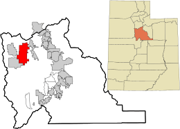 Location in Utah County and the state of Utah | |
| Coordinates: 40°18′22″N 112°0′35″W | |
| Country | United States |
| State | Utah |
| County | Utah |
| Incorporated | December 3, 1996 |
| Became a city | May 31, 2001 |
| Government | |
| • Type | Six Member Council [2] |
| • Mayor | Tom Westmoreland |
| • Council | Donna Burnham, Melissa Clark, Colby Curtis, Stephanie Gricius, Ben Reaves |
| Area | |
| • Total | 50.43 sq mi (130.60 km2) |
| • Land | 50.43 sq mi (130.60 km2) |
| • Water | 0.00 sq mi (0.00 km2) |
| Elevation | 4,882 ft (1,488 m) |
| Population (2010) | |
| • Total | 21,415 |
| • Estimate (2019)[4] | 38,391 |
| • Density | 706.30/sq mi (272.70/km2) |
| Time zone | UTC-7 (Mountain (MST)) |
| • Summer (DST) | UTC-6 (MDT) |
| ZIP code | 84005 |
| Area code(s) | 385, 801 |
| FIPS code | 49-20810[5] |
| GNIS feature ID | 1759211[6] |
| Website | www.emcity.org |
History
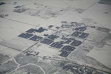
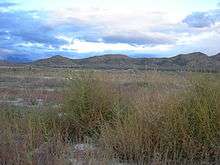
The area is home to a number of natural landmarks, including a site along the original Pony Express trail[11] and 1,800-year-old rock art petroglyphs carved by ancient Fremont Indians.[12] In 2011 Eagle Mountain extended further west with the annexation of the White Hills neighborhood, which had about 400 residents, as well as an area that is part of the Pole Canyon development plan. The land outside of White Hills was almost 2,900 acres.[13]
Geography
Eagle Mountain is located at the western and northern bases of the Lake Mountains in the flat Cedar Valley east, and northeast of the town of Cedar Fort. According to the United States Census Bureau, the city has a total area of 41.7 square miles (108.0 km2).
Climate
Eagle Mountain's climate varies drastically between the northeastern Ranches area and southwestern City Center area. Despite being further south than Salt Lake City, both areas have cooler temperatures due to sitting at a higher elevation. The Ranches section of the city has slightly milder temperatures since it is closer to the moderating impact of the Salt Lake Valley and Great Salt Lake which gives it a climate closer to Salt Lake City. The City Center area near Fairfield lies in the Cedar Valley which cuts that area off from the moderating influence of the Salt Lake Valley and Great Salt lake. This causes nights to get significantly colder than in the Ranches but also puts it in a rain shadow causing less precipitation and more sunshine than the Ranches part of the city.
Under the Köppen climate classification, the climate of the Ranches area is classified as humid subtropical (Cfa) or hot-summer humid continental (Dfa) depending on which variant of the system is used. The City Center area is drier and cooler. The Köppen classification for this area is cold semi-arid (BSk), although rainfall is nearly enough to classify the area as warm-summer humid continental (Dfb).
| Climate data for Eagle Mountain (Ranches), Utah (1980-2010 Averages) | |||||||||||||
|---|---|---|---|---|---|---|---|---|---|---|---|---|---|
| Month | Jan | Feb | Mar | Apr | May | Jun | Jul | Aug | Sep | Oct | Nov | Dec | Year |
| Average high °F (°C) | 37.1 (2.8) |
41.9 (5.5) |
52.5 (11.4) |
61.1 (16.2) |
71.0 (21.7) |
82.0 (27.8) |
90.7 (32.6) |
89.0 (31.7) |
78.2 (25.7) |
63.6 (17.6) |
49.3 (9.6) |
38.6 (3.7) |
62.9 (17.2) |
| Average low °F (°C) | 18.9 (−7.3) |
22.4 (−5.3) |
30.3 (−0.9) |
36.3 (2.4) |
45.2 (7.3) |
54.3 (12.4) |
62.5 (16.9) |
61.5 (16.4) |
51.5 (10.8) |
39.2 (4.0) |
28.9 (−1.7) |
20.6 (−6.3) |
39.3 (4.1) |
| Average precipitation inches (mm) | 1.0 (25) |
1.1 (28) |
1.8 (46) |
1.9 (48) |
2.2 (56) |
1.0 (25) |
1.0 (25) |
0.9 (23) |
1.4 (36) |
1.6 (41) |
1.6 (41) |
1.3 (33) |
16.75 (425) |
| Average snowfall inches (cm) | 8.0 (20) |
7.0 (18) |
3.9 (9.9) |
2.8 (7.1) |
0.2 (0.51) |
0.0 (0.0) |
0.0 (0.0) |
0.0 (0.0) |
0.0 (0.0) |
0.7 (1.8) |
4.2 (11) |
8.8 (22) |
35.48 (90.1) |
| Source: [14] | |||||||||||||
| Climate data for Fairfield (near Eagle Mountain City Center), Utah (1950-2005 Averages) | |||||||||||||
|---|---|---|---|---|---|---|---|---|---|---|---|---|---|
| Month | Jan | Feb | Mar | Apr | May | Jun | Jul | Aug | Sep | Oct | Nov | Dec | Year |
| Average high °F (°C) | 38.6 (3.7) |
43.6 (6.4) |
53.0 (11.7) |
62.2 (16.8) |
71.8 (22.1) |
81.7 (27.6) |
89.3 (31.8) |
87.7 (30.9) |
79.3 (26.3) |
66.7 (19.3) |
50.6 (10.3) |
39.7 (4.3) |
63.7 (17.6) |
| Average low °F (°C) | 12.4 (−10.9) |
16.9 (−8.4) |
24.0 (−4.4) |
29.6 (−1.3) |
36.9 (2.7) |
43.9 (6.6) |
50.7 (10.4) |
49.4 (9.7) |
39.7 (4.3) |
29.0 (−1.7) |
20.3 (−6.5) |
13.2 (−10.4) |
30.5 (−0.8) |
| Average precipitation inches (mm) | 1.04 (26) |
0.99 (25) |
1.11 (28) |
1.06 (27) |
1.21 (31) |
0.73 (19) |
0.94 (24) |
0.99 (25) |
0.92 (23) |
1.09 (28) |
0.95 (24) |
0.93 (24) |
11.95 (304) |
| Average snowfall inches (cm) | 9.2 (23) |
6.5 (17) |
4.6 (12) |
1.9 (4.8) |
0.3 (0.76) |
0.0 (0.0) |
0.0 (0.0) |
0.0 (0.0) |
0.0 (0.0) |
0.9 (2.3) |
4.3 (11) |
8.0 (20) |
35.9 (91) |
| Source: [15] | |||||||||||||
| Climate data for Eagle Mountain, Utah (combined averages) | |||||||||||||
|---|---|---|---|---|---|---|---|---|---|---|---|---|---|
| Month | Jan | Feb | Mar | Apr | May | Jun | Jul | Aug | Sep | Oct | Nov | Dec | Year |
| Average high °F (°C) | 37.9 (3.3) |
42.7 (5.9) |
52.8 (11.6) |
61.6 (16.4) |
71.4 (21.9) |
81.9 (27.7) |
90.0 (32.2) |
88.3 (31.3) |
78.8 (26.0) |
65.1 (18.4) |
50.0 (10.0) |
39.1 (3.9) |
63.3 (17.4) |
| Average low °F (°C) | 15.7 (−9.1) |
19.6 (−6.9) |
27.2 (−2.7) |
32.9 (0.5) |
41.1 (5.1) |
49.1 (9.5) |
56.6 (13.7) |
55.4 (13.0) |
45.6 (7.6) |
34.1 (1.2) |
24.6 (−4.1) |
16.9 (−8.4) |
34.9 (1.6) |
| Average precipitation inches (mm) | 1.02 (26) |
1.05 (27) |
1.40 (36) |
1.48 (38) |
1.71 (43) |
0.86 (22) |
0.97 (25) |
0.95 (24) |
1.16 (29) |
1.34 (34) |
1.28 (33) |
1.11 (28) |
14.33 (364) |
Demographics
| Historical population | |||
|---|---|---|---|
| Census | Pop. | %± | |
| 2000 | 2,157 | — | |
| 2010 | 21,415 | 892.8% | |
| Est. 2019 | 38,391 | [4] | 79.3% |
| U.S. Decennial Census[16] | |||
As of the census[5] of 2010, there were 21,415 people, 5,111 households, and 4,741 families residing in the town. The population density was 513.6 inhabitants per square mile (20.0/km²). There were 5,546 housing units at an average density of 133 per square mile. The racial makeup of the town was 91.9% White, 0.6% African American, 0.5% American Indian and Alaskan Native, 0.6% Asian, 0.6% Pacific Islander, 2.7% from other races, and 3.1% from two or more races. Hispanic or Latino of any race were 8.6% of the population.
There were 5,111 households of which 72.9% had children under the age of 18 living with them, 84.7% were married couples living together, 5.6% had a female householder with no husband present, and 7.2% were non-families. 5.0% of all households were made up of individuals and 0.3% had someone living alone who was 65 years of age or older. The average household size was 4.19 and the average family size was 4.34.
In the town the population was spread out with 49.5% under the age of 18, 4.6% from 20 to 24, 35.7% from 25 to 44, 8.0% from 45 to 64, and 1.8% who were 65 years of age or older. The median age was 20.3 years.
According to the U.S. Census Bureau's 2007-2011 statistics, the median income for a household in the city was $64,676. The per capita income for the town was $17,814 (U.S. Census Bureau 2007-2011). About 7.6% of the population was below the poverty line.
In 2015, Eagle Mountain was the 10th most conservative city in the United States as judged by political donations.[17]
Parks and recreation
The city lists four regional parks and about 35 local parks.[18] Eagle Mountain City parks are identified on the city's Parks Finder Map. In 2009, Eagle Mountain opened the Mountain Ranch Bike Park. This park is the first of its kind on the Wasatch Front. It features a jump line, two slope style tracks, a single track network, and a skills area with a pump track and wood features.[19]
On January 20, 2015 the city council approved budget for expanding Cory B Wride Memorial park.[20]
Government
Eagle Mountain City has a six-member Traditional Council form of government. The Mayor is a non-voting member of the Council except in the situation of a tie vote. The mayor acts as an elected executive with the city council functioning with legislative powers. Eagle Mountain by ordinance offers candidates for mayor the option of declaring candidacy as primary source of income at $70,000 per year or secondary source of income at $27,700.[21] The mayor may select a chief administrative officer to oversee the different departments. The current mayor is Tom Westmoreland who took office in January 2018.[22] Eagle Mountain City has seen a voting history from 3% (2014) of registered voter to 95% (1997) of registered voters participating in an election over the course of its incorporation.[23]
Education
Eagle Mountain is located in the Alpine School District and currently has six elementary schools (Eagle Valley, Hidden Hollow, Mountain Trails, Pony Express, Blackridge and Brookhaven). Frontier Middle School serves students in grades 7-8 except for those in the Silverlake area who attend Vista Heights Middle School in Saratoga Springs. Cedar Valley High School opened in August 2019. Some in the SilverLake area attend Westlake High School. Samuel Jarman is the Superintendent of Schools.[24]
The city also has two public charter schools (The Ranches Academy, grades K-6 and Rockwell Charter High School, grades 7-12).
Infrastructure
Transportation
The three major roads running into Eagle Mountain are Utah State Route 73, which runs through the northern part of the city and along its western edge into Cedar Fort, Eagle Mountain Blvd which goes straight to city center, and Pony Express Pkwy, which was extended east to Redwood road in Saratoga Springs in 2010. This was done to facilitate access with the rest of Utah County via connection with Pioneer Crossing, the east-west connector from Redwood Road to I-15.[25][26][27]
SR-73, Eagle Mountain Boulevard, and Ranches Parkway provide regional access to the city from Salt Lake Valley, and Pioneer Crossing, Redwood Road, and Pony Express Parkway provide access to the city from Utah County although the city center sits at least 15 miles (24 km) from the two valleys' main transportation corridor along Interstate 15. The Utah Department of Transportation is in the process of building a western freeway for the Salt Lake Valley (the Mountain View Corridor), which will connect to SR-73 only a few miles from the city.[28]
In 2008, the Utah Transit Authority (UTA) began service on an express bus route (#806) into Eagle Mountain. It is the first UTA bus to service the city.
See also
- List of cities and towns in Utah
References
- List of mayors of Eagle Mountain, Utah
- "Utah forms of government" (PDF). Retrieved 2016-09-01.
- "2018 U.S. Gazetteer Files". United States Census Bureau. Retrieved Feb 16, 2020.
- "Population and Housing Unit Estimates". Retrieved May 21, 2020.
- "American FactFinder". United States Census Bureau. Archived from the original on 2020-02-12. Retrieved 2008-01-31.
- "US Board on Geographic Names". United States Geological Survey. 2007-10-25. Retrieved 2008-01-31.
- "American FactFinder - Results". Archived from the original on 2014-03-05. Retrieved 2012-02-25. 2010 Census Information. Accessed November 9, 2011.
- §10-2-301 of the Utah Code, last amended in 2003. Accessed 2008-06-14.
- "Eagle Mountain elementary schools bursting - help may be on the way". Salt Lake Tribune. Retrieved 2007-09-23.
- "City votes to double size of new sewer". Salt Lake Tribune. Retrieved 2007-09-23.
- "Dedication of Pony Express Trail Monument" (PDF). Eagle Mountain City. Archived from the original (PDF) on 2008-01-07. Retrieved 2007-09-23.
- "Eagle Mountain Hopes to Protect Rock Art". KSL. Retrieved 2010-07-06.
- Provo Daily Herald article on annexation of White Hills to Eagle Mountain
- {{cite web |url=http://www.usa.com./eagle-mountain-ut-weather.htm |accessdate=May 25, 2020
- {{cite web |https://wrcc.dri.edu/cgi-bin/cliMAIN.pl?utfair |accessdate=May 25, 2020
- "Census of Population and Housing". Census.gov. Archived from the original on April 26, 2015. Retrieved June 4, 2015.
- Phillips, Amber (2015-12-14). "The 10 most liberal and conservative cities in the U.S. — as judged by campaign donors". The Washington Post. ISSN 0190-8286. Retrieved 2016-04-03.
- "Eagle Mountain City : Parks". eaglemountaincity.org. Retrieved 2016-04-03.
- "Eagle Mountain City : Mountain Ranch Bike Park". eaglemountaincity.org. Retrieved 2016-04-03.
- "Cory Wride Memorial Park". i84005.com. Retrieved 2016-04-03.
- "Eagle Mountain City Code". www.codepublishing.com. Retrieved 2016-09-01.
- "Eagle Mountain City : Mayor". www.eaglemountaincity.org. Retrieved 2016-05-23.
- "Eagle Mountain Voting History". i84005.com. Retrieved 2018-01-22.
- "Administration". Alpine School District. Retrieved 2012-06-16.
- Eagle Mountain City, Pony Express Parkway Road Extension Now Open. Accessed 2010-07-19.
- KSL, Eagle Mountain's Pony Express Pkwy to be extended to Redwood Rd Accessed 2010-07-19.
- "Archived copy". Archived from the original on 2010-07-15. Retrieved 2010-07-19.CS1 maint: archived copy as title (link) Udot, Welcome to Pioneer Crossing. Accessed 2010-07-19
- "MountainView Corridor". Utah Department of Transportation. Retrieved 2006-08-13.
External links
| Wikimedia Commons has media related to Eagle Mountain, Utah. |
Places adjacent to Eagle Mountain, Utah | |
|---|---|
Municipalities and communities of Utah County, Utah, United States | ||
|---|---|---|
| Cities | 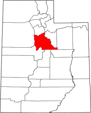 Map of Utah highlighting Utah County | |
| Towns | ||
| CDPs | ||
| Unincorporated communities | ||
| Indian reservation | ||
| Ghost towns | ||
| Footnotes | ‡This populated place also has portions in an adjacent county or counties | |
| Authority control |
|
|---|