Durrow, County Westmeath (civil parish)
Durrow (Irish: Darú)[1] is a civil parish in County Westmeath, Ireland. It is located about 22.89 kilometres (14 mi) south–south–west of Mullingar.
Durrow Darú | |
|---|---|
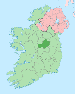
 Durrow Location of Durrow within County Westmeath in the Republic of Ireland | |
| Coordinates: 53°20′16″N 7°29′18″W | |
| Country | |
| Province | Leinster |
| County | County Westmeath |
| Irish grid reference | N341320 |
Durrow is one of 8 civil parishes in the barony of Moycashel in the Province of Leinster. The civil parish covers 2,256.4 acres (9.131 km2). It is contiguous with the remainder of the Durrow civil parish, which is in County Offaly.
Durrow civil parish, County Westmeath comprises 8 townlands: Ballybroder, Ballycahan, Cappalahy, Derrygolan, Frevanagh, Keeloge, Pallas and Rostalla.
The neighbouring civil parishes are: Ardnurcher or Horseleap and Kilbeggan to the north, Rahugh to the east and County Offaly to the south and west.[2][3]
References
- Durrow civil parish The Placenames Database of Ireland. Retrieved on 15 July 2015.
- Durrow civil parish, Co. Westmeath townlands.ie Retrieved on 15 July 2015.
- Durrow civil parish, Co. Westmeath The IreAtlas Townland Data Base. Retrieved on 15 July 2015.
External links
- Durrow civil parish at the IreAtlas Townland Data Base
- Durrow civil parish at townlands.ie
- Durrow civil parish at The Placenames Database of Ireland
This article is issued from Wikipedia. The text is licensed under Creative Commons - Attribution - Sharealike. Additional terms may apply for the media files.