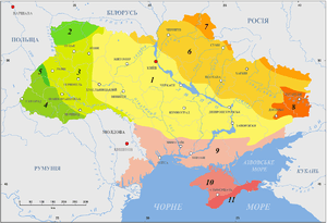
Dnieper-Donets Rift
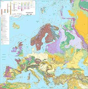
The Dnieper-Donets Rift or Pripyat-Dnieper-Donets Rift (also referred as a "paleorift" and "aulacogen") is an east-west running rift in the Sarmatian Craton that developed and was most active in the Paleozoic. The rift extends from the Caspian Depression in Russia to northern Ukraine passing by the Donbas region. The rift separates the Voronizh Massif in the north from the Ukrainian Shield in south.[1]
The Dniepr-Donets Paleorift was the site of Devonian magmatic activity that begun in Late Frasnian and peaked in the Famennian caused by a mantle plume. Extensional tectonics were also most active during the Famennian.[2]
There have been suggestions that the Dnepr-Donets Paleorift is related to the coeval Kola Alkaline Province.[3]
The technical and economic analysis showed that on the basis of the DDD oil and gas wells it is possible to construct geothermal power plants with depths of drilling or disclosing wells up to 3 – 4.5 km. At such depths, the 90% thermal potential of geothermal waters in productive oil and gas horizons of сarboniferous deposits does not exceed 108 ºC. In this case, the replacement of organic fuel and electricity by the heat of geothermal waters and rocks is much more profitable for providing heat and heating (by 3 – 5 times). Two wells from the depth of сarboniferous deposits can provide 0.4 – 4.5 MW of thermal energy.[4]
References
- Gorbatchev, R.; Bogdanova, S. (1993). "Frontiers in the Baltic Shield". Precambrian Research. 64: 3–21.
- Wilson, M.; Lyashkevich, Z.M. (1996). "Magmatism and the geodynamics of rifting of the Pripyat-Dnieper-Donets rift, East European Platform". Tectonophysics. 268: 65–81. doi:10.1016/s0040-1951(96)00234-x.
- Downes, Hilary; Balaganskaya, Elena; Beard, Andrew; Liferovich, Ruslan; Demaiffe, Daniel (2005). "Petrogenetic processes in the ultramafic, alkaline and carbonatitic magmatism in the Kola Alkaline Province: a review" (PDF). Lithos. 85: 48–75. doi:10.1016/j.lithos.2005.03.020.
- Resource evaluation of geothermal power plant under the conditions of carboniferous deposits usage in the Dnipro-Donetsk depression / Mykhailo Fyk, Volodymyr Biletsky, Mokhammed Abbud // E3S Web of Conferences. Ukrainian School of Mining Engineering. Berdiansk, Ukraine, September 4–8, 2018. – 2018. – Vol. 60. – Article Number: 00006. P. 8. – URL: https://doi.org/10.1051/e3sconf/20186000006.