Stevns Klint
Stevns Klint is a white chalk cliff located some 6 km (3.7 mi) southeast of Store Heddinge on the Danish island of Zealand. Stretching 17 km (11 mi) along the coast, it is of geological importance as one of the best exposed Cretaceous-Tertiary (K/T) boundaries in the world.[1] Subject to frequent erosion, the cliff rises to a height of up to 40 m (130 ft).[2] The cliffs are a UNESCO site.
| UNESCO World Heritage Site | |
|---|---|
 | |
| Location | Stevns Municipality, Zealand, Denmark |
| Criteria | Natural: (viii) |
| Reference | 1416 |
| Inscription | 2014 (38th session) |
| Area | 50 ha (120 acres) |
| Buffer zone | 4,136 ha (10,220 acres) |
| Coordinates | 55°16′2″N 12°25′24″E |
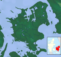 Location of Stevns Klint in Zealand  Stevns Klint (Denmark) | |

Geology
The cliff reveals sections from the uppermost part of the Maastrichtian stage (72 to 66 million years ago) and from the lowermost part of the Danian stage (66 to 62 million years ago).[3] The dark layer of fiskeler,[lower-alpha 1] mainly five to ten centimeters thick, clearly marks the Cretaceous–Paleogene boundary.[2] The fiskeler is enriched in iridium, a fact used as an argument for the Alvarez hypothesis that the worldwide Cretaceous–Paleogene mass extinction was caused by the impact of an asteroid. The layers can also be seen deep in the tunnels of Stevnsfortet, a cold-war fortress constructed in 1953. The bryozoa chalk in the cliff is highly shock resistant to both conventional and nuclear weapons.[5]
Cold War museum
In 2008 Cold War Museum Stevns Fortress opened to the public. It features a large exhibition of military equipment and a 1.5-hour guided tour in the large underground system of the fortress. The underground system of the fortress features 1.6 kilometres (0.99 mi) of tunnels, living quarters and command centers, including a hospital and a chapel. There are also two ammunition depots for its two 15 centimetres (5.9 in) cannons. The tunnels are 18–20 metres (59–66 ft) below the surface, dug deep into the chalk of Stevns. The top-secret fortress was built in 1953 and remained operational until 2000.[6]
Højerup Church

The old Højerup Church (Højerup Gamle Kirke) which stands at the top of the cliff dates from the year 1200. As a result of erosion, a landslide in 1928 caused the chancel to collapse and fall to the shore below. The cliff can be accessed via steps from the church. A new church completed in 1913 is located 300 m (980 ft) back from the cliff.[7]
UNESCO listing
On 23 June 2014 it was announced that Stevns Klint and the Wadden Sea had been added to the UNESCO list of World Heritage Sites in Denmark.[8][9]
See also
Notes
- A Danish word that is traditionally used by geologists as a label for this layer, parallel to its English translation "Fish Clay". It was given this name by the Danish geologist Johan Georg Forchhammer in 1825, as it contained scales and teeth from fish, but few other fossils.[4]
References
- "Stevns Klint". UNESCO. Retrieved 23 June 2014.
- "Stevns Klint". Den Store Danske (in Danish). Retrieved 23 June 2014.
- Surlyk F, Damholt T. & Bjerager M. (2006). "Stevns Klint, Denmark: Uppermost Maastrichtian chalk, Cretaceous-Tertiary boundary, and lower Danian bryozoan mound complex" (PDF). Bulletin of the Geological Society of Denmark. 54: 1–48.
- Syrlyk, Damholt & Bjerager pages 29 and 31.
- "Coastal Cliff Stevns Klint" (in Danish). Rotary Danmark.
- "Stevensfort Cold War Museum". Kalklanded. Retrieved 23 June 2014.
- "Højerup". Den Store Danske (in Danish). Retrieved 24 June 2014.
- "Stevns Klint og Vadehavet på Unesco-liste" (in Danish). Danmarks Radio. Retrieved 23 June 2014.
- "Six new sites inscribed on World Heritage List". UNESCO. Retrieved 23 June 2014.
External links
| Wikimedia Commons has media related to Stevns Klint. |
![]()