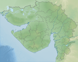
Dharoi dam
Dharoi Dam is a gravity dam on the Sabarmati river near Dharoi, Kheralu Taluka, Mehsana district of northern Gujarat in India. Constructed in 1978, the dam is meant for irrigation, power generation and flood control.[2]
| Dharoi Dam | |
|---|---|
.jpg) Dharoi dam before monsoon | |
 Dharoi Dam | |
| Official name | Dharoi dam |
| Country | India |
| Location | Mehsana and Sabarkantha districts |
| Coordinates | 24°0′16″N 72°51′13″E |
| Purpose | Irrigation & water supply |
| Status | Operational |
| Construction began | 1971 |
| Opening date | 1978 |
| Construction cost | Rs 960 Million |
| Dam and spillways | |
| Impounds | Sabarmati River |
| Height (foundation) | 45.87 metres (150 ft) |
| Length | 1,207 metres (4,000 ft) |
| Spillways | 12 radial |
| Spillway type | Ogee |
| Spillway capacity | 21662 m3/s |
| Reservoir | |
| Total capacity | 908.6 MCM[1] |
| Catchment area | 5,475 square kilometres (5.9×10¹⁰ sq ft) |
| Surface area | 107 square kilometres (1.2×10⁹ sq ft) |
| Power Station | |
| Type | Conventional |
| Hydraulic head | 31.7 metres (100 ft) |
| Installed capacity | 1.4 MW |
| Website Dharoi Dam | |
About
19 villages partially and 28 villages fully submerged into its reservoir so they were relocated to new villages. Total land submerged under reservoir include 349.39 hectares (863.4 acres; 1.3490 sq mi) forest land, 2,727.55 hectares (6,739.9 acres; 10.5311 sq mi) wasteland, 7,489.87 hectares (18,507.9 acres; 28.9185 sq mi) cultivable land.[3]
It irrigated 31,393 hectares (77,570 acres; 121.21 sq mi) in 2007-08.[3]
References
- Hydrological Data (Unclassified) Book. Central Water Commission. 2018.
- "Dharoi dam brimming over". The Times of India. September 2, 2011. Retrieved 2013-04-10.
- "Dharoi Water Resources Project". Government of Gujarat. Narmada, Water Resources, Water Supply and Kalpsar Department (Water Resources Division). Retrieved 2013-04-15.
This article is issued from Wikipedia. The text is licensed under Creative Commons - Attribution - Sharealike. Additional terms may apply for the media files.