Denton, Montana
Denton is a town in Fergus County, Montana, United States. The population was 255 at the 2010 census.
Denton, Montana | |
|---|---|
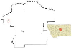 Location of Denton, Montana | |
| Coordinates: 47°19′8″N 109°56′48″W | |
| Country | United States |
| State | Montana |
| County | Fergus |
| Government | |
| • Mayor | Joel Barber |
| Area | |
| • Total | 0.76 sq mi (1.97 km2) |
| • Land | 0.76 sq mi (1.97 km2) |
| • Water | 0 sq mi (0 km2) |
| Elevation | 3,599 ft (1,097 m) |
| Population | |
| • Total | 255 |
| • Estimate (2016)[3] | 247 |
| • Density | 340/sq mi (130/km2) |
| Time zone | UTC-7 (Mountain (MST)) |
| • Summer (DST) | UTC-6 (MDT) |
| ZIP code | 59430 |
| Area code(s) | 406 |
| FIPS code | 30-20425 |
| GNIS feature ID | 0770605 |
History
A post office called Denton has been in operation since 1888.[4] The town was established at its present site when the railroad was extended to that point.[5]
Geography
Denton is located at 47°19′8″N 109°56′48″W (47.318923, -109.946610).[6]
According to the United States Census Bureau, the town has a total area of 0.76 square miles (1.97 km2), all of it land.[1]
Demographics
| Historical population | |||
|---|---|---|---|
| Census | Pop. | %± | |
| 1920 | 431 | — | |
| 1930 | 345 | −20.0% | |
| 1940 | 406 | 17.7% | |
| 1950 | 435 | 7.1% | |
| 1960 | 410 | −5.7% | |
| 1970 | 398 | −2.9% | |
| 1980 | 356 | −10.6% | |
| 1990 | 350 | −1.7% | |
| 2000 | 301 | −14.0% | |
| 2010 | 255 | −15.3% | |
| Est. 2016 | 247 | [3] | −3.1% |
| U.S. Decennial Census[7][8] | |||
2010 census
As of the census[2] of 2010, there were 255 people, 120 households, and 64 families living in the town. The population density was 335.5 inhabitants per square mile (129.5/km2). There were 156 housing units at an average density of 205.3 per square mile (79.3/km2). The racial makeup of the town was 99.2% White and 0.8% from two or more races. Hispanic or Latino of any race were 2.0% of the population.
There were 120 households, of which 23.3% had children under the age of 18 living with them, 45.0% were married couples living together, 4.2% had a female householder with no husband present, 4.2% had a male householder with no wife present, and 46.7% were non-families. 42.5% of all households were made up of individuals, and 21.7% had someone living alone who was 65 years of age or older. The average household size was 2.13 and the average family size was 2.92.
The median age in the town was 44.8 years. 22.7% of residents were under the age of 18; 5.6% were between the ages of 18 and 24; 22% were from 25 to 44; 22.7% were from 45 to 64; and 27.1% were 65 years of age or older. The gender makeup of the town was 51.8% male and 48.2% female.
2000 census
As of the census[9] of 2000, there were 301 people, 133 households, and 82 families living in the town. The population density was 395.4 people per square mile (152.9/km2). There were 158 housing units at an average density of 207.6 per square mile (80.3/km2). The racial makeup of the town was 99.34% White, and 0.66% from two or more races. Hispanic or Latino of any race were 1.00% of the population.
There were 133 households, out of which 24.8% had children under the age of 18 living with them, 56.4% were married couples living together, 4.5% had a female householder with no husband present, and 37.6% were non-families. 34.6% of all households were made up of individuals, and 15.0% had someone living alone who was 65 years of age or older. The average household size was 2.26 and the average family size was 2.96.
In the town, the population was spread out, with 24.6% under the age of 18, 7.3% from 18 to 24, 21.6% from 25 to 44, 24.3% from 45 to 64, and 22.3% who were 65 years of age or older. The median age was 42 years. For every 100 females there were 109.0 males. For every 100 females age 18 and over, there were 100.9 males.
The median income for a household in the town was $28,393, and the median income for a family was $32,232. Males had a median income of $23,125 versus $16,528 for females. The per capita income for the town was $14,982. About 5.9% of families and 8.5% of the population were below the poverty line, including 4.9% of those under the age of eighteen and 2.4% of those 65 or over.
Notable residents
- Walter A. Coslet, science fiction fan and officer of the National Fantasy Fan Federation, lived here.
- Don Koehler, one of the few people on record to grow over eight feet tall.
- James A. Shelton, Navy ensign who received the Navy Cross posthumously for his service during the Battle of Midway.
References
- "US Gazetteer files 2010". United States Census Bureau. Archived from the original on 2012-01-25. Retrieved 2012-12-18.
- "U.S. Census website". United States Census Bureau. Retrieved 2012-12-18.
- "Population and Housing Unit Estimates". Retrieved June 9, 2017.
- "Fergus County". Jim Forte Postal History. Retrieved 27 April 2015.
- "Origins of Names on Milwaukee". Roundup Record-Tribune & Winnett Times. August 22, 1940. p. 6. Retrieved 27 April 2015.
- "US Gazetteer files: 2010, 2000, and 1990". United States Census Bureau. 2011-02-12. Retrieved 2011-04-23.
- "Census of Population and Housing". Census.gov. Retrieved June 4, 2015.
- "Census & Economic Information Center". Retrieved July 3, 2015.
- "U.S. Census website". United States Census Bureau. Retrieved 2008-01-31.
External links
- Kirk Johnson (December 27, 2009). "Tough Times Test the Bonds Between a Town and Its Railroad". New York Times.
Municipalities and communities of Fergus County, Montana, United States | ||
|---|---|---|
| City | 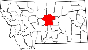 Fergus County map | |
| Towns | ||
| CDP | ||
| Other unincorporated communities | ||
| Ghost town | ||
| Indian reservation | ||
| Footnotes | ‡This populated place also has portions in an adjacent county or counties | |