Grass Range, Montana
Grass Range is a town in Fergus County, Montana, United States. The population was 110 at the 2010 census.
Grass Range, Montana | |
|---|---|
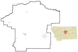 Location of Grass Range, Montana | |
| Coordinates: 47°1′34″N 108°48′12″W | |
| Country | United States |
| State | Montana |
| County | Fergus |
| Area | |
| • Total | 0.15 sq mi (0.39 km2) |
| • Land | 0.15 sq mi (0.39 km2) |
| • Water | 0 sq mi (0 km2) |
| Elevation | 3,484 ft (1,062 m) |
| Population | |
| • Total | 110 |
| • Estimate (2016)[3] | 108 |
| • Density | 730/sq mi (280/km2) |
| Time zone | UTC-7 (Mountain (MST)) |
| • Summer (DST) | UTC-6 (MDT) |
| ZIP codes | 59032, 59441 |
| Area code(s) | 406 |
| FIPS code | 30-32575 |
| GNIS feature ID | 0771931 |
History
A post office has been in operation in Grass Range since 1883.[4] The town was probably named from the fact livestock graze here.[5]
Geography
Grass Range is located at 47°1′34″N 108°48′12″W (47.025980, -108.803391).[6]
According to the United States Census Bureau, the town has a total area of 0.15 square miles (0.39 km2), all of it land.[1]
Demographics
| Historical population | |||
|---|---|---|---|
| Census | Pop. | %± | |
| 1920 | 262 | — | |
| 1930 | 212 | −19.1% | |
| 1940 | 206 | −2.8% | |
| 1950 | 234 | 13.6% | |
| 1960 | 222 | −5.1% | |
| 1970 | 181 | −18.5% | |
| 1980 | 139 | −23.2% | |
| 1990 | 159 | 14.4% | |
| 2000 | 149 | −6.3% | |
| 2010 | 110 | −26.2% | |
| Est. 2016 | 108 | [3] | −1.8% |
| U.S. Decennial Census[7][8] | |||
2010 census
As of the census[2] of 2010, there were 110 people, 61 households, and 29 families living in the town. The population density was 733.3 inhabitants per square mile (283.1/km2). There were 82 housing units at an average density of 546.7 per square mile (211.1/km2). The racial makeup of the town was 99.1% White and 0.9% from two or more races.
There were 61 households of which 16.4% had children under the age of 18 living with them, 39.3% were married couples living together, 6.6% had a female householder with no husband present, 1.6% had a male householder with no wife present, and 52.5% were non-families. 47.5% of all households were made up of individuals and 23% had someone living alone who was 65 years of age or older. The average household size was 1.80 and the average family size was 2.48.
The median age in the town was 55.5 years. 13.6% of residents were under the age of 18; 2.7% were between the ages of 18 and 24; 16.3% were from 25 to 44; 37.3% were from 45 to 64; and 30% were 65 years of age or older. The gender makeup of the town was 53.6% male and 46.4% female.
2000 census
As of the census[9] of 2000, there were 149 people, 67 households, and 42 families living in the town. The population density was 1,022.9 people per square mile (383.5/km²). There were 80 housing units at an average density of 549.2 per square mile (205.9/km²). The racial makeup of the town was 100.00% White.
There were 67 households out of which 25.4% had children under the age of 18 living with them, 50.7% were married couples living together, 6.0% had a female householder with no husband present, and 37.3% were non-families. 32.8% of all households were made up of individuals and 14.9% had someone living alone who was 65 years of age or older. The average household size was 2.22 and the average family size was 2.81.
In the town, the population was spread out with 21.5% under the age of 18, 6.0% from 18 to 24, 22.1% from 25 to 44, 36.2% from 45 to 64, and 14.1% who were 65 years of age or older. The median age was 45 years. For every 100 females there were 101.4 males. For every 100 females age 18 and over, there were 108.9 males.
The median income for a household in the town was $19,375, and the median income for a family was $30,625. Males had a median income of $18,125 versus $0 for females. The per capita income for the town was $10,939. There were 37.5% of families and 44.4% of the population living below the poverty line, including 82.4% of under eighteens and 16.0% of those over 64.
Notable residents
- Thomas Siebel, corporate officer and owner of two ranches in the Grass Range area.
- Clyde Summers (1918-2010), labor lawyer and law professor at the Yale Law School and University of Pennsylvania Law School, subject of In re Summers
References
- "US Gazetteer files 2010". United States Census Bureau. Archived from the original on 2012-01-25. Retrieved 2012-12-18.
- "U.S. Census website". United States Census Bureau. Retrieved 2012-12-18.
- "Population and Housing Unit Estimates". Retrieved June 9, 2017.
- "Fergus County". Jim Forte Postal History. Retrieved 27 April 2015.
- "Origins of Names on Milwaukee". Roundup Record-Tribune & Winnett Times. August 22, 1940. p. 6. Retrieved 27 April 2015.
- "US Gazetteer files: 2010, 2000, and 1990". United States Census Bureau. 2011-02-12. Retrieved 2011-04-23.
- "Census of Population and Housing". Census.gov. Retrieved June 4, 2015.
- "Census & Economic Information Center". Retrieved July 3, 2015.
- "U.S. Census website". United States Census Bureau. Retrieved 2008-01-31.
Municipalities and communities of Fergus County, Montana, United States | ||
|---|---|---|
| City | 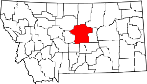 Fergus County map | |
| Towns | ||
| CDP | ||
| Other unincorporated communities | ||
| Ghost town | ||
| Indian reservation | ||
| Footnotes | ‡This populated place also has portions in an adjacent county or counties | |