Delisser Land District
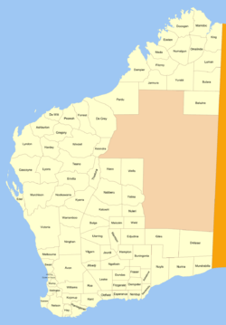
Delisser Land District is a land district (cadastral division) of Western Australia, located within the Eastern and Eucla land divisions on the Nullarbor Plain. It spans roughly 29°00'S - 31°00'S in latitude and 126°30'E - 129°00'E in longitude. It was named after E.A. Delisser who surveyed and described the Nullarbor Plain in the 1860s.
| Delisser Western Australia | |||||||||||||||
|---|---|---|---|---|---|---|---|---|---|---|---|---|---|---|---|
 | |||||||||||||||
The district was created on 20 October 1916 and was defined in the Government Gazette:
Bounded by lines starting from the 300 mile mark on the Trans-Australian Railway line, and extending Eastward along said line to the 129deg. East longitude, thence North to a point due East of survey mark R. 82 at Brickey's Soak, thence West to a point due North of the aforesaid 300-mile mark on the Railway line, and thence due South to the starting point.
Notes
References
- "New Land Districts (per 7835/97)". Western Australia Government Gazette. 20 October 1916. p. 1916:1771.