Cuchara, Colorado
Cuchara is an unincorporated community in Huerfano County, Colorado, United States. It is located near a former ski resort in the mountains south of the town of La Veta.[3] Its altitude is 8,468 feet (2,581 m).[4] State Highway 12 travels through Cuchara as it approaches Trinidad to the southeast.
Cuchara | |
|---|---|
 Entering Cuchara from the north on State Highway 12. | |
 Cuchara Location within the state of Colorado | |
| Coordinates: 37°22′45″N 105°06′01″W | |
| Country | United States |
| State | Colorado |
| County | Huerfano |
| Elevation | 8,468 ft (2,581 m) |
| Time zone | UTC-7 (Mountain (MST)) |
| • Summer (DST) | UTC-6 (MDT) |
| ZIP codes | 81055[1] |
| GNIS feature ID | 203635[2] |
Description
Cuchara is situated on the eastern slopes of the Sangre de Cristo Mountains in south-central Colorado. It is west of the Spanish Peaks. Cucharas Pass, at almost 10,000 feet, is a few miles south of the town of Cuchara. The Cucharas River flows on the outskirts of town. The San Isabel National Forest surrounds the town.[3]
In Spanish, "cuchara" means "spoon," reflecting the area's valley being so shaped.[5] A large number of locations are listed as having the name of "Cuchara" or some derivation there of in Huerfano County, including Cuchara Junction northeast of Walsenburg and the Cuchara Formation.[6]
This small town has a few small businesses such as restaurants and small hotels or lodges. This is a midpoint for stopping along the scenic State Highway 12.[7]
History
In the summer of 2018, Cuchara was evacuated due to the spring fire in the middle of their thriving season as the Spring Fire. The fire threatened the entire town. This whole evacuation caused the businesses to lose money as the town became empty for this amount of time.[8]
References
- "Cuchara, CO ZIP Code - United States". codigo-postal.co. Retrieved 16 March 2020.
- "Cuchara, Colorado". Geographic Names Information System. United States Geological Survey. 13 October 1978. Retrieved 16 March 2020.
- "Cuchara, Colorado" Sangres.com. Retrieved 23 July 2009.
- U.S. Geological Survey Geographic Names Information System: Cuchara, Colorado
- Dawson, John Frank (1954). "Cuchara". Place Names in Colorado: Why 700 Communities Were So Named. p. 16. Retrieved 16 March 2020.
- US Geographical Survey (13 October 1978). "Cuchara Junction". GNIS. Retrieved 16 March 2020.
- "Cuchara Vacations, Activities & Things To Do | Colorado.com". www.colorado.com. Retrieved 2019-04-11.
- Severancy, Ryan (July 9, 2018). "Cuchara businesses suffering while village is evacuated for the Spring Fire". The Pueblo Chieftan. Retrieved April 11, 2019.
Municipalities and communities of Huerfano County, Colorado, United States | ||
|---|---|---|
| City | 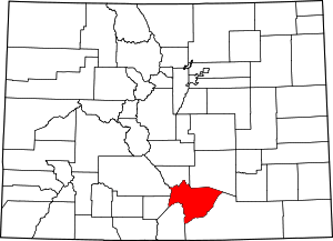 Map of Colorado highlighting Huerfano County | |
| Town | ||
| Unincorporated communities | ||
| Ghost towns | ||