Crécy-en-Ponthieu
Crécy-en-Ponthieu, known in archaic English as Cressy, is a commune in the Somme department in Hauts-de-France in northern France, located south of Calais. It gives its name to Crécy Forest, which starts about two kilometres to the south-west of the town and which is one of the largest forests in the north of France. A small river, the Maye, runs through the town. It was the site of the Battle of Crécy in 1346.
Crécy-en-Ponthieu | |
|---|---|
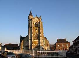 Church of Crécy-en-Ponthieu | |
 Coat of arms | |
Location of Crécy-en-Ponthieu 
| |
 Crécy-en-Ponthieu  Crécy-en-Ponthieu | |
| Coordinates: 50°15′11″N 1°53′02″E | |
| Country | France |
| Region | Hauts-de-France |
| Department | Somme |
| Arrondissement | Abbeville |
| Canton | Rue |
| Intercommunality | CC Ponthieu-Marquenterre |
| Government | |
| • Mayor (2014–2020) | Gérard Lheureux |
| Area 1 | 56.55 km2 (21.83 sq mi) |
| Population (2017-01-01)[1] | 1,436 |
| • Density | 25/km2 (66/sq mi) |
| Time zone | UTC+01:00 (CET) |
| • Summer (DST) | UTC+02:00 (CEST) |
| INSEE/Postal code | 80222 /80150 |
| Elevation | 19–82 m (62–269 ft) (avg. 36 m or 118 ft) |
| 1 French Land Register data, which excludes lakes, ponds, glaciers > 1 km2 (0.386 sq mi or 247 acres) and river estuaries. | |
History
Crécy-en-Ponthieu is best known as the site of the Battle of Crécy in 1346, one of the earliest and most important battles of the Hundred Years' War. There are other significant historical links. The Chausee Brunehaut, which passed within two miles of the town, is the Roman road from Paris and Amiens to Boulogne, and is still visible and walkable today. To the north of the town, slightly to the west of where the battle was fought, there was an airfield used in the Second World War.
The Airfield
The airfield was built by the British to provide air support before the fall of France in 1940. During the Battle of France, the plan seems to have been to deploy RAF squadrons of Bristol Blenheim light bombers there, but it is not clear how intensively the airfield was used. In the confused days of mid-May 1940 one squadron that was ordered to deploy there did not due to the absence of any military protection. It is most notable for its occupation by the German Luftwaffe, with Gruppe Zerstörergeschwader 26 of Messerschmitt Bf 110s stationed there from May 1940 until November 1940 when, after the end of the Battle of Britain, the Gruppe was withdrawn to Germany to rest and re-equip. Several other squadrons came and went, including some Messerschmitt Bf 109s. The entrance to the airfield is still visible on the left of the D12 road from Crécy to Ligescourt, midway between the two. Some fortified installations are also visible, hidden beneath trees on various sides of the airfield.
Museum
The Crécy museum holds a collection of items, displayed over two rooms and a passageway. The collection includes information about the battle of Crecy as well as various items from the Second World War, pre-historic material and geological specimens.
Railway
_-_La_gare.jpg)
There was a station (Crécy-Estrées) on a branch of the Réseau des Bains de Mer which ran between Abbeville and Dompierre-sur-Authie. It opened on 19 June 1892 and closed to passengers on 10 March 1947 and freight on 1 February 1951.
See also
- Communes of the Somme department
- Carrot soup – a dish in French cuisine named Potage Crécy that is named after Crécy-en-Ponthieu
References
- "Populations légales 2017". INSEE. Retrieved 6 January 2020.
External links
| Wikimedia Commons has media related to Crécy-en-Ponthieu. |
| Authority control |
|
|---|