Combles
Combles is a commune in the Somme department in Hauts-de-France in northern France.
Combles | |
|---|---|
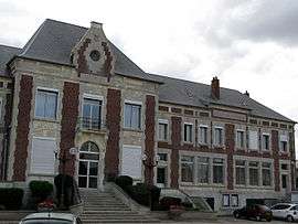 The town hall in Combles | |
Location of Combles 
| |
 Combles  Combles | |
| Coordinates: 50°00′36″N 2°51′58″E | |
| Country | France |
| Region | Hauts-de-France |
| Department | Somme |
| Arrondissement | Péronne |
| Canton | Péronne |
| Intercommunality | Haute Somme |
| Government | |
| • Mayor (2001–2008) | René Damay |
| Area 1 | 9.87 km2 (3.81 sq mi) |
| Population (2017-01-01)[1] | 765 |
| • Density | 78/km2 (200/sq mi) |
| Time zone | UTC+01:00 (CET) |
| • Summer (DST) | UTC+02:00 (CEST) |
| INSEE/Postal code | 80204 /80360 |
| Elevation | 83–153 m (272–502 ft) (avg. 30 m or 98 ft) |
| 1 French Land Register data, which excludes lakes, ponds, glaciers > 1 km2 (0.386 sq mi or 247 acres) and river estuaries. | |
Geography
Combles is situated on the D20 road, some 50 km (31 mi) north-east of Amiens.
History
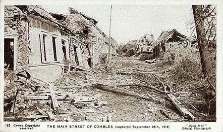
Combles after its capture in 1916 by British and French troops

Combles was the operations centre for the battle of Bapaume during the Franco-Prussian War of 1870–71.
Combles was again at the centre of much fighting during World War I (1914–1918), with many of its buildings damaged and many of its residents injured or killed, not to mention the numerous casualties among the forces in combat there. Many British soldiers who fell in the war are buried in the local cemetery, and there are numerous war cemeteries in the immediate surrounding area.
It has, however, been substantially developed since the war's end.
Population
| Year | 1962 | 1968 | 1975 | 1982 | 1990 | 1999 | 2006 |
|---|---|---|---|---|---|---|---|
| Population | 335 | 342 | 305 | 263 | 242 | 228 | 718 |
| From the year 1962 on: No double counting—residents of multiple communes (e.g. students and military personnel) are counted only once. | |||||||
See also
External links
| Wikimedia Commons has media related to Combles. |
- Combles on the Quid website (in French)
| Authority control |
|
|---|
This article is issued from Wikipedia. The text is licensed under Creative Commons - Attribution - Sharealike. Additional terms may apply for the media files.