Court Square–23rd Street station
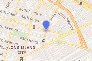
Court Square–23rd Street is a New York City Subway station complex on the IND Crosstown Line, the IRT Flushing Line and the IND Queens Boulevard Line. The complex is located in the vicinity of One Court Square in Long Island City, Queens, and is served by the 7, E, and G trains at all times; the M train on weekdays; and the <7> express train during weekdays in the peak direction.
Court Square–23 Street | |||||||||||
|---|---|---|---|---|---|---|---|---|---|---|---|
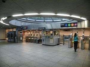 The station's main fare control area leading from One Court Square | |||||||||||
| Station statistics | |||||||||||
| Address | the immediate vicinity of One Court Square Queens, NY 11101 | ||||||||||
| Borough | Queens | ||||||||||
| Locale | Long Island City | ||||||||||
| Coordinates | 40.7476°N 73.9451°W | ||||||||||
| Division | A (IRT), B (IND) | ||||||||||
| Line | IND Crosstown Line IRT Flushing Line IND Queens Boulevard Line | ||||||||||
| Services | 7 E G M | ||||||||||
| Transit connections | |||||||||||
| Levels | 3 | ||||||||||
| Other information | |||||||||||
| Opened | 1990 (Queens Boulevard & Crosstown lines) June 3, 2011 (Flushing line) | ||||||||||
| Station code | 606[1] | ||||||||||
| Accessible | |||||||||||
| Wireless service | |||||||||||
| Traffic | |||||||||||
| Passengers (2019) | 7,033,377[3] | ||||||||||
| Rank | 55 out of 424[3] | ||||||||||
| |||||||||||
| |||||||||||
| |||||||||||


The complex comprises three originally separate stations, formerly known as 23rd Street–Ely Avenue (Queens Boulevard Line), Long Island City–Court Square (Crosstown Line), and 45th Road–Court House Square (Flushing Line). The Flushing Line station was the first to open, in 1916. The Crosstown Line station opened in 1933, followed by the Queens Boulevard Line station in 1939.
Two passageways were built to connect the three stations. The first was built in 1990, following the opening of the Citigroup office tower at One Court Square. In December 2001, this passageway came into greater use when G trains started to terminate at Court Square. A second passageway was completed between the Crosstown and Flushing Line stations in 2011. The Crosstown and Flushing Line stations were renamed "Court Square" with the latter being made fully ADA-accessible. The Queens Boulevard Line station, which is not ADA-compliant, was renamed "Court Square–23rd Street".
History
.jpg)
The station complex is located in Long Island City, in western Queens.[4] The first station to open was 45th Road–Court House Square on November 5, 1916, built as part of a two-stop extension of the future IRT Flushing Line from Hunters Point Avenue to Queensboro Plaza.[5][6] This part of the Flushing Line, in turn, was built under the Dual Contracts, under which the Interborough Rapid Transit Company and Brooklyn Rapid Transit Company would construct and operate lines as part of a unified subway system.[7]
In the late 1920s and early 1930s, the city-owned Independent Subway System (IND) constructed the first sections of the Crosstown and Queens Boulevard Lines; the Court Square Crosstown Line station was the first Queens station of either line to be built, with its structure having been completed in July 1930 and the tilework and equipment installed afterward.[8][9] On August 19, 1933, the IND opened the Court Square station as part of the first leg of the IND Crosstown Line. The IND Queens Boulevard Line between Manhattan and Roosevelt Avenue opened that same day, with GG trains (predecessor to today's G service) operating between Queens Plaza and Nassau Avenue in Brooklyn.[10][11] The 23rd Street–Ely Avenue station had been partially built in the early 1930s,[8][9][12] but was not completed until August 28, 1939, with E trains serving the station.[13][14]
Connections created
In 1984, the Metropolitan Transportation Authority (MTA) planned to construct a transfer passageway between the Queens Boulevard and Crosstown Line stations as part of a planned connector between the Queens Boulevard Line and the IND 63rd Street Line.[15][16] Around 1986, Citigroup (then Citicorp) agreed to fund the passageway, at a cost of $8.5 million, as part of a zoning requirement for the construction of the adjacent One Court Square tower, which was being built to allow Citicorp to split its operations between several different buildings.[17]:9[18][19][20] Two of these buildings, Citigroup Center and 399 Park Avenue, were located near the Lexington Avenue–53rd Street station, the next stop southbound on the Queens Boulevard Line. However, that stop was located in Manhattan, across the East River from Queens. The company selected the Court Square site due to its proximity to the Queens Boulevard subway.[21]
The building opened in 1989, with the passageway completed later on.[20] In 2000, the MTA began designing a second in-system passageway between the Flushing and Crosstown line stations.[22][23] On December 16, 2001, the 63rd Street Line connector was opened and service on the Queens Boulevard Line was increased, requiring G trains to terminate at Court Square on weekdays. To compensate Crosstown riders going into Queens, a free out-of-system transfer to the Flushing Line station was created.[24][25]
In October 2005, Citigroup announced they would be funding the passageway between the Flushing and Crosstown line stations, as a zoning requirement for the construction of the Court Square Two building.[26][27] On March 17, 2011, the Queens Boulevard station was renamed to "Court Square–23rd Street".[28] On June 3, 2011, the $47 million ADA-accessible connection between the Crosstown Line and Flushing Line stations was opened and the two stations were renamed "Court Square".[29][30][31] Most of the project was funded by Citigroup, but $13.9 million was covered by the MTA.[26][32] The Flushing Line station was closed from January 21, 2012 to April 2, 2012 to complete further renovations, including platform upgrades and alterations to the station's mezzanine to make the station fully ADA-compliant.[33][34]
Station layout
| 2F Flushing platforms |
Side platform | |
| Southbound | ← | |
| Northbound | | |
| Side platform | ||
| 1F | Upper mezzanine | Fare control, station agent, MetroCard machines |
| G | Street level | Exit/entrance |
| B1 | Lower mezzanine | Fare control, station agent, MetroCard machines, passageways between platforms |
| B2 Queens Boulevard platforms |
Side platform | |
| Southbound | ← ← | |
| Northbound | | |
| Side platform | ||
| B2 Crosstown platform |
Southbound | (No service: Queens Plaza) |
| Island platform | ||
| Southbound | | |
The station complex consists of three formerly separate stations along the IND Queens Boulevard Line, IND Crosstown Line, and IRT Flushing Line. There are several entrances to the complex, with two passageways within fare control connecting the stations.[15][35]
Crosstown–Queens Boulevard Lines transfer passageway
The northernmost passageway, which is 360 feet (110 m) long, connects the eastern end of the Queens Boulevard Line station, at 44th Drive east of 23rd Street, with the north end of the Crosstown Line station at Jackson Avenue and 45th Avenue.[15][35] This passageway was originally planned in the 1980s to compensate for the planned reroute of the G service away from the Queens Boulevard line when the track connection from the Queens Boulevard Line to the 63rd Street Line was completed[15][16] (which ultimately occurred in 2001).[24][25] It was constructed in the 1990s after Citigroup opened its 658-foot (201 m) office tower at One Court Square.[17]:9[18][20]
The main fare control area has a skylight and the passageway formerly contained the only moving walkway in the subway system, which moved passengers from the Crosstown and Flushing Lines' platforms to the Queens Boulevard Line's platforms. These were installed in December 2001 when the G began terminating at this station complex on weekdays.[24][25][36] However, the moving walkway was found to have limited benefits: it saved commuters an average of 9 seconds; was often out of service; and could only operate in one direction toward the Queens Boulevard Line platforms.[37][38] As a result, in 2016, it was announced the moving walkway would be removed in summer 2018 to provide additional capacity in the passageway. This was in anticipation of the Canarsie Tunnel shutdown in 2019, which would displace many passengers who usually travel across the East River via the BMT Canarsie Line (L train), since the section of the tunnel under the East River would be closed for renovations.[37][39] The walkways were removed starting in June 2018.[40]
The passageway is split into two sections, and between these two sections is the full-time fare control area for the complex that has a turnstile bank, token booth, and two staircases. One has two escalators and goes up to south side of 44th Drive inside a Citibank location next to the tower, and the other is open weekdays only and leads to the entrance plaza of One Court Square.[17][35] A set of escalators opposite the street stairs lead to the building's lobby.[25]
Lining the walls of this passageway is Stream, a glass mosaic mural by the late Elizabeth Murray. This is one of two murals Murray made for MTA Arts & Design; the other, Blooming, can be found at Lexington Avenue/59th Street.
Flushing–Crosstown Lines transfer passageway
The second passageway, opened in June 2011, consists of two escalators, one elevator, and one staircase within a glass-enclosed structure that connects the underground Crosstown Line station and the elevated Flushing Line station at 45th Road.[24][26][32] Between 2001 and 2011, this was a free out-of-system transfer that could be made using MetroCards.[24] While the elevators make both passageways ADA-accessible, only the IRT Flushing Line platforms are fully ADA-accessible with elevators to platform level. Starting in 2020, one of the stairs to the IND Crosstown Line platform will be demolished and replaced with an elevator.[41] In December 2019, the MTA announced that the IND Queens Boulevard Line station would become ADA-accessible as part of the agency's 2020–2024 Capital Program.[42] In addition, there is no direct connection between the Flushing and Queens Boulevard platforms.[35]
IRT Flushing Line platforms
Court Square | |||||||||
|---|---|---|---|---|---|---|---|---|---|
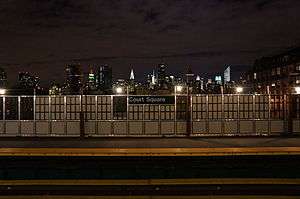 The north end of the station with the Manhattan skyline in the background. | |||||||||
| Station statistics | |||||||||
| Address | 45th Road & 23rd Street | ||||||||
| Division | A (IRT) | ||||||||
| Line | IRT Flushing Line | ||||||||
| Services | 7 | ||||||||
| Structure | Elevated | ||||||||
| Platforms | 2 side platforms | ||||||||
| Tracks | 2 | ||||||||
| Other information | |||||||||
| Opened | November 5, 1916 (first station)[5] June 3, 2011 (second station) | ||||||||
| Station code | 462[1] | ||||||||
| Accessible | |||||||||
| Wireless service | |||||||||
| Opposite-direction transfer available | Yes | ||||||||
| Former/other names | 45th Road–Court House Square | ||||||||
| Station succession | |||||||||
| Next north | Queensboro Plaza: 7 | ||||||||
| Next | 61st Street–Woodside: 7 | ||||||||
| Next south | Hunters Point Avenue: 7 | ||||||||
| Next | Grand Central–42nd Street: 7 | ||||||||
| |||||||||
45th Road – Court House Square (Dual System IRT) | |||||||||
| MPS | New York City Subway System MPS | ||||||||
| NRHP reference No. | 05000229[43] | ||||||||
| Added to NRHP | March 3, 2005 | ||||||||
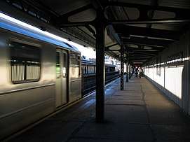
Court Square is an elevated station on the IRT Flushing Line of the New York City Subway. There are two side platforms and two tracks at the station.[44]
The station opened on November 5, 1916 as 45th Road–Court House Square as part of an extension of the Flushing Line two stops to the west to Queensboro Plaza.[5][6] The platforms at 45th Road were extended in 1955–1956 to accommodate 11-car trains.[45] In 2005, this station was listed on the National Register of Historic Places.[46][47]:L6
The current platforms were installed in the 2012 renovations. They are composed of numerous panels of composite fiberglass resin, lighter than conventional concrete and designed to resist corrosion and thermal expansion. The platform edges are equipped with ADA-compliant tactile strips.[33][34] Both platforms have beige windscreens that run along their entire lengths and brown canopies with green frames and support columns except for a small section at their north ends.[33] Small sections of the windscreens are mesh, allowing a view into the local area.[34]
Exits
This station has an elevated station house beneath the tracks at the extreme south end. A single staircase from each platform goes down to a combined waiting area and crossunder, where a turnstile bank provides entrance and exit from the station. Near these staircases, one elevator leads from each platform to the mezzanine.[35] Outside fare control, there is a token booth; an elevator and two staircases go down to the northwestern corner of 45th Road and 23rd Street.[47]:K2 Two escalators and a staircase, located within an enclosed structure, lead directly to the complex's underground mezzanine area via a new transfer passageway.[33][35] The northbound platform's elevator also leads to the underground mezzanine within fare control, stopping at the station house level but bypassing the street along the way.[35] The southbound platform's elevator only connects that platform to the station house. A single staircase also leads to the southwestern corner of 45th Road and 23rd Street.[47]:K2 It is signposted as serving only the Flushing Line station, as opposed to all three stations of the complex.[33][35]
The station house formerly had two more staircases leading to either eastern corner, as well as another staircase to the northwestern corner.[17] In June 2011, they were replaced by the in-system transfer to the underground platforms, which added a new staircase to the former southeast corner of the intersection.[30][35] As part of the project, a short strip of 45th Road between 23rd Street and Jackson Avenue was de-mapped, while the adjacent Albert Short Triangle was renovated.[47]:G3, G5
In the early 20th century, there were requests for an additional entrance from 23rd Street at the north end of the station, but this was never constructed.[48]
Gallery
 Manhattan-bound platform before renovation, looking south
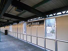 Covered section of new platform at Court Square
.jpg) Outdoor section of new platform
Outdoor section of new platform Station entrance in 2005, prior to the construction of the direct connection to the IND complex
IND Queens Boulevard Line platforms
Court Square–23 Street | |||||||||
|---|---|---|---|---|---|---|---|---|---|
 The Forest Hills and Jamaica-bound platform in August 2013 | |||||||||
| Station statistics | |||||||||
| Address | 23rd Street & 44th Drive | ||||||||
| Division | B (IND) | ||||||||
| Line | IND Queens Boulevard Line | ||||||||
| Services | E M | ||||||||
| Structure | Underground | ||||||||
| Platforms | 2 side platforms | ||||||||
| Tracks | 2 | ||||||||
| Other information | |||||||||
| Opened | August 28, 1939[49] | ||||||||
| Station code | 274[1] | ||||||||
| Accessible | |||||||||
| Wireless service | |||||||||
| Opposite-direction transfer available | Yes | ||||||||
| Former/other names | 23rd Street–Ely Avenue | ||||||||
| Station succession | |||||||||
| Next north | Queens Plaza: E | ||||||||
| Next south | Lexington Avenue–53rd Street: E | ||||||||
| |||||||||
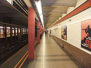
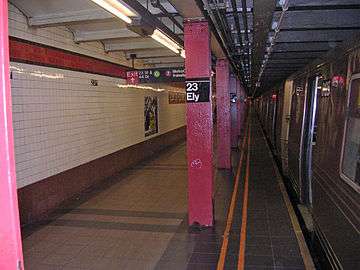
Court Square–23rd Street on the IND Queens Boulevard Line is an underground station with two tracks and two side platforms.[44] It is located along 44th Drive between 21st and 23rd Streets and is the westernmost station on the line in Queens. Going by railroad directions, Court Square–23rd Street is the Queens Boulevard Line's southernmost station in Queens.[28][35]
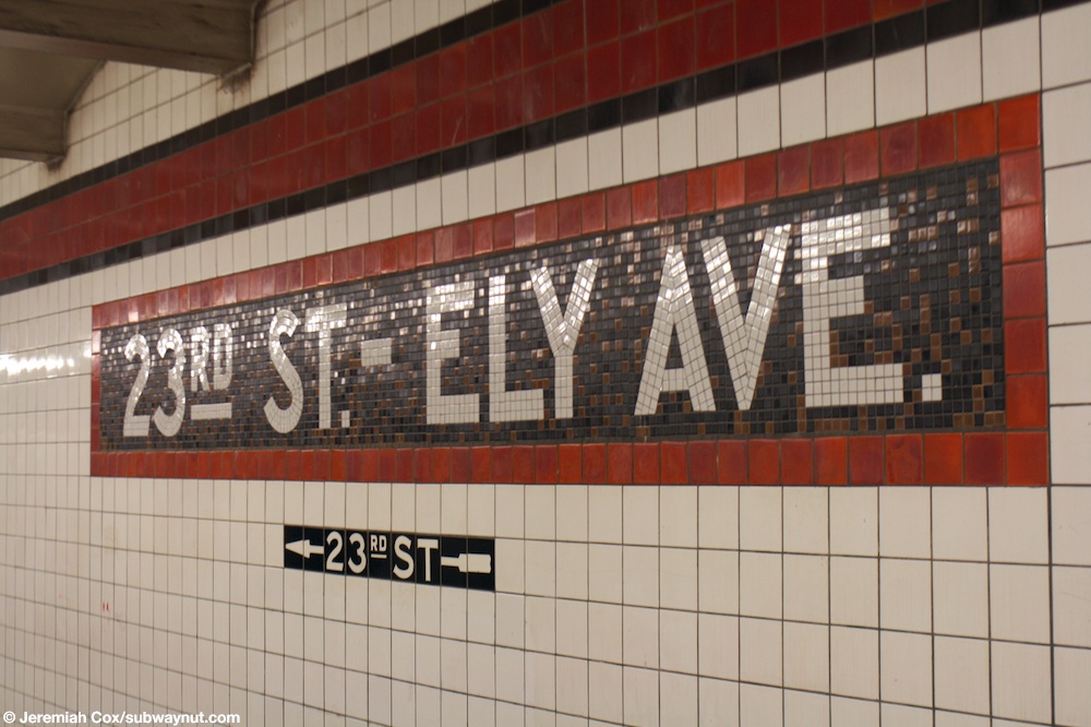
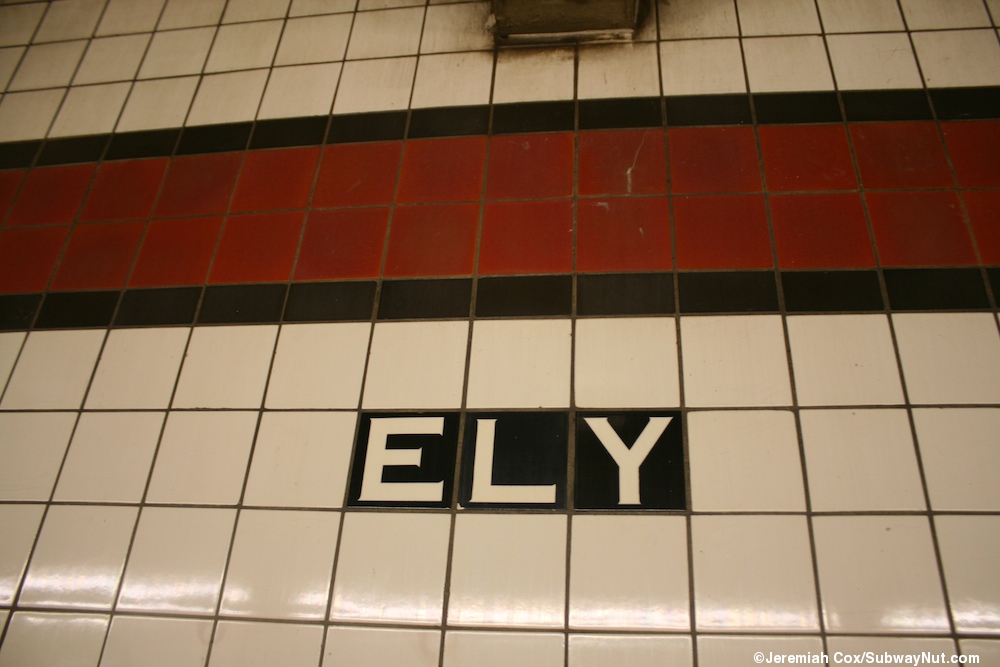
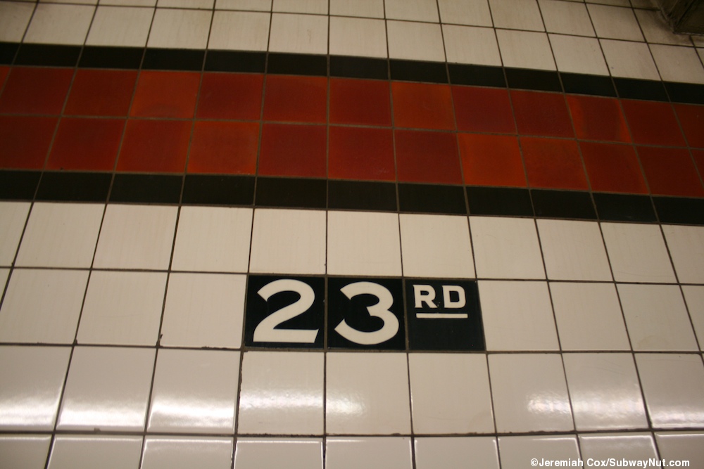
Each platform has a scarlet lake trim line with a black border and name tablets reading "23RD ST. – ELY AVE." in white sans serif letting on a black and brown background and matching scarlet lake border.[50] Below the trim line and name tablets are small directional signs and station signs alternating between "23RD" and "ELY" in white lettering on a black border.[51][52] Red I-beam columns run along both platforms at regular intervals with alternating ones having the standard black station name plate in white lettering.[53]
The station, provisionally called "21st Street/Van Alst Avenue,"[9][54] was constructed between 1931 and 1933 along with the original section of the line east to Roosevelt Avenue.[55] Although the station had been completed,[54][55] it was not opened alongside the rest of the line due to lack of demand perceived by the city Board of Transportation, which called the station a "dead" station.[9][13][14][12] This was in spite of protests from local civic and industry leaders, due to the numerous factories in the surrounding area.[8][9][54][56] By December 1933, the station was referred to as "Ely Avenue", likely to avoid confusion with the nearby station on the Crosstown Line.[55] In September 1936, it was decided to complete the station as an in-fill station due to expanding commercial and industrial operations in the area, with tilework, staircases, and other equipment installed.[12][13][14][57] The station was finished by 1938, but its opening was delayed once again due to alleged lack of demand, with calls to open the station to serve the Long Island City Courthouse, St. John's Hospital (now the site of One Court Square), and the newly opened Queensbridge Houses.[58][59]
The station finally opened as 23rd Street–Ely Avenue on August 28, 1939, six years after the first section of the Queens Boulevard Line and the opening of Court Square station on the Crosstown line.[13][14] Ely Avenue was the former name of 23rd Street[14][55][60] until many named streets in the borough were given numbers by the Queens Topographical Bureau in 1915.[28] Similarly, Van Alst Avenue is now 21st Street,[8][14][61] while the former Nott Avenue is the present-day 44th Drive.[54]
There are four ceramic mosaic/relief murals on the two platforms and connecting mezzanines, made by Frank Olt in 1992. Each one has an individual title according to nearby plaques, but collectively they are the Temple Quad Reliefs.
Exits
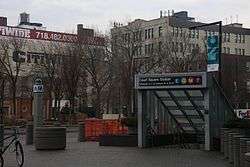
This station has three entrances and exits; the full-time one is at the extreme geographical east end. A single staircase from each platform leads up to a crossover. Formerly, on the Manhattan-bound side, one exit-only turnstile and one full-height turnstile led from the crossover to a single staircase that went up to the northeast corner of 44th Drive and 23rd Street.[35][55][62]:11 The long passageway to the IND Crosstown Line platform extends to the south, past the crossover.[24][35] Prior to the construction of the passageway, this exit contained a full-time token booth and staircases to both sides of 44th Drive.[14][15] There are plans to add a new entrance to the crossover as part of the construction of the Skyline Tower at the northeast corner of this intersection, which will replace the former HEET entrance.[63]
This station's second fare control area is at the station's extreme western end. A single staircase from each platform goes up to a raised crossover split in two by a steel fence.[14][55] The Manhattan-bound side has a turnstile bank, token booth, and one staircase going up to the northeast corner of 21st Street and 44th Drive while the Queens-bound side has two exit-only turnstiles and one staircase going up to the southeast corner of that same intersection.[35][62]:7 All fare control areas have their original IND-style directional mosaics.[64]
Gallery
 The Manhattan-bound platform as it looked when the station was known as "23rd Street – Ely Avenue".
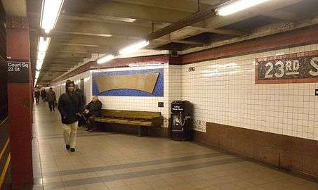 The Manhattan-bound platform with updated Helvetica signs and "Ely" mosaics.
IND Crosstown Line platform
Court Square | |||||||
|---|---|---|---|---|---|---|---|
 IND Crosstown Line station platform | |||||||
| Station statistics | |||||||
| Address | 45th Avenue & Jackson Avenue | ||||||
| Division | B (IND) | ||||||
| Line | IND Crosstown Line | ||||||
| Services | G | ||||||
| Structure | Underground | ||||||
| Platforms | 1 island platform | ||||||
| Tracks | 2 | ||||||
| Other information | |||||||
| Opened | August 19, 1933[10] | ||||||
| Station code | 281[1] | ||||||
| Accessible | |||||||
| Wireless service | |||||||
| Opposite-direction transfer available | Yes | ||||||
| Former/other names | Long Island City–Court Square[28] | ||||||
| Station succession | |||||||
| Next north | Queens Plaza: no regular service (Terminal): G | ||||||
| Next south | 21st Street: G | ||||||
| |||||||
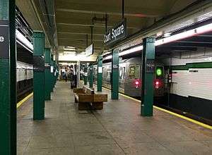
Court Square, previously called Long Island City−Court Square,[28] is the northernmost station on the IND Crosstown Line and the northern terminal for G trains at all times.[65] Although G service terminates here, the tracks themselves continue north and merge with the 60th Street Tunnel Connection to form the IND Queens Boulevard Line's local tracks just south of Queens Plaza. This section of the tracks are not used in regular service, though until April 19, 2010, trains traveled over this connection to continue to Forest Hills–71st Avenue at various times of the day. Just south of the station, the two tracks split into three, then merge again into two tracks. The third track is used to switch trains between track directions.[44][66]:D1
This underground station, opened on August 19, 1933,[10] has one island platform between two tracks.[8][44] Each track wall has a green trim line with a black border and small "COURT SQ" signs below it in white lettering on black background. Green I-beam columns run along both sides of the platform at regular intervals.[67]
Two staircases between the platform and the mezzanine are being widened and two new staircases are being added to provide additional capacity. After 2020, when construction on the Canarsie tubes is completed, one of the new staircases will be replaced by an elevator, which would make the platform ADA-accessible.[39] The project is funded as part of the 2015–2019 Capital Program.[68][69][70] The elevator project was originally expected to begin in 2018.[71]
Exits
Three staircases from the platform go up to the full length mezzanine above and a passageway within fare control connects the station to the Queens Boulevard platform. All fare control areas are unstaffed, containing just full height turnstiles. The main fare control area has a single staircase that goes up to the southwest corner of Jackson Avenue and Court Square West, and a staircase to the north side of Jackson Avenue at Thompson Avenue in front of One Court Square.[17][35] There was previously a street stair to the southeast corner of Court Square West and Jackson Avenue and another to the southwest corner of Pearson Street and Jackson Avenue; the latter is currently used as employee space.[17]
After the IND 63rd Street Line was connected to the Queens Boulevard Line in December 2001, during a project known as the "63rd Street Connector",[25] another unstaffed entrance was added to the south end of the mezzanine at 45th Road. This was done to allow an out-of-system transfer to the IRT Flushing Line.[24] From this fare control area, a single staircase goes up to the north side of Jackson Avenue at Pearson Street directly outside the staircases to the IRT station.[17][35] A second staircase to the southwest corner of the intersection no longer exists.[17] In June 2011, this transfer was replaced by an enclosed in-system transfer that consists of two escalators, one elevator, and one staircase connecting both stations.[30][35]
Gallery
_train_at_Court_Square.jpg) An R68 G train on the Crosstown Line tracks.
An R68 G train on the Crosstown Line tracks.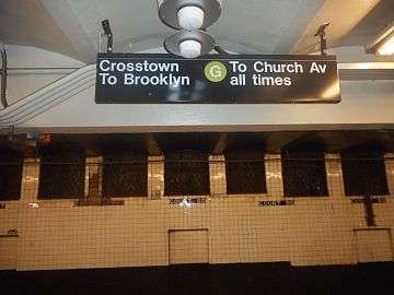 G trains go south to Church Avenue, the opposite terminal.
Nearby points of interest
The P.S. 1 Contemporary Art Center (MoMA PS1) is nearby at 46th and Jackson Avenues. The One Court Square building, owned by Citicorp, sits right above the station as well. Queens County Criminal Court is directly on Court Square, just east of Jackson Avenue.[35]
The site of the 5 Pointz building at Jackson Avenue and Davis Street,[35] which was famously covered in graffiti until its demolition in 2014,[72] is visible just south of the Flushing Line station and can be seen by passing 7 and <7> trains.[73]
In addition, the station sits in the center of the Hunters Point Historic District, and as a result, many historic buildings can be found near the stations.[35] However, the area right around the station is also seeing a revitalization, with high-rise condominiums and rental buildings being built in the area, and upscale restaurants being built near the train station. In addition, there is a bourgeoning art community due to the presence of MoMA PS1 and 5 Pointz. There is also a 15,000-square-foot (1,400 m2) supermarket proposed for the area.[74]
References
- "Station Developers' Information". Metropolitan Transportation Authority. Retrieved June 13, 2017.
- "NYC Subway Wireless – Active Stations". Transit Wireless Wifi. Retrieved November 13, 2019.
- "Facts and Figures: Annual Subway Ridership 2014–2019". Metropolitan Transportation Authority. 2020. Retrieved May 26, 2020.
- Google (January 11, 2018). "Court Square-23 St Station, New York, NY" (Map). Google Maps. Google. Retrieved January 11, 2018.
- Rogoff, David (April 1960), "The Steinway Tunnels", Electric Railroads, Electric Railroaders’ Association (29), retrieved May 30, 2011,
A station was erected midway at 11th St. and is now known as ‘45th Rd.-Court House Square’. Operation was extended to Hunters Point Ave. on the eastbound track on Feb. 15th, 1916, and to Queensboro Plaza on the following Nov. 5th, opening Court House Square station.
- "New Subway Link" (PDF). The New York Times. November 5, 1916. p. XX4. Retrieved October 2, 2011.
- "SUBWAY CONTRACTS SOLEMNLY SIGNED; Cheers at the Ceremonial Function When McCall Gets Willcox to Attest" (PDF). The New York Times. March 20, 1913. ISSN 0362-4331. Retrieved January 11, 2018.
- "Court Square Station Of New Tube Completed; War Over Van Alst Ave". Long Island Daily Star. Fultonhistory.com. July 19, 1930. p. 1. Retrieved July 27, 2016 – via Fulton History.
- "Court Square Station Of New Tube Completed; War Over Van Alst Ave" (PDF). Long Island Daily Star. Fultonhistory.com. July 19, 1930. p. 3. Retrieved July 27, 2016.
- "Two Subway Units Open at Midnight – Links in City-Owned System in Queens and Brooklyn to Have 15 Stations" (PDF). The New York Times. August 18, 1933. Retrieved November 7, 2015.
- "New Queens Subway Service Will Be Launched Tonight; Tunnel From Manhattan Open to Jackson Heights; Service Will Eventually Be Extended Through To Jamaica". Long Island Daily Press. Fultonhistory.com. August 18, 1933. p. 20. Retrieved July 27, 2016.
- "Award Contract For Subway Work". Brooklyn Daily Eagle. January 6, 1939. p. 29. Retrieved October 4, 2015 – via Newspapers.com.
- "Subway Station Opens Aug. 28" (PDF). The New York Times. August 5, 1939. Retrieved October 4, 2015.
- "Ely Subway Stop to Open – Queens Station on City-Owned Line Begins Service Tomorrow" (PDF). The New York Times. August 26, 1939. Retrieved October 4, 2015.
- Queens Subway Options Study, New York: Environmental Impact Statement. United States Department of Transportation, Metropolitan Transportation Authority, Urban Mass Transit Administration. May 1984. pp. 90–91. Retrieved July 10, 2016.
- Daley, Suzanne (December 15, 1980). "MTA Votes to Extend 63rd St. Line". The New York Times. p. 25.
- "History of NYC Transit Bonuses: Department of City Planning 1982-2014" (PDF). New York City Department of City Planning. 2014. Retrieved July 27, 2016.
- DePalma, Anthony (August 7, 1988). "A Giant to Dominate Low-Rise Queens". The New York Times. Retrieved July 27, 2016.
- Oser, Alan S. (May 17, 1987). "Perspectives: Offices in Queens; British Airways Lands in Jackson Heights". The New York Times. Retrieved July 27, 2016.
- Lambert, Bruce (February 6, 1994). "Neighborhood Report: Long Island City – Citicorp's Tower: Still a Majestic Misfit". The New York Times. Retrieved July 27, 2016.
- Gottlieb, Martin (December 16, 1985). "Citicorp, To Decentralize, Plans Queens Complex". The New York Times. Retrieved July 27, 2016.
- Bertrand, Donald (May 15, 2000). "$7M Slated for Fencing, Rail & Subway Station Plans". Daily News (New York). Retrieved July 28, 2016.
- "Construct Transfer Between Court Square Station & Courthouse Square Station Queens". Metropolitan Transportation Authority. 2000. Archived from the original on August 16, 2000. Retrieved December 30, 2016.
- "Review of the G Line" (PDF). mta.info. Metropolitan Transportation Authority. July 10, 2013. p. 2. Retrieved August 2, 2015.
- Kennedy, Randy (May 25, 2001). "Panel Approves New V Train but Shortens G Line to Make Room". The New York Times. Retrieved March 20, 2010.
- Henely, Rebecca (June 15, 2011). "LIC subway station opens". Times Ledger. Retrieved July 27, 2016.
- "Mayor Bloomberg, Queens Borough President Marshall and Citigroup Break Ground on 15-Story Office Tower in Long Island City: Mayor Announces Nearly $50 Million Commitment to Fund Area Infrastructure Improvements". News from the Blue Room. October 26, 2005. Archived from the original on August 17, 2016. Retrieved July 27, 2016.
- "23rd Street-Ely Avenue Station becomes Court Square: In Anticipation of New G to 7 Transfer Connection". Metropolitan Transportation Authority. March 17, 2011. Retrieved July 27, 2016.
- Lee, Vivian (June 3, 2011). "Long-Awaited Queens Subway Station Opens To Riders". NY1. Archived from the original on June 6, 2011. Retrieved June 3, 2011.
- "New Transfer at Court Square". mta.info. Metropolitan Transportation Authority. June 3, 2011. Retrieved June 4, 2011.
- "Court Square Opening June 3, 2011". MTA.info (Facebook). June 3, 2011. Retrieved June 4, 2011.
- "New Transfer at Court Square". Metropolitan Transportation Authority. June 3, 2011. Retrieved July 27, 2016.
- "Court Square on the No.7 Line Re-Opens". Metropolitan Transportation Authority. April 2, 2012. Retrieved July 28, 2016.
- Kern-Jedrychowska, Ewa (May 1, 2012). "New Court Square Subway Station Design Invites Peeping Toms, Residents Say". DNAinfo.com. Long Island City. Archived from the original on August 21, 2016. Retrieved July 28, 2016.
- "MTA Neighborhood Maps: Long Island City" (PDF). Metropolitan Transportation Authority. 2015. Retrieved September 27, 2015.
- Donohue, Pete (March 31, 2002). "The Subway's Walkways Not Running Well". Daily News (New York). Retrieved July 27, 2016.
- Gordon, Aaron (April 11, 2018). "Is the Rest of the Subway Ready for the L Train Shutdown?". Village Voice. Retrieved May 4, 2018.
- Rivoli, Dan (May 4, 2017). "Long-broken walkway in Queens subway station shows MTA 'maintenance mess'". New York Daily News. Retrieved May 4, 2018.
- Pesantez, Nathaly (March 7, 2018). "Moving Walkway at Court Square Will Be Removed, Stairs Widened, for L Train Shutdown | LIC Post". LIC Post. Retrieved March 8, 2018.
- Rivoli, Dan (June 22, 2018). "Queens subway station loses moving walkways". New York Daily News. Retrieved August 8, 2018.
- "MTA Capital Program 2015–2019: Renew. Enhance. Expand" (PDF). Metropolitan Transportation Authority. October 28, 2015. p. 62. Retrieved October 28, 2015.
- "Press Release - MTA Headquarters - MTA Announces 20 Additional Subway Stations to Receive Accessibility Improvements Under Proposed 2020-2024 Capital Plan". MTA. December 19, 2019. Retrieved December 20, 2019.
- "NPS Focus". National Register of Historic Places. National Park Service. Retrieved December 9, 2011.
- Dougherty, Peter (2020). Tracks of the New York City Subway 2020 (16th ed.). Dougherty. OCLC 1056711733.
- Authority, New York City Transit (January 1, 1955). Minutes and Proceedings. p. 599.
- "National Register of Historical Places - NEW YORK (NY), Queens County". nationalregisterofhistoricplaces.com.
- "22-44 Jackson Avenue Environmental Assessment Statement and Attachments" (PDF). nyc.gov. New York City Department of City Planning. August 16, 2013. Retrieved July 28, 2016.
- "As We See It: Court Square Station Stairways Inadequate". Long Island Daily Star. Fultonhistory.com. May 4, 1927. p. 1. Retrieved July 28, 2016.
- Feinman, Mark (2000). "The History of the Independent Subway". Retrieved July 3, 2006.
- Cox, Jeremiah (August 14, 2008). "A 23 St-Ely Ave name tablet with a mosaic arrow for the exit to 23rd St beneath it". subwaynut.com. Retrieved January 14, 2018.
- Cox, Jeremiah (December 29, 2008). "Ely is still beneath the trimline". subwaynut.com. Retrieved January 14, 2018.
- Cox, Jeremiah (December 29, 2008). "Alternating with 23rd". subwaynut.com. Retrieved January 14, 2008.
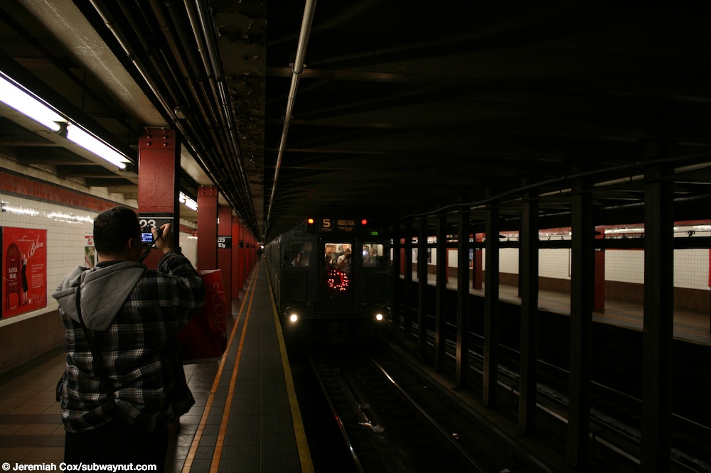
- Cox, Jeremiah. "R4 #401 slows down to stop at 23 St-Ely Av on a special Holiday Nostalgia Regular Train service on the V." subwaynut.com. Retrieved January 14, 2018.
- "Long Island City Companies Urge Subway Station: Van Alst Avenue Station Held Necessity to Local Labor Needs". Long Island Daily Star. Fultonhistory.com. July 18, 1932. p. 5. Retrieved July 27, 2016.
- "Power Resumes Campaign To Open Ely Tube Station". Greenpoint Weekly Star. Fultonhistory.com. December 15, 1933. p. 4. Retrieved July 27, 2016.
- "The Case for the Twenty-first Street Station". New York Daily Star. July 31, 1930. p. 1. Retrieved August 2, 2016 – via Fulton History.
- "Ely Ave. Subway Station To Be Completed". Long Island Daily Press. Fultonhistory.com. September 13, 1936. p. 12. Retrieved July 27, 2016.
- "Campaign To Open Ely Avenue City Subway Station Renewed; Mayor's Help To Be Sought By Committee; Stop On 8th Avenue Line Was Made Ready Year Ago". Long Island Star-Journal. Fultonhistory.com. July 11, 1939. p. 3. Retrieved July 27, 2016.
- "New 8th Ave. Station Promised for L.I. City". Brooklyn Eagle. Fultonhistory.com. July 13, 1939. Retrieved July 27, 2016.
- Street Name Changes in Queens, New York
- Roberts, Sam (November 3, 2014). "Long in Repose, Last Remnants of a Founding Family Will Leave Long Island City". The New York Times. Retrieved November 7, 2015.
- "Silvercup West FEIS:10.0 Transit and Pedestrians" (PDF). nyc.gov. New York City Department of City Planning. Archived from the original (PDF) on October 13, 2006. Retrieved September 27, 2015.
- Margolies, Jane (December 27, 2018). "Interest in Court Square Condo Spikes Thanks to Amazon". The New York Times. Retrieved June 24, 2019.
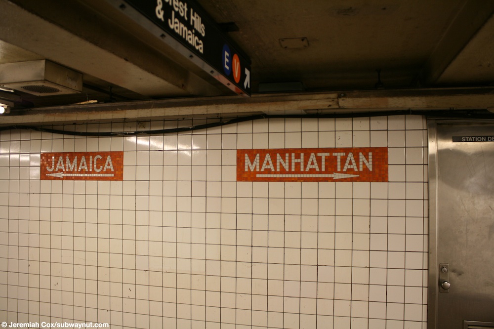
- Cox, Jeremiah. "Tiled signs for Jamaica and Manhattan on the mezzanine at 23 St-Ely Avenue". subwaynut.com. Retrieved January 14, 2018.
- "G Subway Timetable, Effective November 17, 2019" (PDF). Metropolitan Transportation Authority. Retrieved January 16, 2020.
- "Review of the G Line: Appendices" (PDF). Metropolitan Transportation Authority. July 10, 2013. Retrieved October 28, 2015.
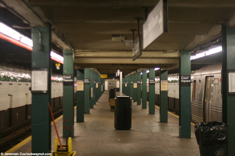
- Cox, Jeremiah (August 14, 2008). "Looking down the long (with portions that haven't had a train stop at them in quite a long time) island platform at Court Square". subwaynut.com. Retrieved January 16, 2018.
- "MTA Capital Program 2015-2019: Renew. Enhance. Expand" (PDF). Metropolitan Transportation Authority. October 28, 2015. p. 186. Retrieved October 28, 2015.
- "MTA 2017 Preliminary Budget July Financial Plan 2017 – 2020 Volume 2" (PDF). mta.info. Metropolitan Transportation Authority. July 2016. p. IV-3. Retrieved August 6, 2016.
- "Metropolitan Transportation Authority (MTA) Notice of Public Hearing and Description of Projects – Tuesday, August 23, 2016 4:30 P.M. – Request for Federal Financial Assistance Under the Federal Transportation Authorization For Federal Fiscal Year 2017 Capital Improvement Projects" (PDF). mta.info. Metropolitan Transportation Authority. July 28, 2016. p. 16. Archived from the original (PDF) on August 17, 2016. Retrieved August 7, 2016.
- "Project Description, Budget and Scope". Metropolitan Transportation Authority. September 30, 2016. Retrieved January 28, 2017.
- "Photos of 5Pointz's Heartbreaking Demolition". Complex. November 6, 2014. Retrieved December 23, 2014.
- Sara Frazier and Jeff Richardson (November 19, 2013). "5Pointz Building, Graffiti Mecca in Queens, Painted Over During the Night". NBC 4 New York. NBC Universal Media. Retrieved August 31, 2014.
- Sheftell, Jason (February 16, 2013). "Court Square on the rise". nydailynews.com. New York Daily News. Retrieved July 27, 2016.
External links
| Wikimedia Commons has media related to Court Square (New York City Subway). |
nycsubway.org
- nycsubway.org – IND Queens Boulevard Line: 23rd St./Ely Avenue
- nycsubway.org – IND Crosstown Line: Court Square
- nycsubway.org – IRT Flushing Line: Court House Square/45th Road
The Subway Nut
- The Subway Nut — 23rd Street–Ely Avenue Pictures
- The Subway Nut — Court Square Pictures
- The Subway Nut — Court Square (7) Pictures
Other
- MTA's Arts For Transit — 23rd Street–Ely Avenue/Long Island City–Court Square
- Forgotten NY — Subway Signs That Remember...
- Station Reporter — Court Square Complex
Google Maps Street View