Collins Point
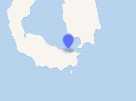
Collins Point is a small but prominent headland 1.4 km (0.87 mi) west-south-west of Fildes Point, on the south side of Port Foster, Deception Island, in the South Shetland Islands of Antarctica. It was charted by a British expedition under Foster, 1828–31. It was named by Lieutenant Commander D.N. Penfold, Royal Navy, following his survey of the island in 1948–49, for Rear Admiral Kenneth Collins of the Hydrographic Department of the Admiralty.[2]
 Collins Point[1] Antarctica | |
| |
| Location | Collins Point Deception Island South Shetland Islands Antarctica |
|---|---|
| Coordinates | 62°59′45″S 60°35′11″W |
| Foundation | concrete base |
| Construction | fiberglass tower[1] |
| Tower shape | cylindrical tower with lantern |
| Markings / pattern | white tower with red horizontal bands[1] |
| Tower height | 3 metres (9.8 ft)[1] |
| Focal height | 10 metres (33 ft)[1] |
| Light source | solar power |
| Range | 6 nautical miles (11 km; 6.9 mi)[1] |
| Characteristic | Fl W 5s.[1] |
| Admiralty number | G1382[1] |
| NGA number | 2745[1] |
Antarctic Specially Protected Area
The site forms part of an Antarctic Specially Protected Area (ASPA 140), comprising several separate sites on Deception Island, and designated as such primarily for its botanic and ecological values.[3]
See also
References
- List of Lights, Pub. 111: The West Coasts of North and South America (Excluding Continental U.S.A. and Hawaii), Australia, Tasmania, New Zealand, and the Islands of the North and South Pacific Oceans (PDF). List of Lights. United States National Geospatial-Intelligence Agency. 2017.
- "Collins Point". Geographic Names Information System. United States Geological Survey. Retrieved 2011-11-18.
- "Parts of Deception Island, South Shetland Islands" (PDF). Management Plan for Antarctic Specially Protected Area No. 140: Measure 3, Appendix 1. Antarctic Treaty Secretariat. 2005. Retrieved 2013-09-28.
![]()