Colfred, Arizona
Colfred is a populated place situated in Yuma County, Arizona.[2] It was named after Charles Frederick Crocker, who served as the Treasurer of the Southern Pacific Railroad in 1881. It has an estimated elevation of 331 feet (101 m) above sea level.[1]
Colfred, Arizona | |
|---|---|
Populated place | |
 Colfred, Arizona Location within the state of Arizona  Colfred, Arizona Colfred, Arizona (the United States) | |
| Coordinates: 32°42′16″N 113°54′06″W | |
| Country | United States |
| State | Arizona |
| County | Yuma |
| Elevation | 331 ft (101 m) |
| Time zone | UTC-7 (Mountain (MST)) |
| • Summer (DST) | UTC-7 (MST) |
| Area code(s) | 928 |
| FIPS code | 04-14730 |
| GNIS feature ID | 24375 |
Colfred Airfield is a disused auxiliary airfield constructed during World War II and located to the south on the Barry M. Goldwater Air Force Range.[3] It has been used as a drone and hawk missile testing site.[4][5]
References
- "Feature Detail Report for: Colfred". Geographic Names Information System. United States Geological Survey.
- "Colfred (in Yuma County, AZ) Populated Place Profile". AZ Hometown Locator. Retrieved November 3, 2016.
- David, Barr (2016), Archaeological Survey of 131.0 Acres for the Proposed Rolle Airfield Improvements Project in Yuma County, Arizona (PDF), pp. ii
- "Yumans Take Part in Electronic Confab". Yuma Sun. 1959-07-29. p. 1. Retrieved 2020-02-20.
- "Smoke Signals from Wellton Mowhawk". Yuma Sun. 1970-10-04. Retrieved 2020-02-20.
Municipalities and communities of Yuma County, Arizona, United States | ||
|---|---|---|
| Cities | 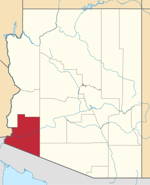 | |
| Town | ||
| CDPs | ||
| Populated places | ||
| Indian reservations | ||
| Ghost towns | ||
| Footnotes | ‡This populated place also has portions in an adjacent county or counties | |
This article is issued from Wikipedia. The text is licensed under Creative Commons - Attribution - Sharealike. Additional terms may apply for the media files.