Asher, Arizona
Asher is a populated place situated in Yuma County, Arizona between Wellton to the east and Tacna to the west. It appears on the Wellton Mesa U.S. Geological Survey Map.[2] It has an estimated elevation of 305 feet (93 m) above sea level.[1]
Asher, Arizona | |
|---|---|
Populated place | |
 Asher, Arizona Location of Asher in Arizona | |
| Coordinates: 32°40′32″N 114°04′25″W | |
| Country | United States |
| State | Arizona |
| County | Yuma |
| Elevation | 305 ft (93 m) |
| Time zone | UTC-7 (Mountain (MST)) |
| • Summer (DST) | UTC-7 (MST) |
| ZIP codes | 85356 |
| Area code(s) | 520 |
| FIPS code | 04-04370 |
| GNIS feature ID | 24312 |
As of 1940 it had a class 3 post office.[3]
References
- "Feature Detail Report for: Asher". Geographic Names Information System. United States Geological Survey.
- "Asher (in Yuma County, AZ) Populated Place Profile". AZ Hometown Locator. Archived from the original on January 24, 2016. Retrieved January 24, 2016.
- "Arizona - New Mexico Case". Civil Aeronautics Board Reports. 9. United States Civil Aeronautics Board. 1948. p. 127.
Municipalities and communities of Yuma County, Arizona, United States | ||
|---|---|---|
| Cities | 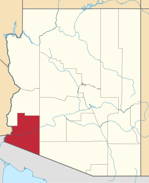 | |
| Town | ||
| CDPs | ||
| Populated places | ||
| Indian reservations | ||
| Ghost towns | ||
| Footnotes | ‡This populated place also has portions in an adjacent county or counties | |
This article is issued from Wikipedia. The text is licensed under Creative Commons - Attribution - Sharealike. Additional terms may apply for the media files.