Clayton, Michigan
Clayton is a village in Lenawee County of the U.S. state of Michigan. The population was 344 at the 2010 census. The village is situated on the boundary between Hudson Township on the west and Dover Township on the east, with a portion of the village in each.
Clayton, Michigan | |
|---|---|
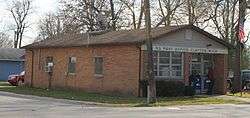
 Facing north along State Street | |
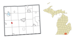 Location within Lenawee County | |
 Clayton Location in Michigan  Clayton Location in the United States | |
| Coordinates: 41°51′49″N 84°14′07″W | |
| Country | United States |
| State | Michigan |
| County | Lenawee |
| Townships | Dover and Hudson |
| Established | 1836 |
| Platted | 1837 |
| Incorporated | 1870 |
| Area | |
| • Total | 0.71 sq mi (1.84 km2) |
| • Land | 0.71 sq mi (1.84 km2) |
| • Water | 0.00 sq mi (0.00 km2) |
| Elevation | 896 ft (273 m) |
| Population | |
| • Total | 344 |
| • Estimate (2017)[3] | 332 |
| • Density | 466.3/sq mi (180.2/km2) |
| Time zone | UTC-5 (Eastern (EST)) |
| • Summer (DST) | UTC-4 (EDT) |
| ZIP code(s) | 49235 |
| Area code(s) | 517 |
| FIPS code | 26-16280[4] |
| GNIS feature ID | 0623395[5] |
M-34 (or W. Carleton Rd.) passes along the south side of the village, while M-156 has its northern terminus at the junction with M-34. The road, also known as Morey Highway, continues north through the village.
History
Clayton was first established in 1836. It got a post office in 1837 and was platted in 1843. It was incorporated as a village in 1870.[6]
Geography
According to the United States Census Bureau, the village has a total area of 0.71 square miles (1.84 km2), all land.[7]
Demographics
| Historical population | |||
|---|---|---|---|
| Census | Pop. | %± | |
| 1880 | 368 | — | |
| 1900 | 370 | — | |
| 1910 | 372 | 0.5% | |
| 1920 | 306 | −17.7% | |
| 1930 | 372 | 21.6% | |
| 1940 | 375 | 0.8% | |
| 1950 | 467 | 24.5% | |
| 1960 | 470 | 0.6% | |
| 1970 | 505 | 7.4% | |
| 1980 | 396 | −21.6% | |
| 1990 | 384 | −3.0% | |
| 2000 | 326 | −15.1% | |
| 2010 | 344 | 5.5% | |
| Est. 2017 | 332 | [3] | −3.5% |
| U.S. Decennial Census[8] | |||
2010 census
As of the census[2] of 2010, there were 344 people, 118 households, and 90 families living in the village. The population density was 484.5 inhabitants per square mile (187.1/km2). There were 131 housing units at an average density of 184.5 per square mile (71.2/km2). The racial makeup of the village was 93.6% White, 1.7% African American, 0.3% Native American, 0.3% Asian, 1.7% from other races, and 2.3% from two or more races. Hispanic or Latino of any race were 5.5% of the population.
There were 118 households, of which 40.7% had children under the age of 18 living with them, 55.1% were married couples living together, 13.6% had a female householder with no husband present, 7.6% had a male householder with no wife present, and 23.7% were non-families. 17.8% of all households were made up of individuals, and 5.1% had someone living alone who was 65 years of age or older. The average household size was 2.92 and the average family size was 3.34.
The median age in the village was 31.5 years. 30.5% of residents were under the age of 18; 8.5% were between the ages of 18 and 24; 31.4% were from 25 to 44; 17.7% were from 45 to 64; and 11.9% were 65 years of age or older. The gender makeup of the village was 52.0% male and 48.0% female.
2000 census
As of the census[4] of 2000, there were 326 people, 113 households, and 83 families living in the village. The population density was 428.2 per square mile (165.6/km2). There were 120 housing units at an average density of 157.6 per square mile (61.0/km2). The racial makeup of the village was 96.63% White, 0.31% African American, 0.31% Native American, 1.23% from other races, and 1.53% from two or more races. Hispanic or Latino of any race were 2.45% of the population.
There were 113 households, out of which 34.5% had children under the age of 18 living with them, 59.3% were married couples living together, 8.0% had a female householder with no husband present, and 25.7% were non-families. 19.5% of all households were made up of individuals, and 8.0% had someone living alone who was 65 years of age or older. The average household size was 2.88 and the average family size was 3.31.
In the village, the population was spread out, with 29.1% under the age of 18, 11.0% from 18 to 24, 26.4% from 25 to 44, 23.6% from 45 to 64, and 9.8% who were 65 years of age or older. The median age was 31 years. For every 100 females, there were 102.5 males. For every 100 females age 18 and over, there were 108.1 males.
The median income for a household in the village was $41,875, and the median income for a family was $46,172. Males had a median income of $30,000 versus $20,000 for females. The per capita income for the village was $17,941. About 5.5% of families and 6.5% of the population were below the poverty line, including 4.8% of those under age 18 and 10.0% of those age 65 or over.
References
- "2017 U.S. Gazetteer Files". United States Census Bureau. Retrieved Jan 3, 2019.
- "U.S. Census website". United States Census Bureau. Retrieved 2012-11-25.
- "Population and Housing Unit Estimates". Retrieved March 24, 2018.
- "U.S. Census website". United States Census Bureau. Retrieved 2008-01-31.
- "US Board on Geographic Names". United States Geological Survey. 2007-10-25. Retrieved 2008-01-31.
- Walter Romig, Michigan Place Names, p. 119-120
- "US Gazetteer files 2010". United States Census Bureau. Archived from the original on 2012-01-25. Retrieved 2012-11-25.
- "Census of Population and Housing". Census.gov. Retrieved June 4, 2015.
Municipalities and communities of Lenawee County, Michigan, United States | ||
|---|---|---|
| Cities | 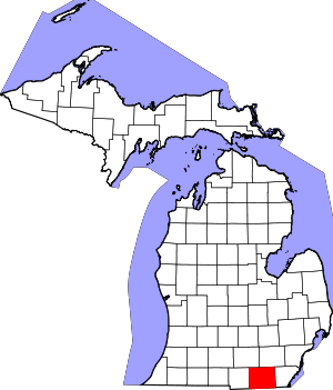 Map of Michigan highlighting Lenawee County.svg | |
| Villages | ||
| Charter townships | ||
| Civil townships | ||
| CDPs | ||
| Other unincorporated communities | ||
| Footnotes | ‡This populated place also has portions in an adjacent county or counties | |