City of Sandringham
The City of Sandringham was a local government area about 20 kilometres (12 mi) south of Melbourne, the state capital of Victoria, Australia, on the eastern side of Port Phillip. The city covered an area of 14.97 square kilometres (5.78 sq mi), and existed from 1917 until 1994.
| City of Sandringham Victoria | |||||||||||||||
|---|---|---|---|---|---|---|---|---|---|---|---|---|---|---|---|
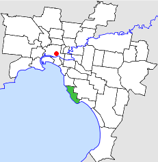 Location in Melbourne | |||||||||||||||
| Population | 32,500 (1992)[1] | ||||||||||||||
| • Density | 2,171/km2 (5,623/sq mi) | ||||||||||||||
| Established | 1917 | ||||||||||||||
| Area | 14.97 km2 (5.8 sq mi) | ||||||||||||||
| Council seat | Sandringham | ||||||||||||||
| Region | Melbourne | ||||||||||||||
| County | Bourke | ||||||||||||||
| |||||||||||||||
History
Sandringham was originally part of the Shire of Moorabbin, and was severed and incorporated as the Borough of Sandringham on 28 February 1917. It was proclaimed a town on 9 April 1919 and a city on 21 March 1923.[2]
On 15 December 1994, the City of Sandringham was abolished, and, along with the City of Brighton and parts of the City of Moorabbin and the eastern section of Beaumaris, from the City of Mordialloc, was merged into the newly created City of Bayside.[3]
Council meetings were held at the Municipal Offices, on Royal Avenue, Sandringham. It presently serves as a corporate centre for the City of Bayside.
Wards
The City of Sandringham was subdivided into three wards on 15 September 1970, each electing three councillors:[2]
- North Ward
- Centre Ward
- South Ward
Suburbs
- Beaumaris (shared with the City of Moorabbin and the City of Mordialloc)
- Black Rock
- Cheltenham (shared with the City of Moorabbin)
- Hampton
- Sandringham
Population
| Year | Population |
|---|---|
| 1921 | 11,316 |
| 1947 | 26,435 |
| 1954 | 31,758 |
| 1958 | 36,800* |
| 1961 | 37,001 |
| 1966 | 36,644 |
| 1971 | 35,460 |
| 1976 | 32,698 |
| 1981 | 31,175 |
| 1986 | 30,416 |
| 1991 | 30,319 |
* Estimate in the 1958 Victorian Year Book.
References
- Australian Bureau of Statistics, Victoria Office (1994). Victorian Year Book. p. 49. ISSN 0067-1223.
- Victorian Municipal Directory. Brunswick: Arnall & Jackson. 1992. p. 473. Accessed at State Library of Victoria, La Trobe Reading Room.
- Australian Bureau of Statistics (1 August 1995). Victorian local government amalgamations 1994-1995: Changes to the Australian Standard Geographical Classification (PDF). Commonwealth of Australia. pp. 4, 6, 8. ISBN 0-642-23117-6. Retrieved 16 December 2007.